 This page
serves as a digital repository for documents
relating to the
QWA's past work & activities and the natural
& human history of the Quittapahilla watershed. The material was
culled from the original files, compiled over the
years by QWA founding member & longtime president
David Lasky, presently housed in two 4-drawer file
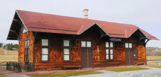
cabinets in the basement of the Old Train Station in
Annville (at right). The collection here includes reports,
correspondence, grant applications, grants & awards,
photographs, newspaper stories, antique postcards,
and more. We begin with the earliest material and
work forward in time.
This page
serves as a digital repository for documents
relating to the
QWA's past work & activities and the natural
& human history of the Quittapahilla watershed. The material was
culled from the original files, compiled over the
years by QWA founding member & longtime president
David Lasky, presently housed in two 4-drawer file
cabinets in the basement of the Old Train Station in
Annville (at right). The collection here includes reports,
correspondence, grant applications, grants & awards,
photographs, newspaper stories, antique postcards,
and more. We begin with the earliest material and
work forward in time.
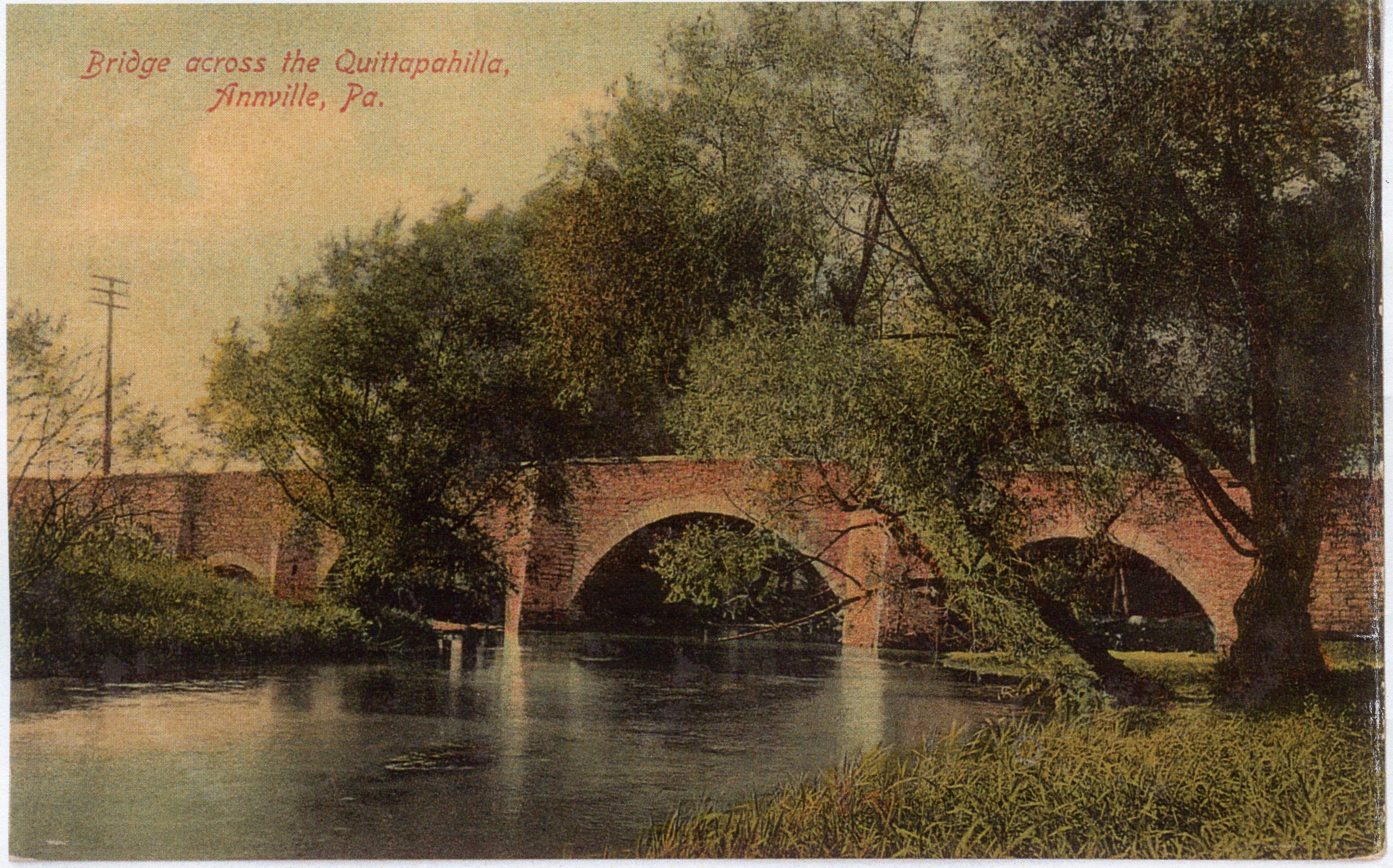
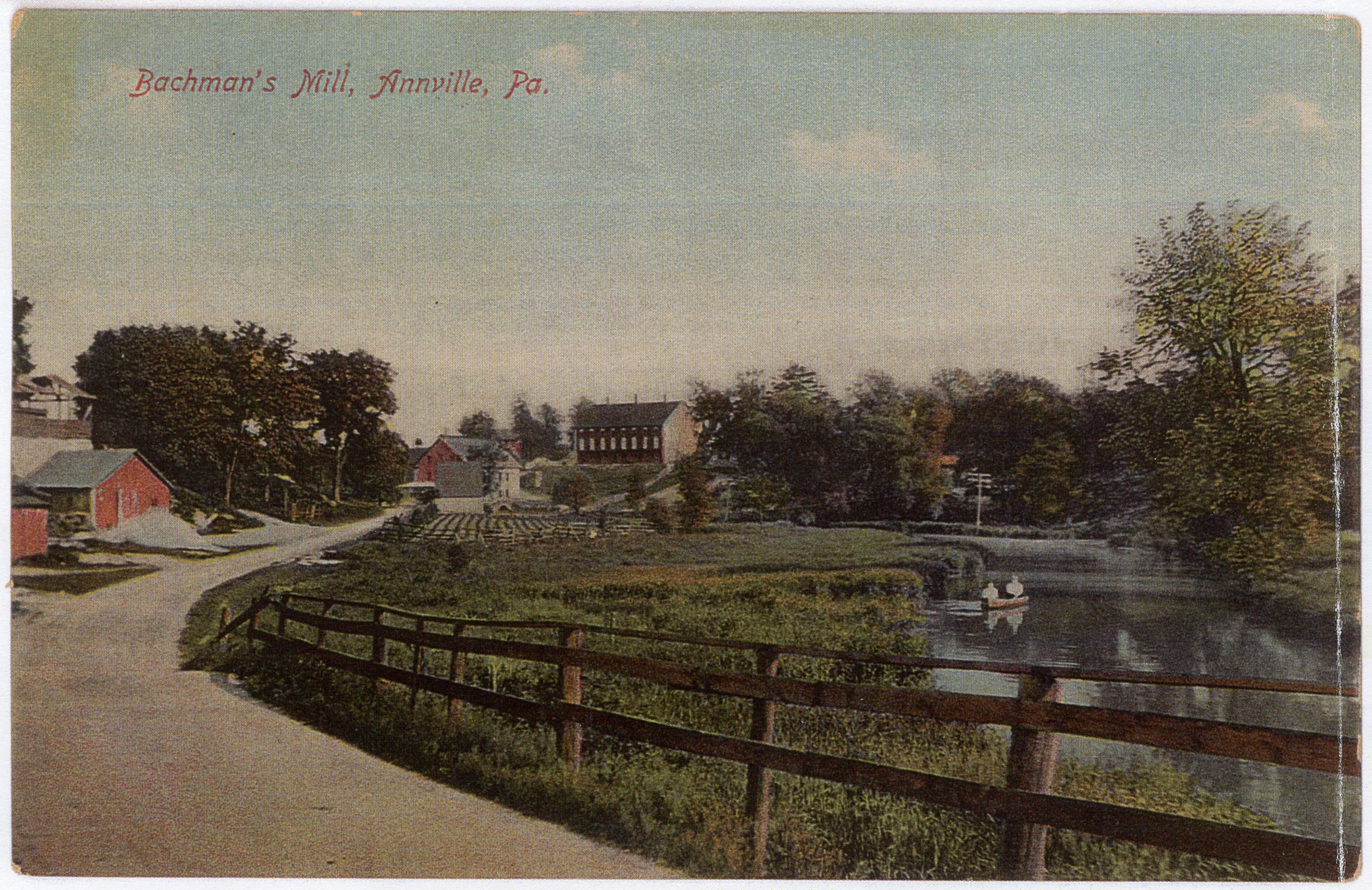
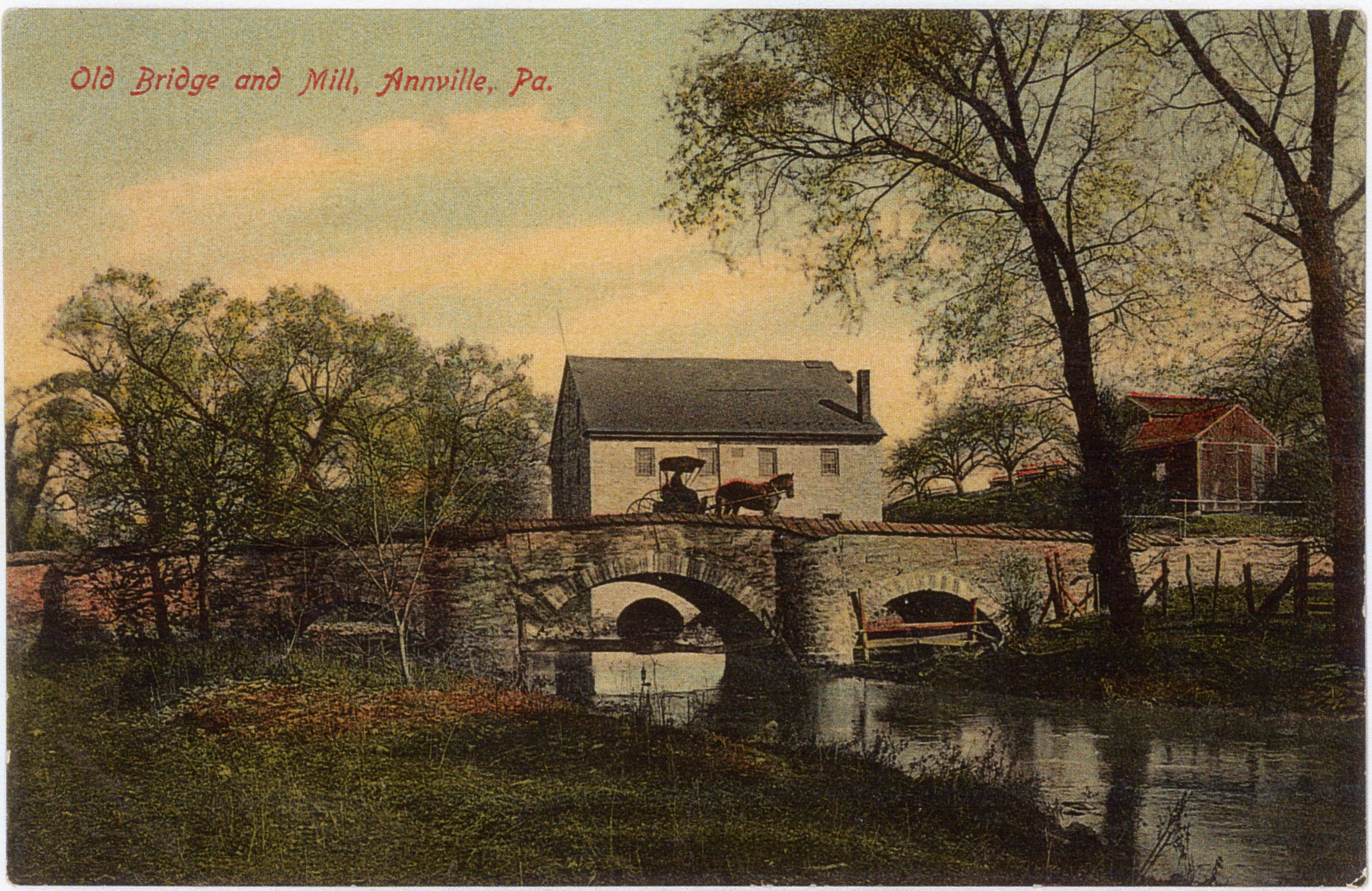
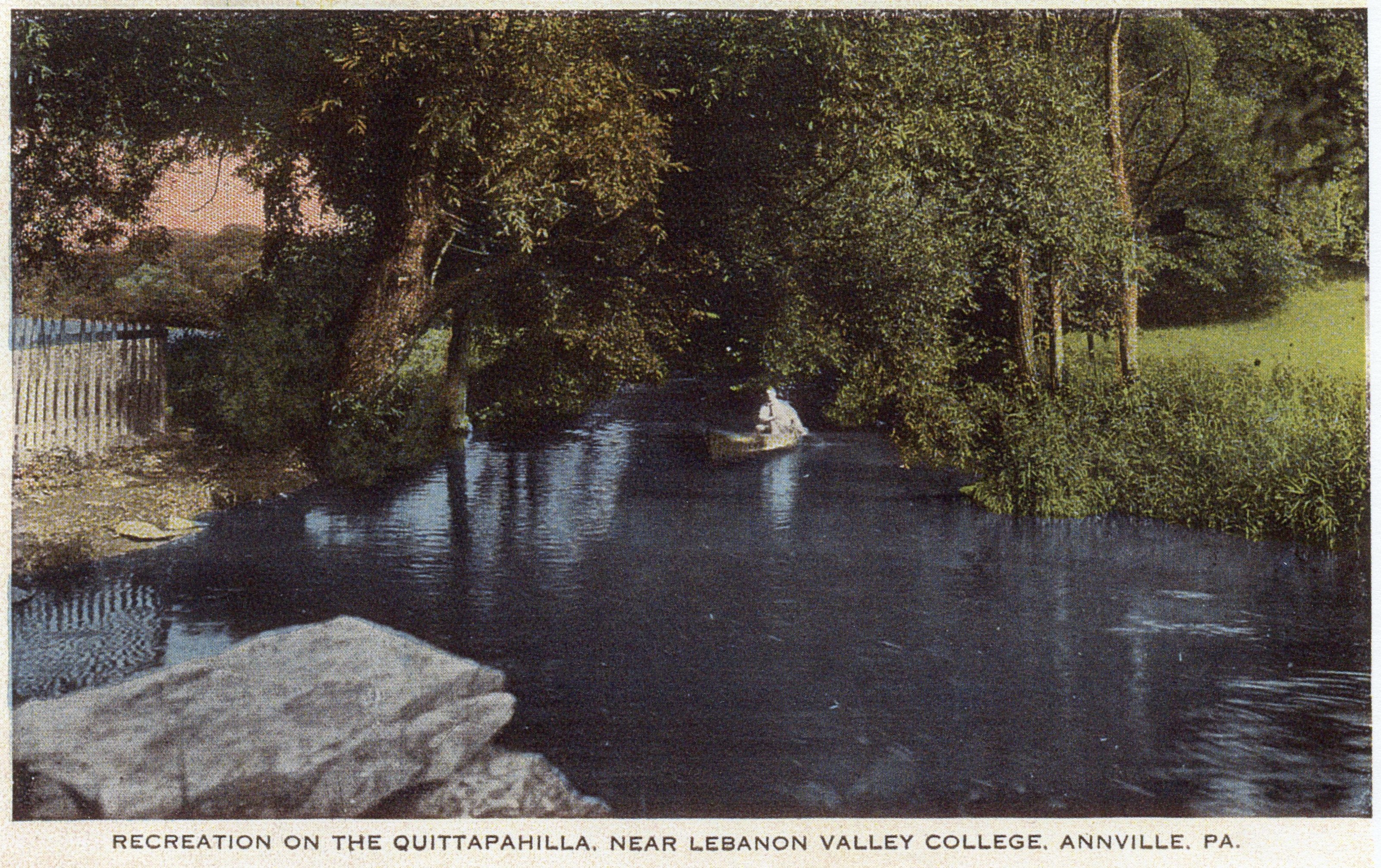
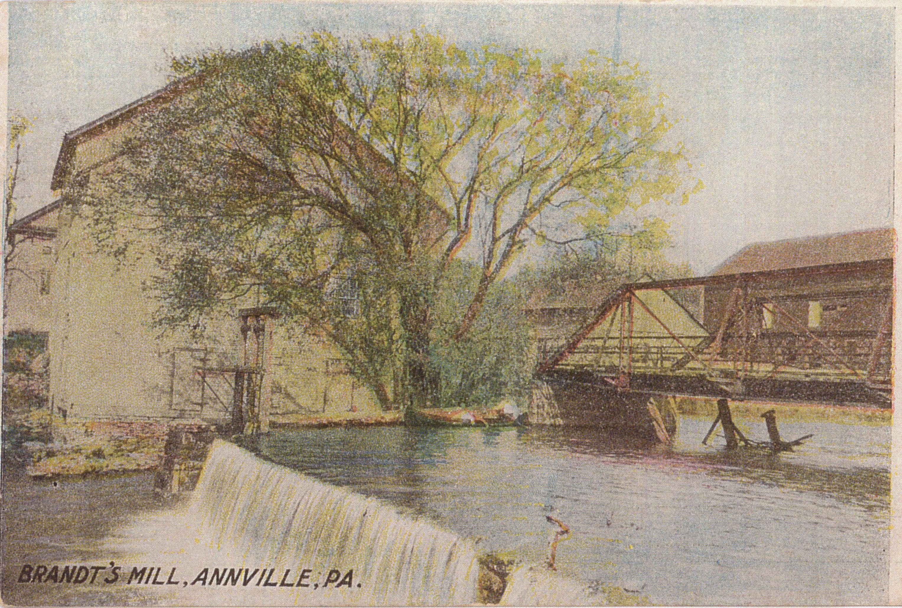
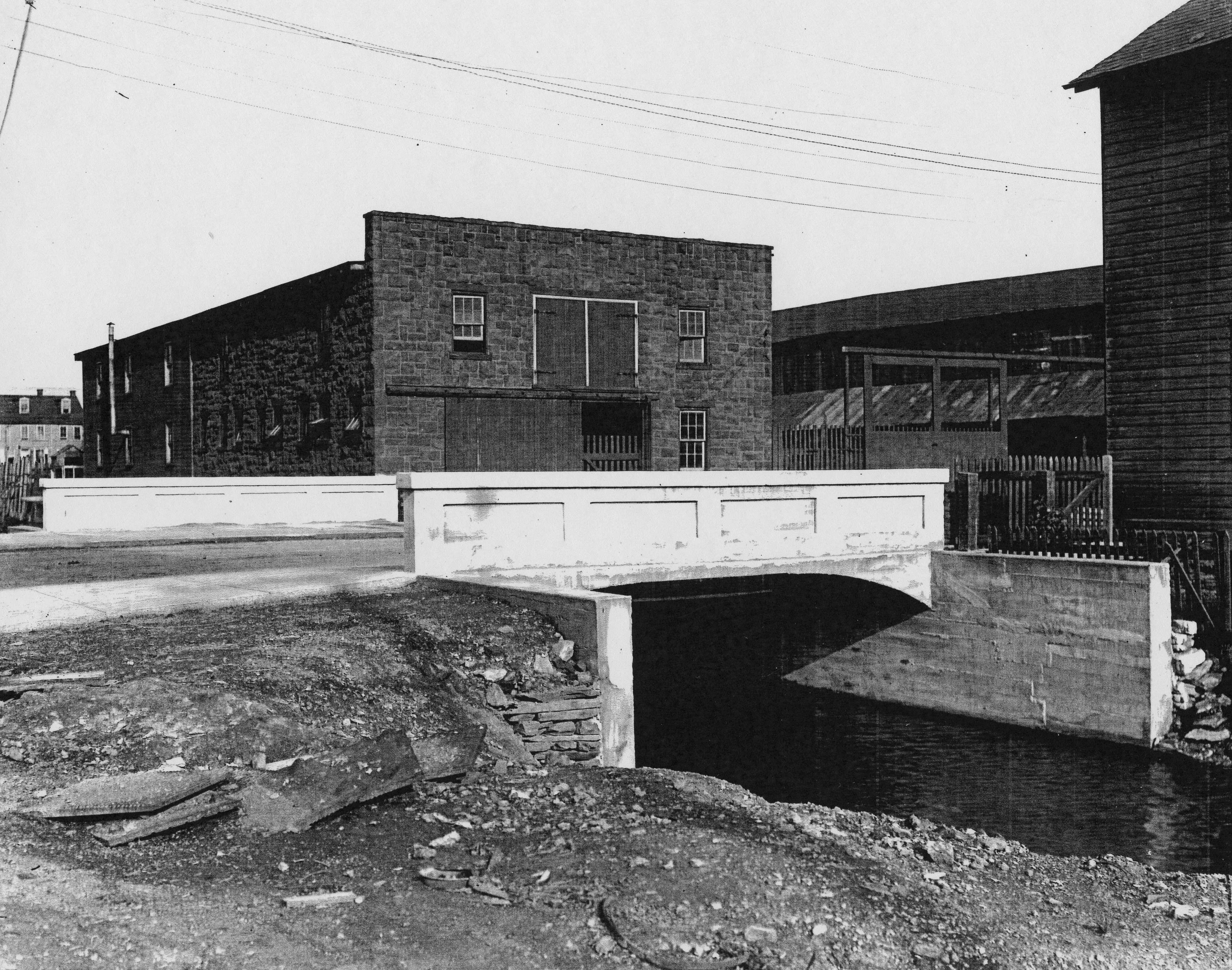
ca. 1890s-1910s • Antique Postcards of Quittapahilla Creek in Annville
This marvelous collection of twelve antique postcards offers romantic, picturesque views of bridges & mills along Quittie Creek in Annville around the turn of the 20th century. The collection includes one of Bachman's Mill (looking south down today's Bachman Road, the entrance to Quittie Creek Nature Park); two of Brandt's Mill (the old mill just south of today's Route 422); and five showing different the "Old Bridge and Mill" (at today's Route 934 bridge). None are dated, but the best estimate is from the mid-1890s to the mid-1910s. These historic postcards offer yet another pointed reminder of how quickly & dramatically landscapes & waterscapes can & do change.
Click on each image for a high-resolution scan (600 dpi JPEG files, avg. 2.5 MB).
 |
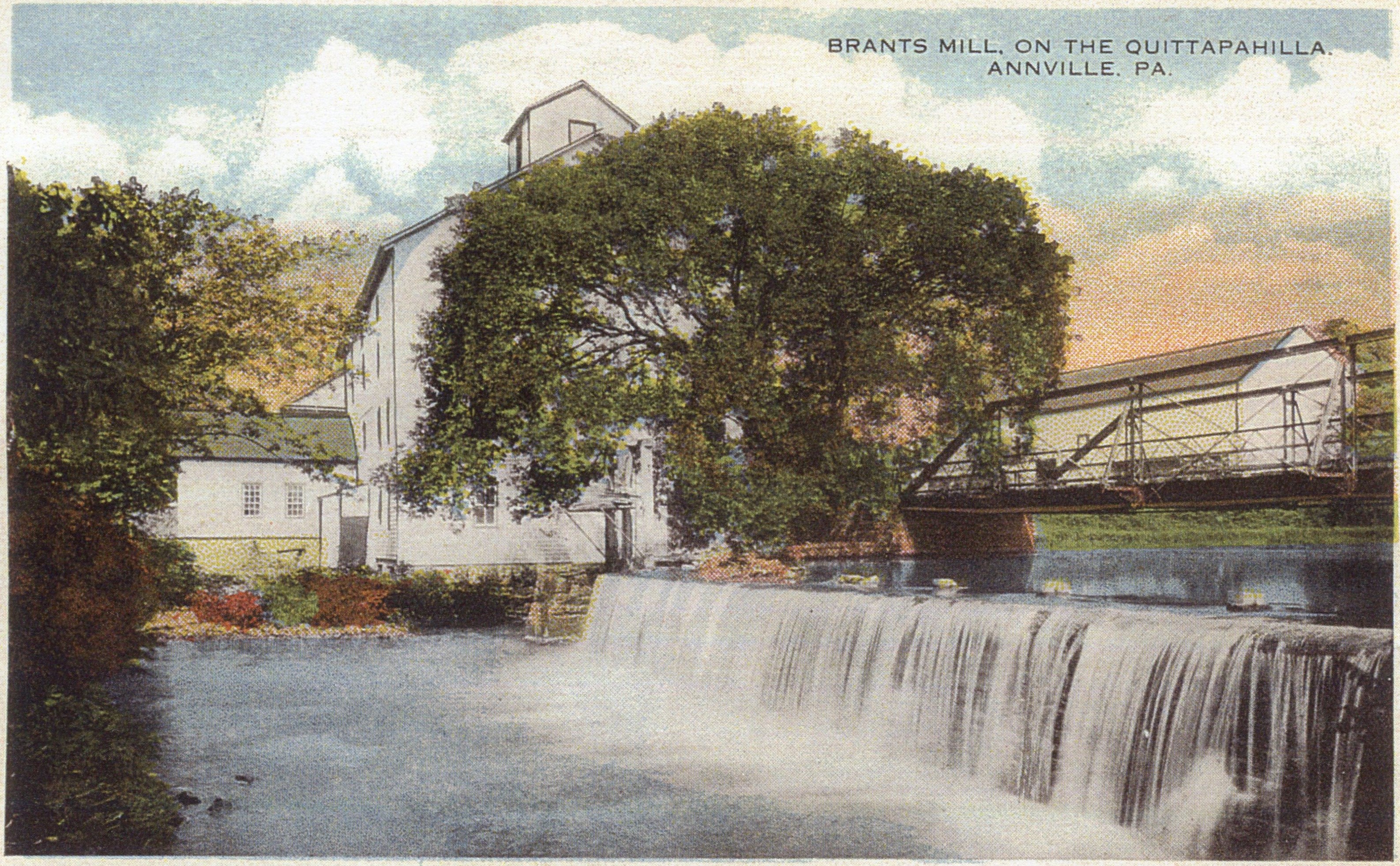 |
| "Bridge across the Quittapahilla, Annville, PA" | "Brandts Mill on the Quittapahilla, Annville PA |
 |
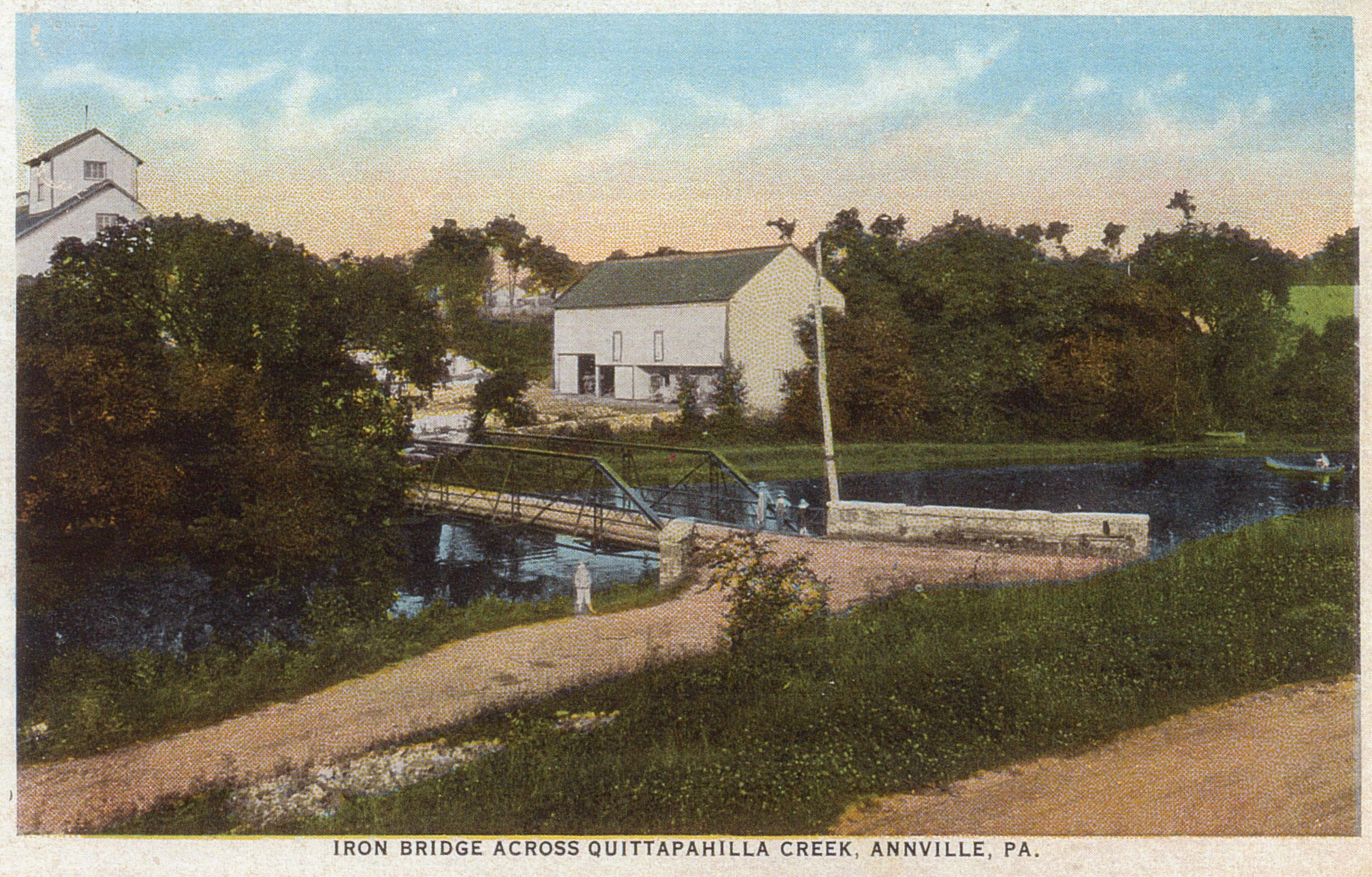 |
| "Bachman's Mill, Annville Pa." | "Iron Bridge Across Quittapahilla Creek, Annville, PA." |
 |
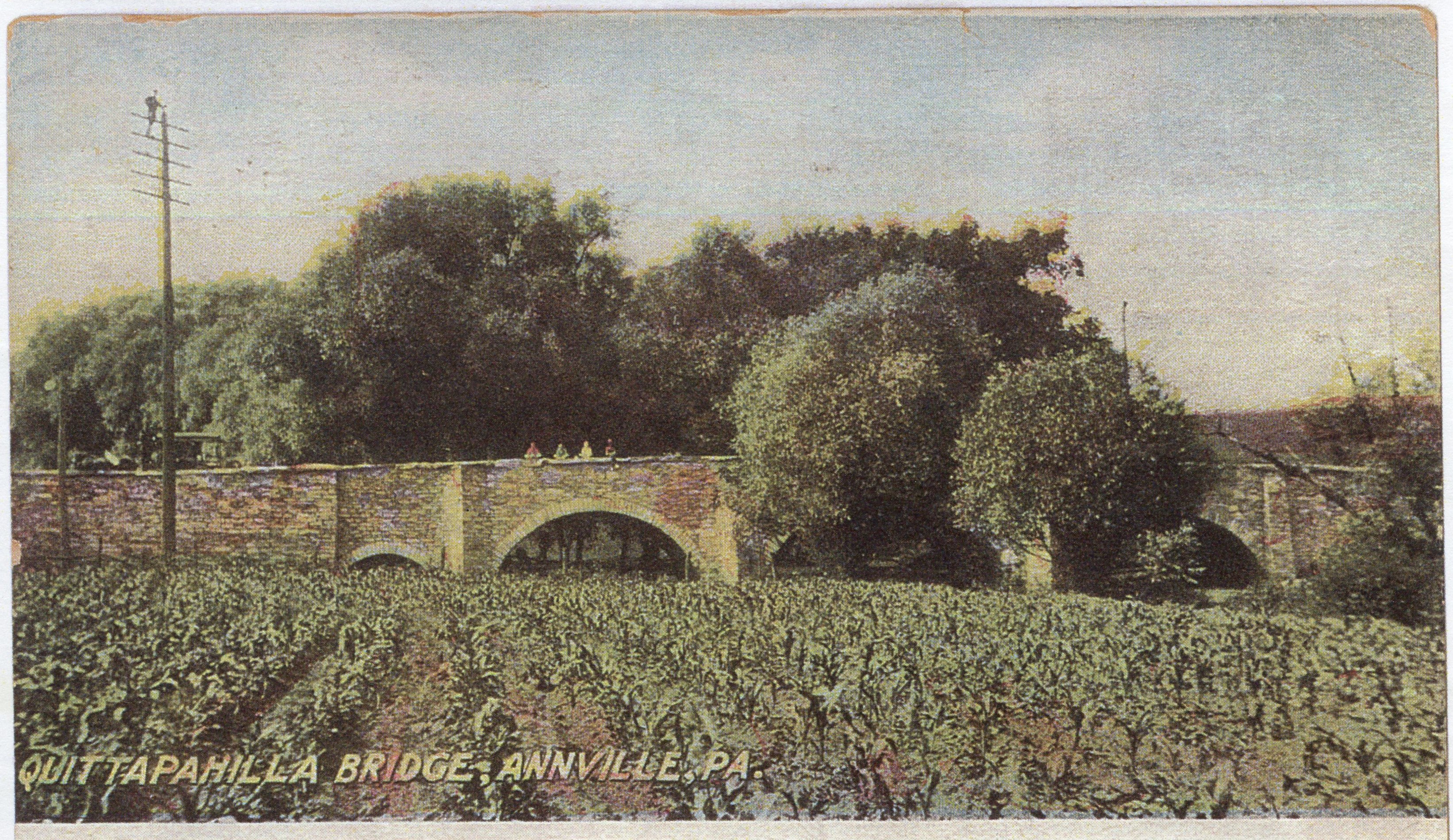 |
| "Old Bridge and Mill, Annville, Pa." | "Quittapahilla Bridge, Annville PA" |
 |
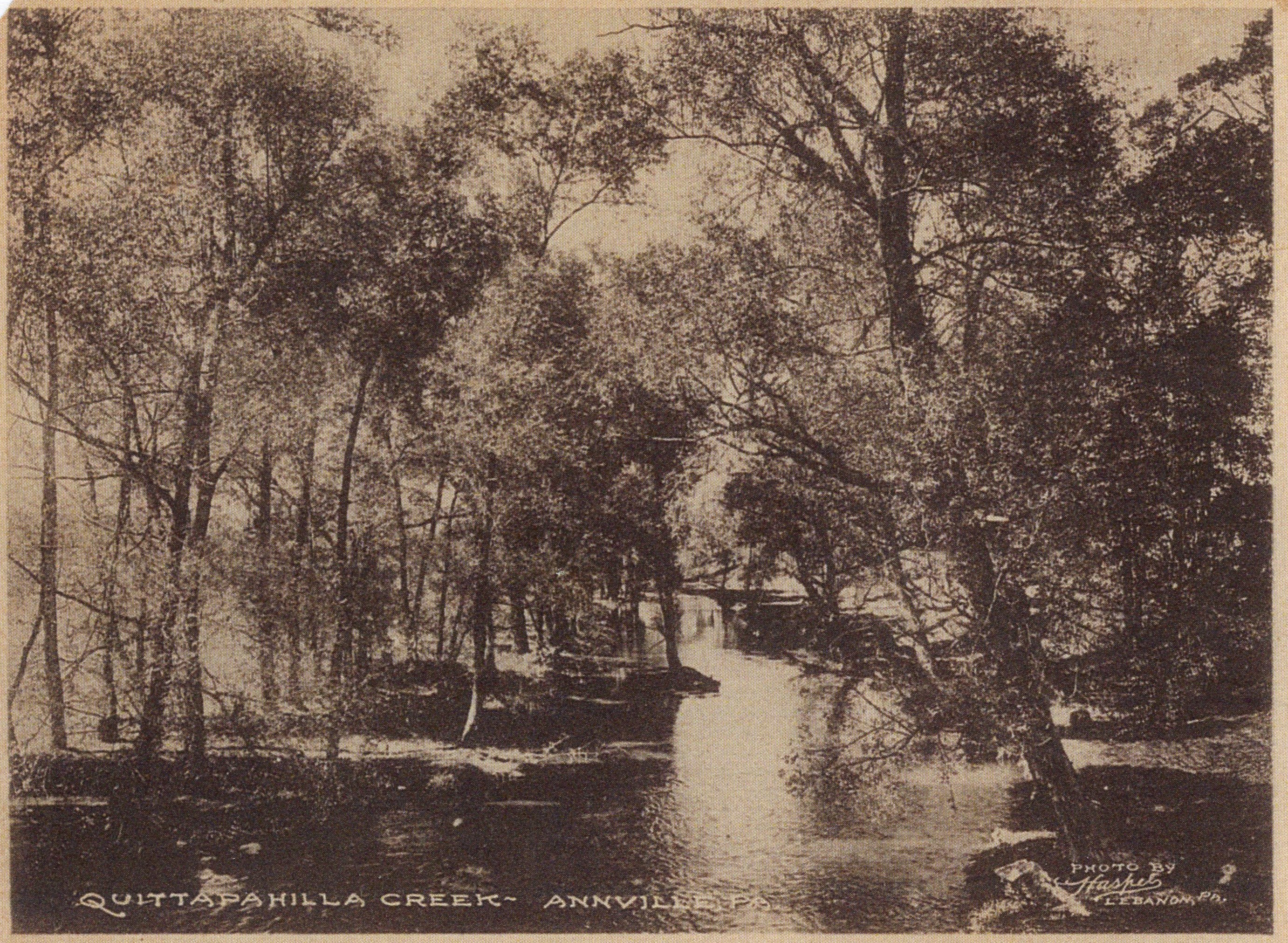 |
| "Recreation on the Quittapahilla near Lebanon Valley College, Annville, PA." | "Quittapahilla Creek, Annville PA. Photo by Haskel, Lebanon PA." |
 |
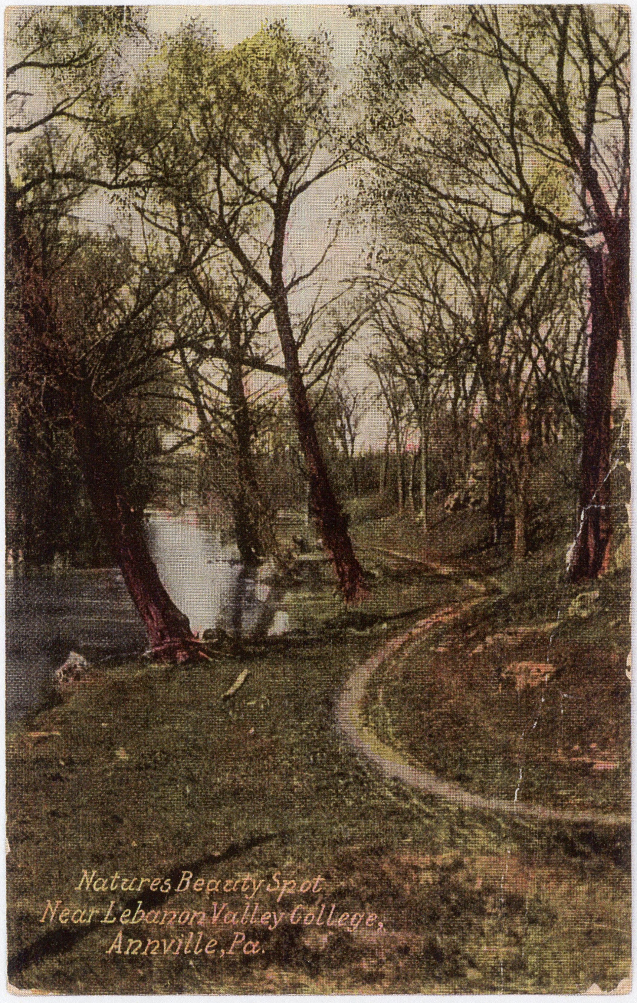 |
| "The Quittapahilla Creek at Lovers Leap Near Lebanon Valley College, Annville, PA." | "Nature's Beauty Spot Near Lebanon Valley College, Annville, Pa." |
 |
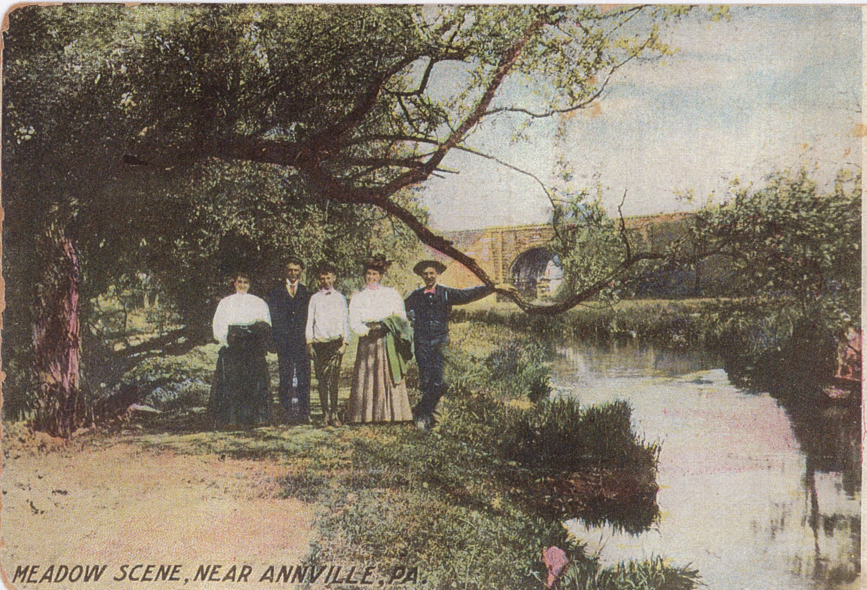 |
| "Brandt's Mill, Annville, PA." | "Meadow Scene, Near Annville, PA." |
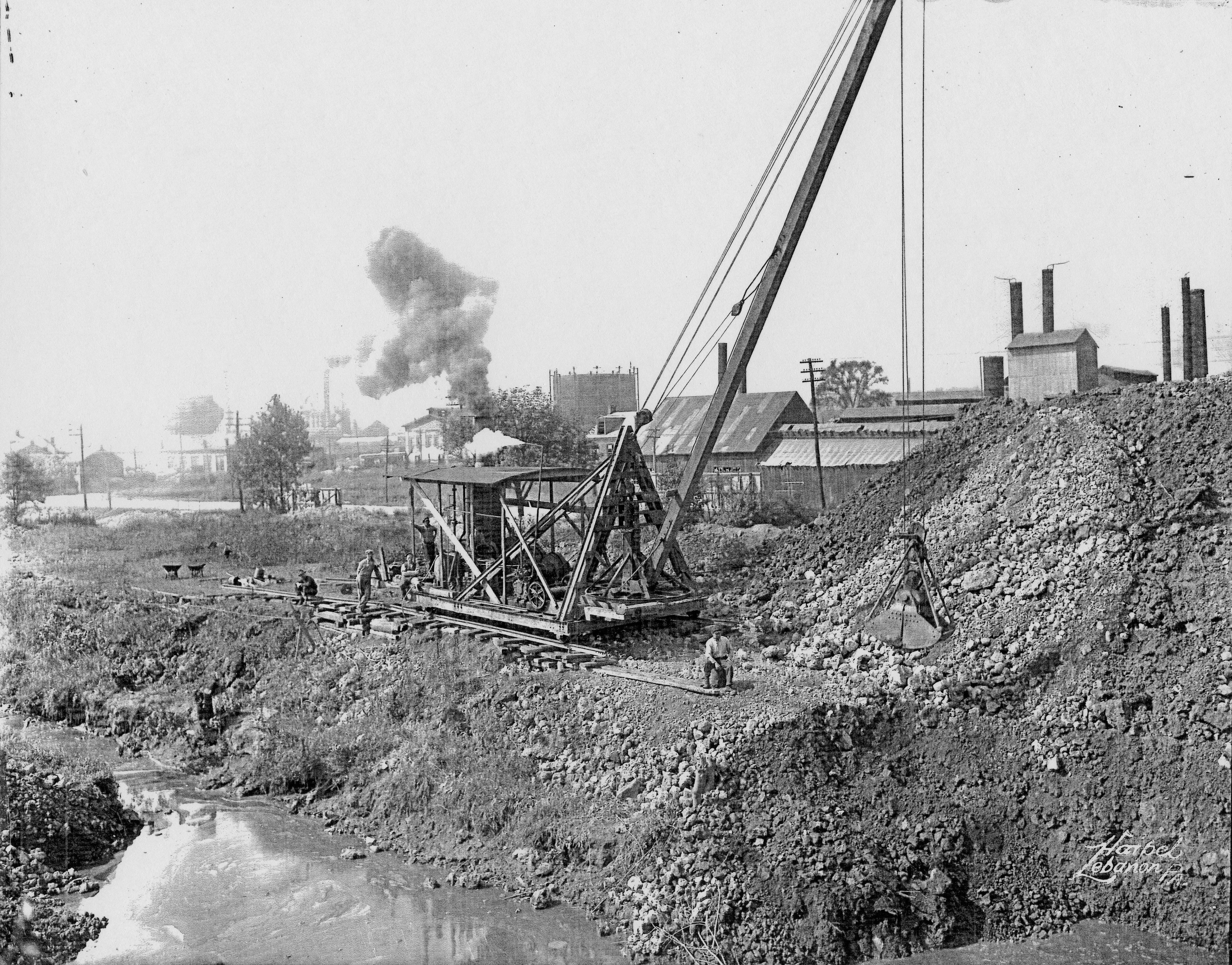
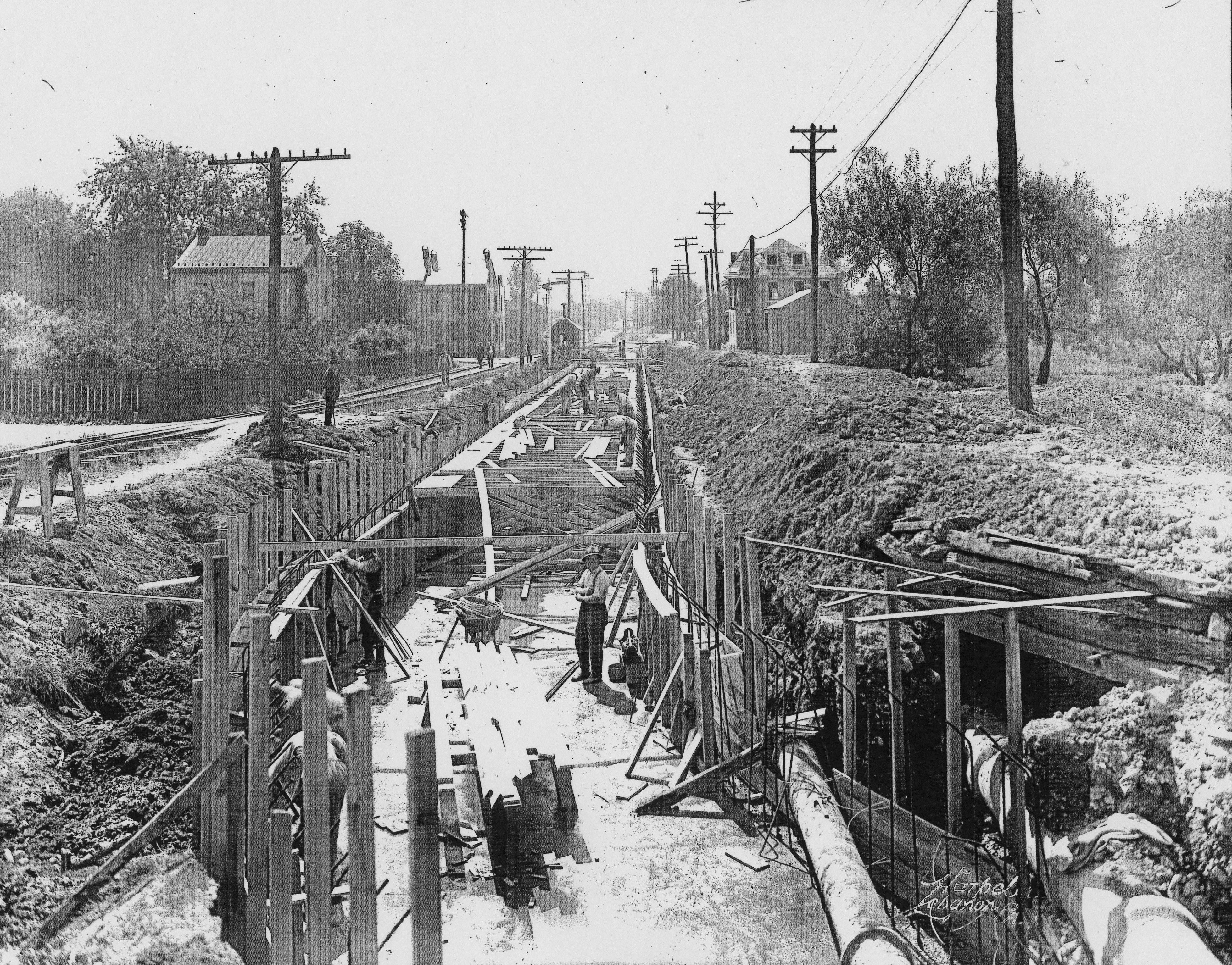
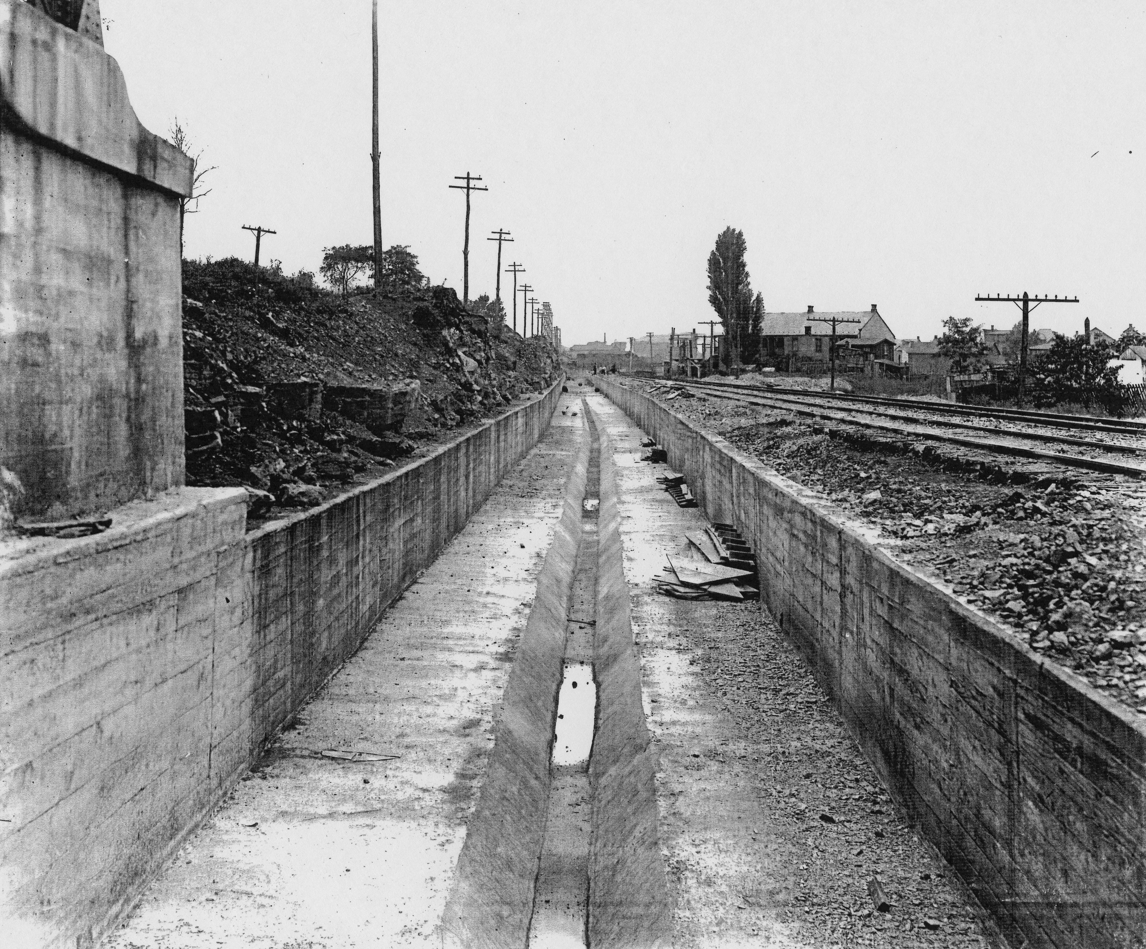
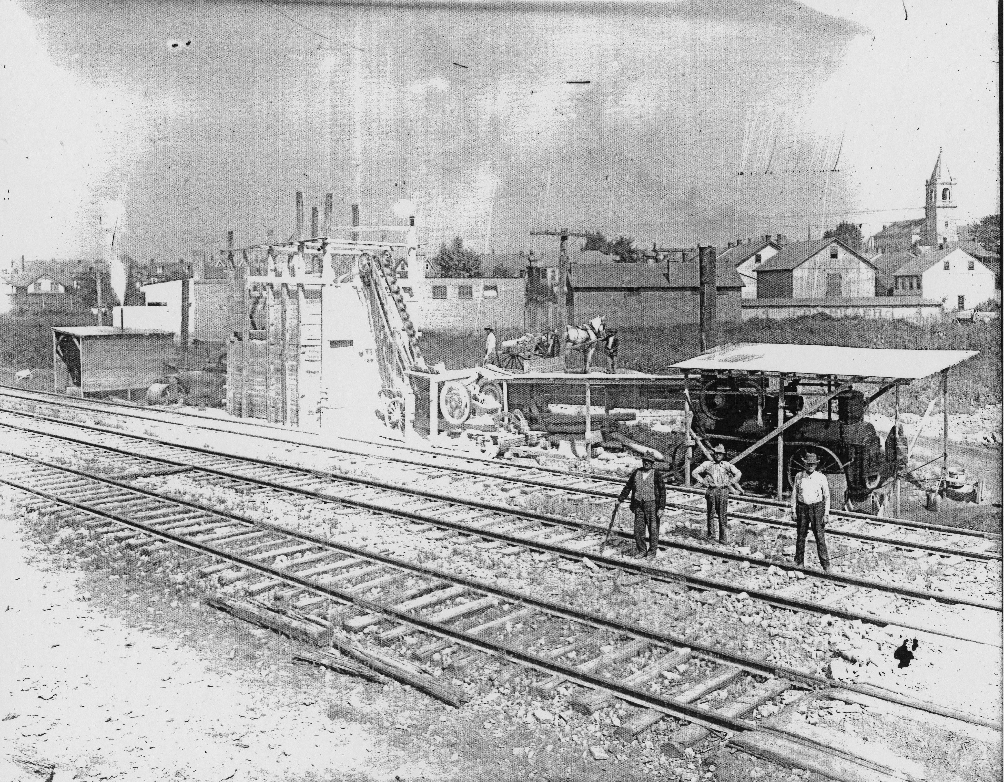
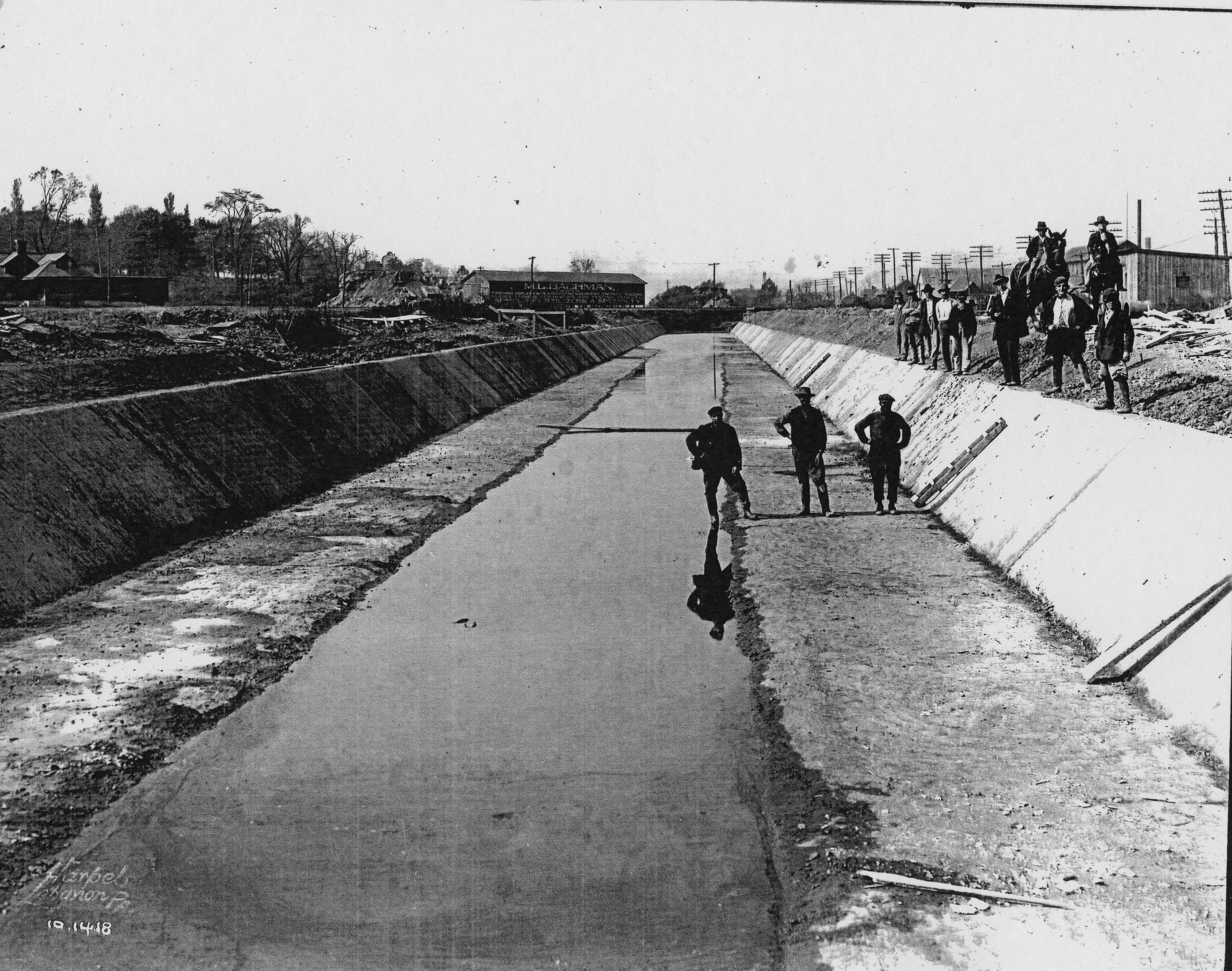
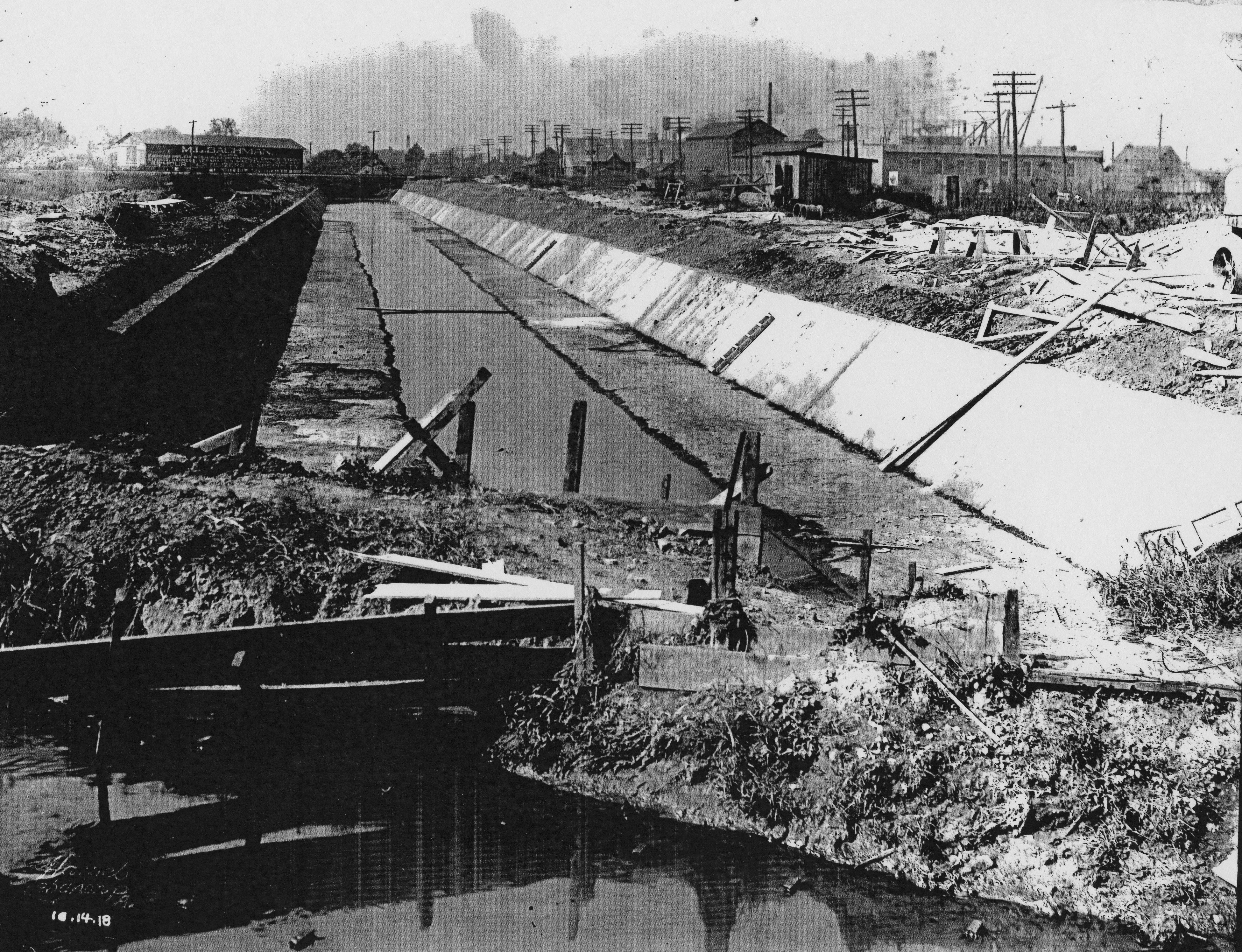
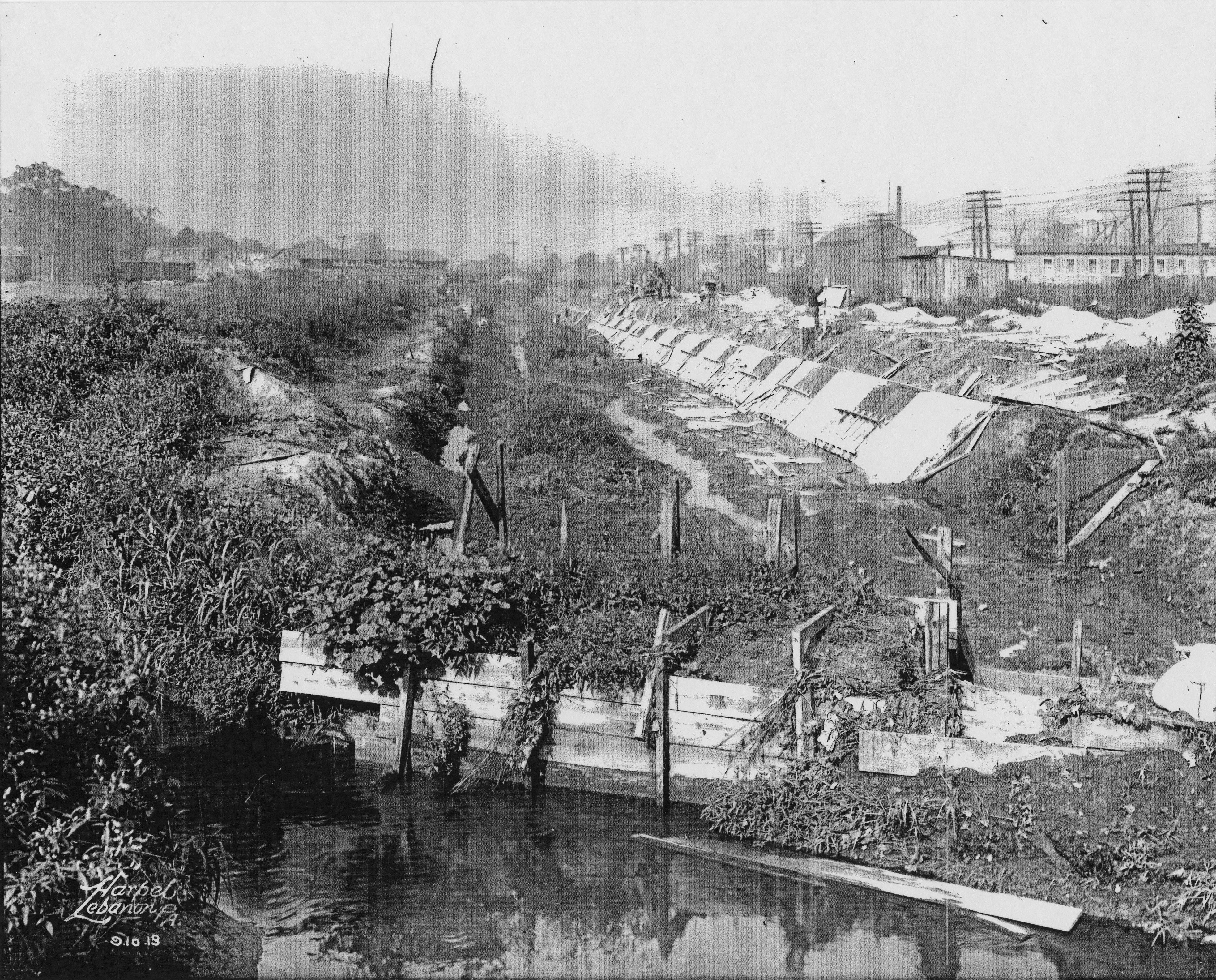
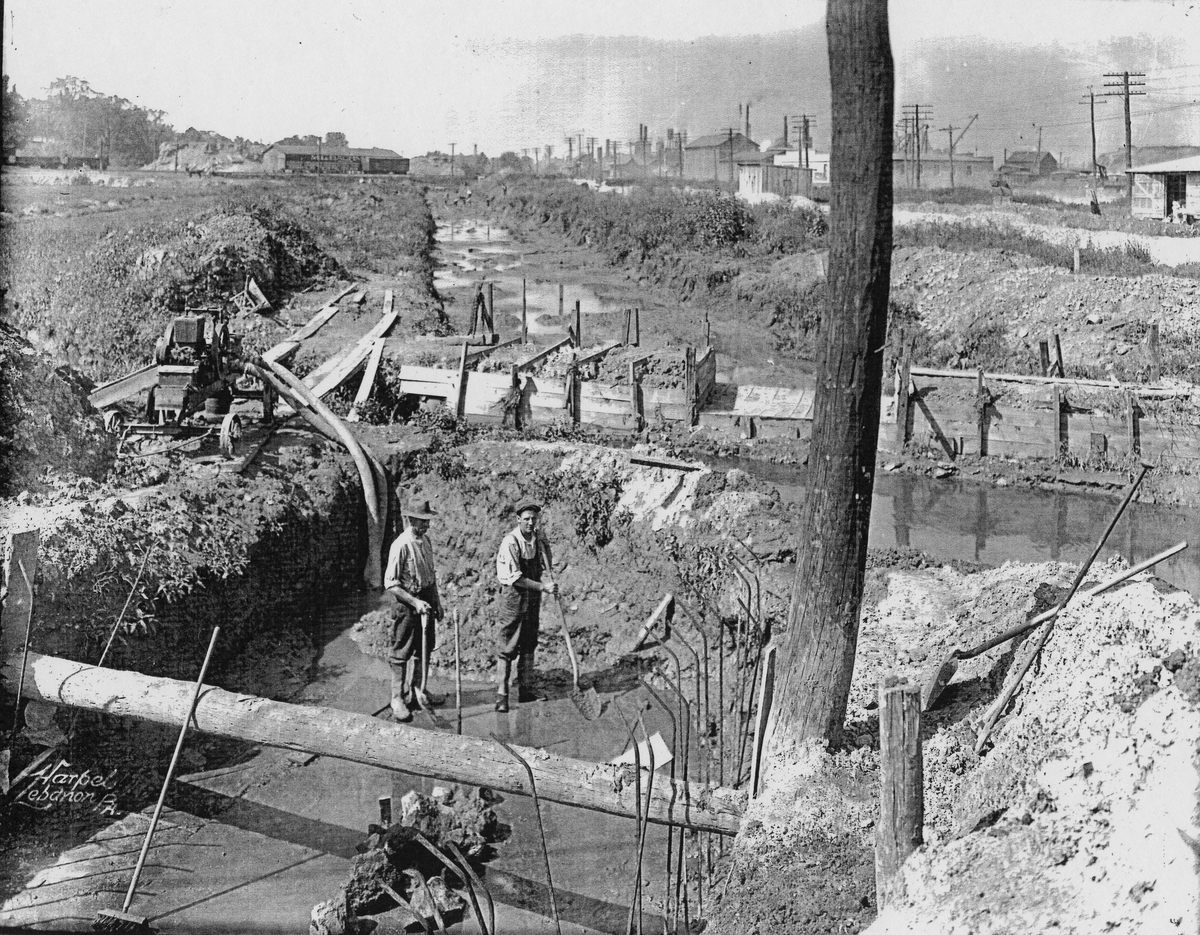
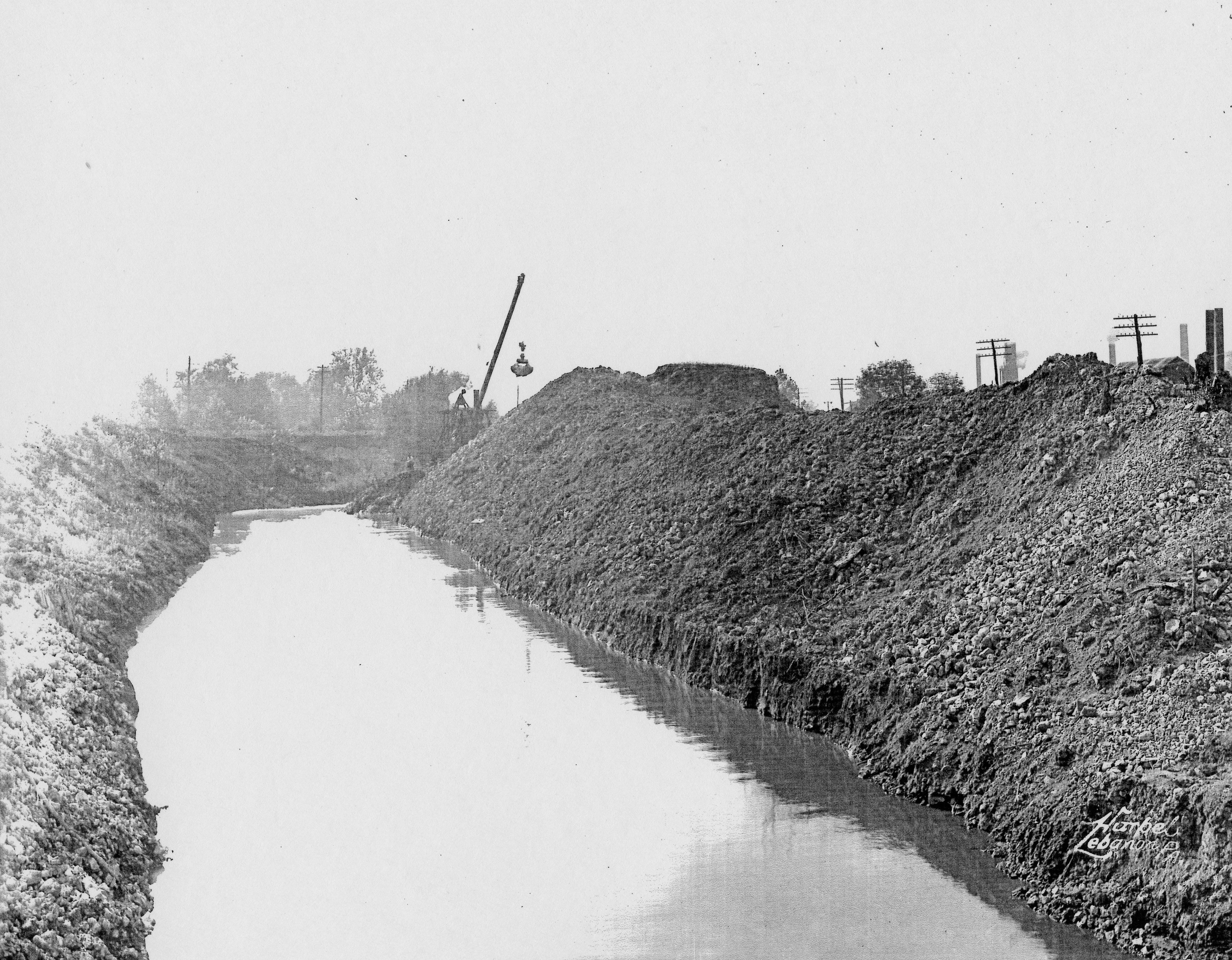
1918 • Photos of the Building of the First Hazel Dike in Lebanon
This collection of 10 photographs of the building of the first Hazel Dike in Lebanon October 1918, just as the war was ending in Europe, offers a fascinating glimpse into Lebanon's earlier efforts to manage the creek's flow and grapple with its periodic flooding. Click on individual images for higher-resolution (400 dpi) JPEG files (avg. size around 5 MB).
 |
 |
| "South 12th Street facing south between Cumberland & Walnut St. -- Chestnut St. intersection between Chestnut & Cumberland." | |
 |
 |
| "10th & Oak St. facing north. Part of base for Lebanon-Hershey Trolley -- still there today." | |
 |
 |
| "Tabor Church at 10th & Walnut St., Lebanon." | |
 |
 |
 |
 |
1939-1947 • David H. Wallace, "Annville Memories: The Quittie & Steinmetz's Woods, 1939-1947"
.jpg) Transcribed & edited oral interview
(PDF file, 3 pp.) of October 2003 with Dr. David H.
Wallace, when he was around 78 years old & offered
his interviewer a richly embroidered narrative of a
childhood and youth shaped by a fascination with
birds & flowers & the natural beauty & wonder of
"the Quitti". His descriptions of the landscape & waterscape of
the Quittie's course through Annville during these
years are riveting. Of the mill near the
quarry in the early 1940s, he recalled that "all the trees
and bushes were coated with white lime dust".
The quarry "at that time was still active," so he &
his friends didn't venture in, except in winter to
ice-skate on the quarry pond. He recalled
playing in the creek many times, but swimming only
once — and that he and a buddy got sick from the
creek's "highly contaminated" water.
Transcribed & edited oral interview
(PDF file, 3 pp.) of October 2003 with Dr. David H.
Wallace, when he was around 78 years old & offered
his interviewer a richly embroidered narrative of a
childhood and youth shaped by a fascination with
birds & flowers & the natural beauty & wonder of
"the Quitti". His descriptions of the landscape & waterscape of
the Quittie's course through Annville during these
years are riveting. Of the mill near the
quarry in the early 1940s, he recalled that "all the trees
and bushes were coated with white lime dust".
The quarry "at that time was still active," so he &
his friends didn't venture in, except in winter to
ice-skate on the quarry pond. He recalled
playing in the creek many times, but swimming only
once — and that he and a buddy got sick from the
creek's "highly contaminated" water.
Sad to know the Quittie's been so impaired for so long.
A second PDF file (5 pp.) offers a list of "Birds & flowers seen by David Wallace along the Quittapahilla Creek & in fields & woods around Annville PA, 1939-1947."
Dave Wallace graduated from Lebanon Valley College in 1947 with a B.A. in English and History, earned his M.A. and Ph.D. from Columbia University, and went on to embark on a rich & prestigious professional career as a public historian.
Above right is a thumbnail of a JPEG file of Dr. Wallace's retirement notice, published in the National Park Service Newsletter Courier of June 1980, which offers a brief synopsis of his major accomplishments and a great photo.
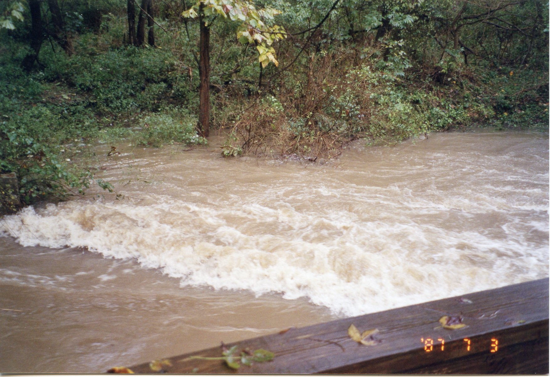
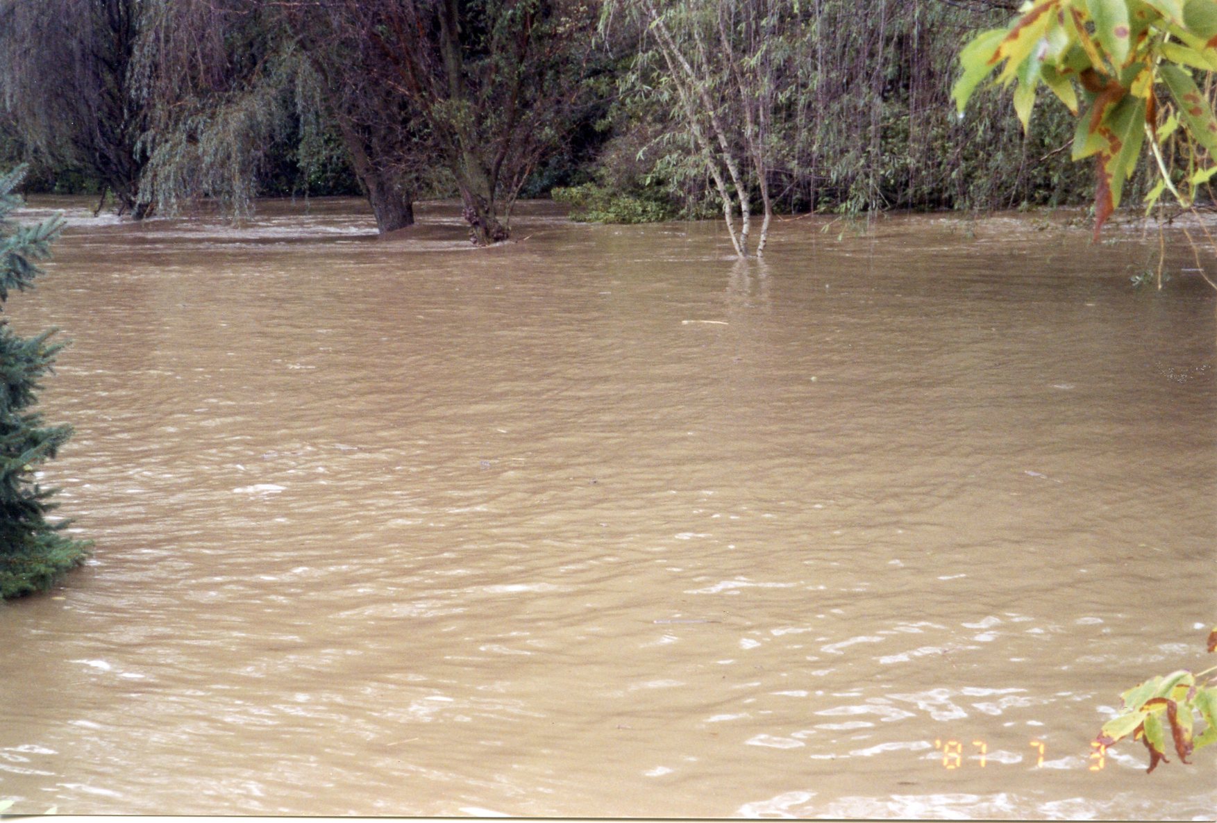
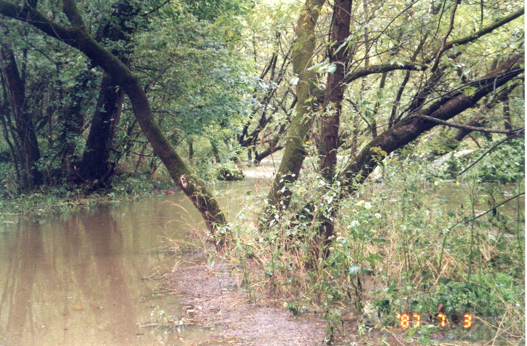
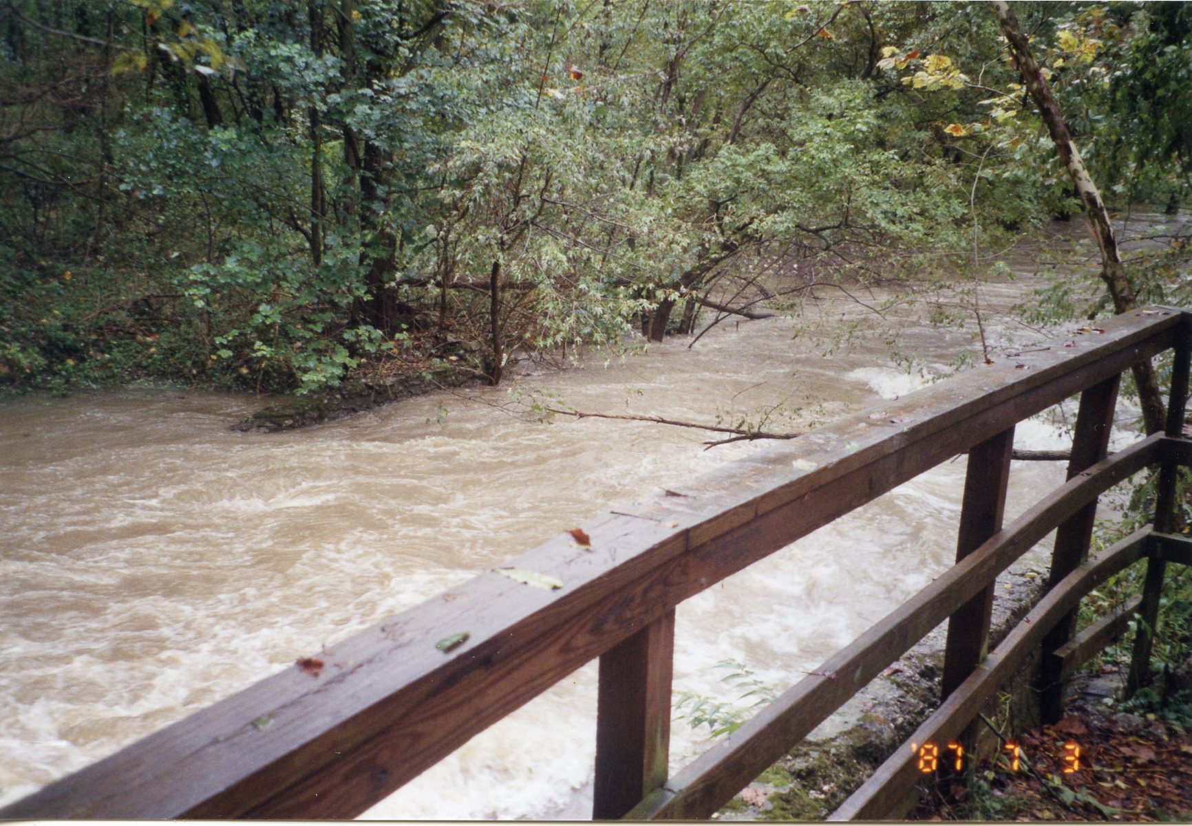
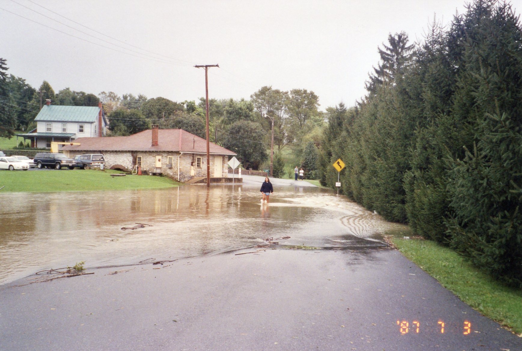
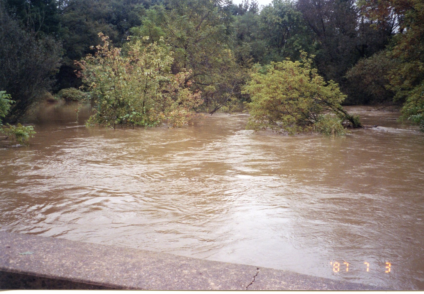
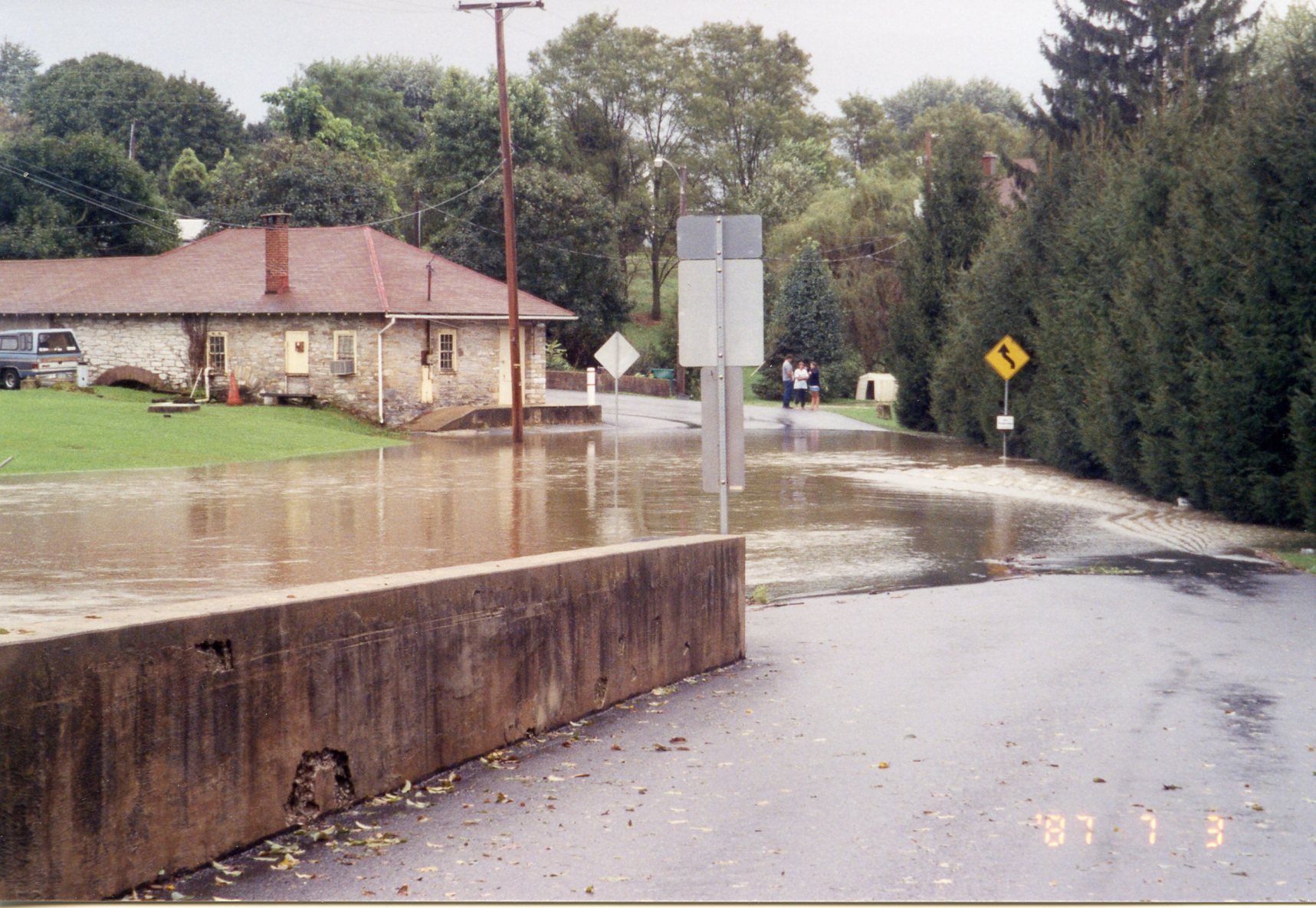
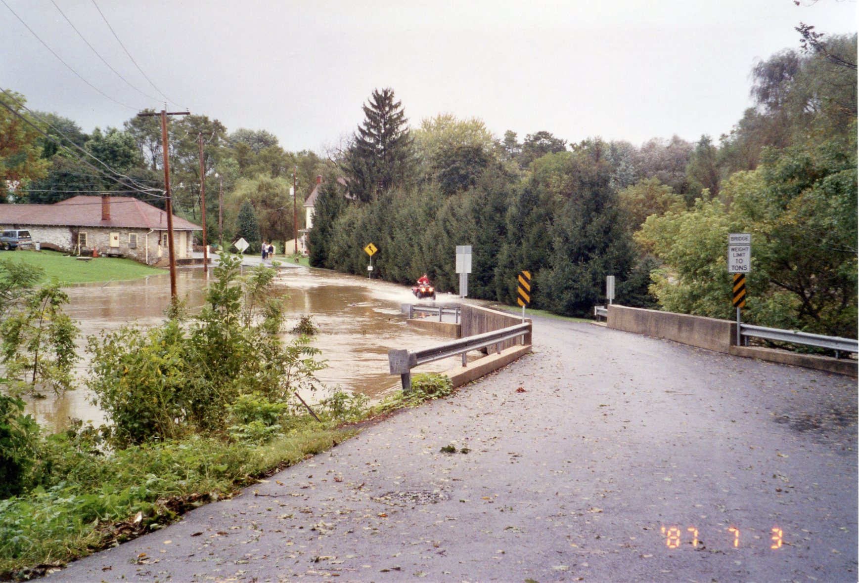
1987 • The Forgotten Flood of 3 July 1987
Eight photos that remind us of the awesome power of water and of the Quittie's constant potential for floodwaters in the Hazel Dike Era, with the loss of wetlands and spread of impervious surfaces atop the cannon-like qualities of water shooting out the end of the Dike after heavy rainfalls. Everyone remembers Hurricane Agnes, but who remembers the flood of July 1987? These photos were taken from the area around the Spruce Street bridge in Annville — so damaged in another "mini-flood" of 22 July 2013 that it had to be closed for repairs for the next six months. (Click on thumbnails for full images.)
 |
 |
 |
 |
 |
 |
 |
 |
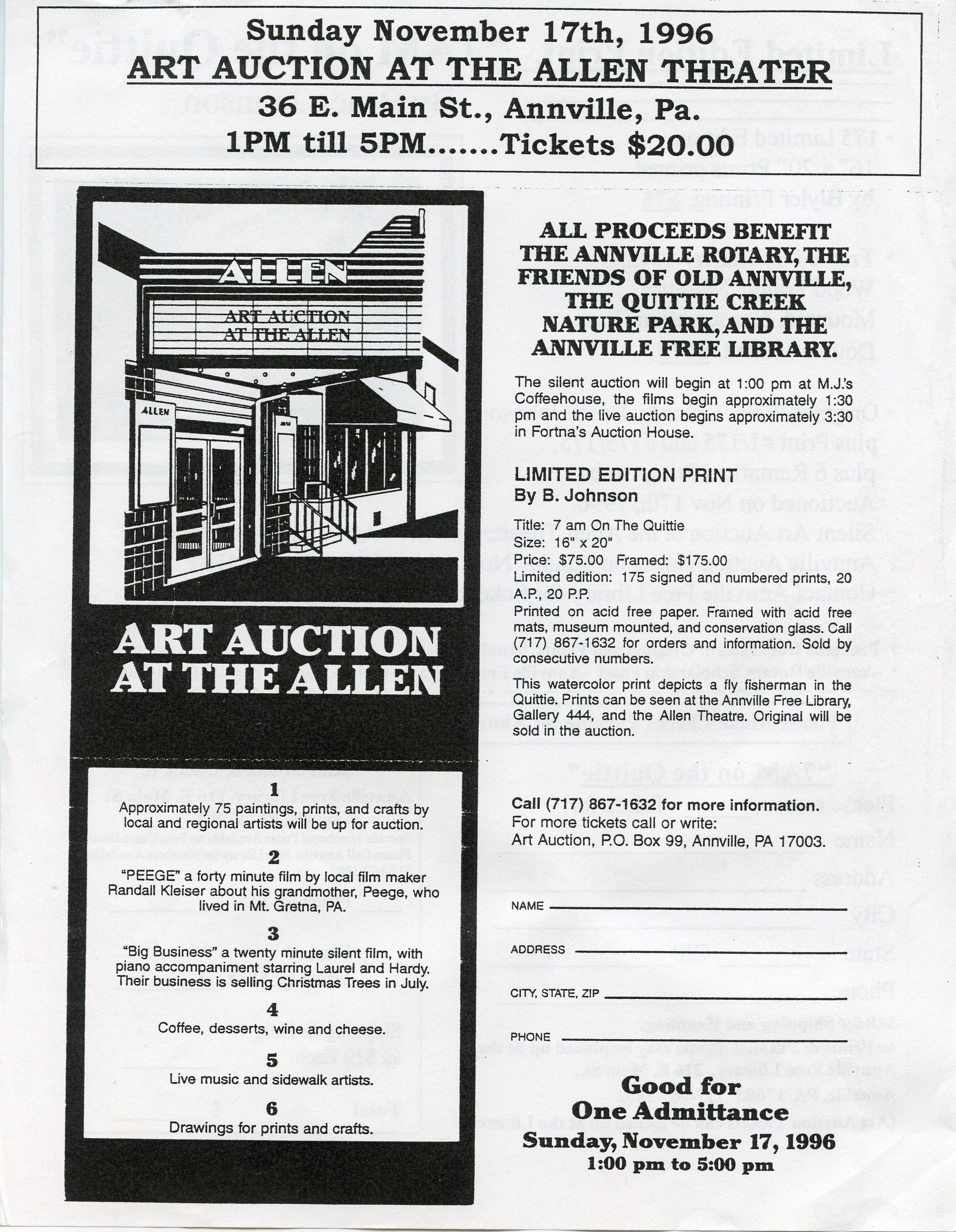
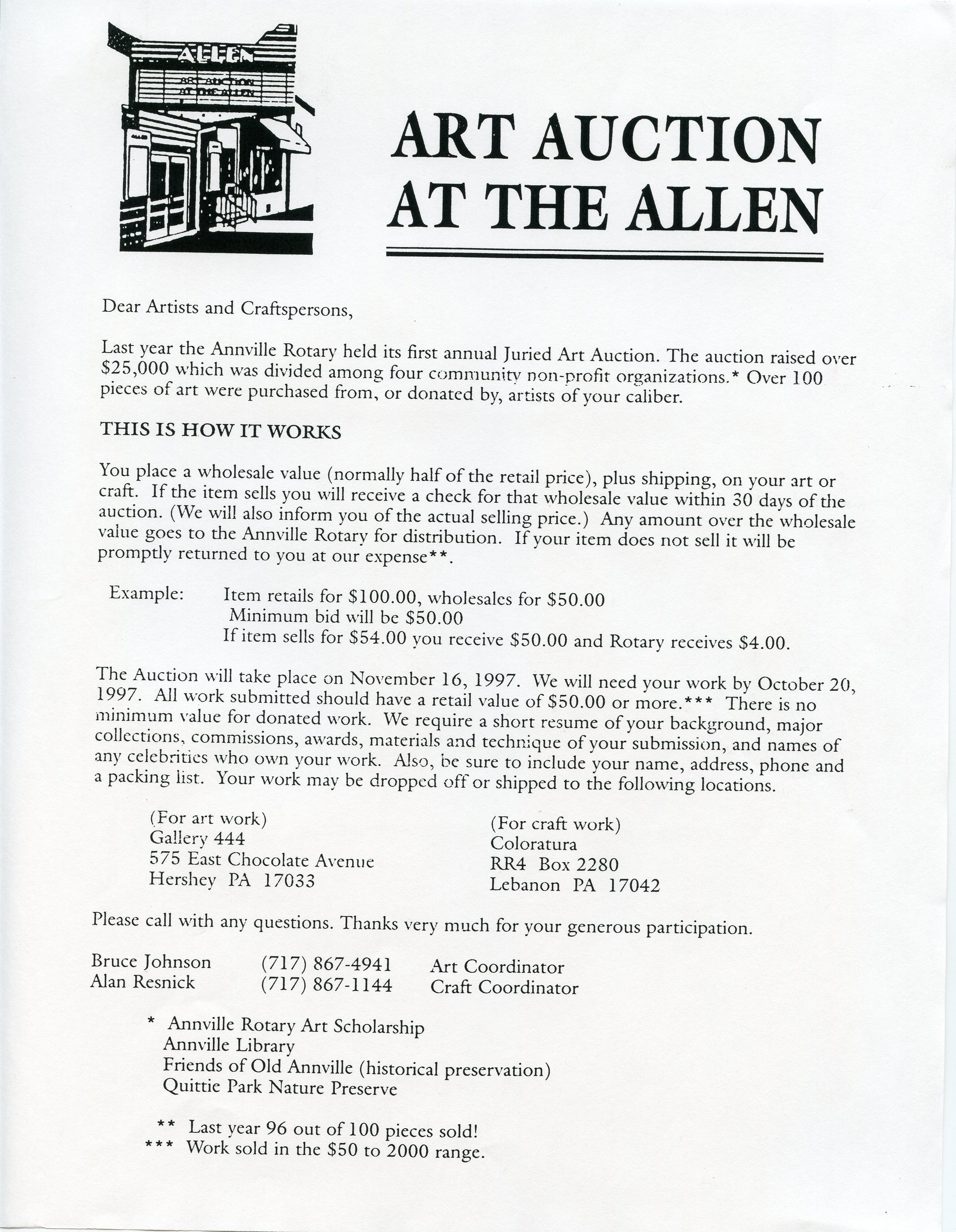
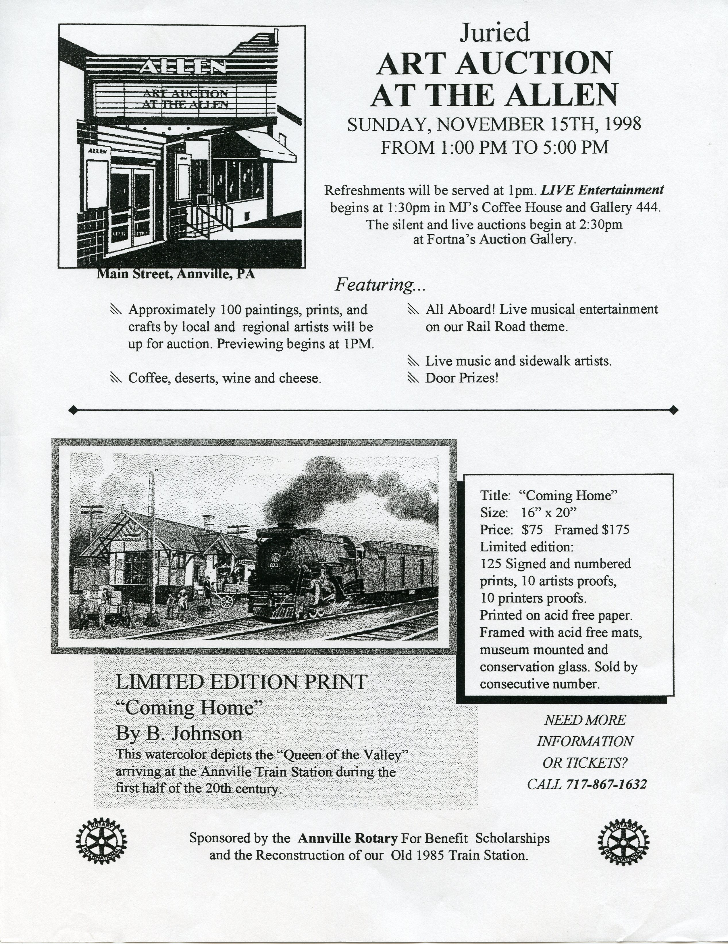
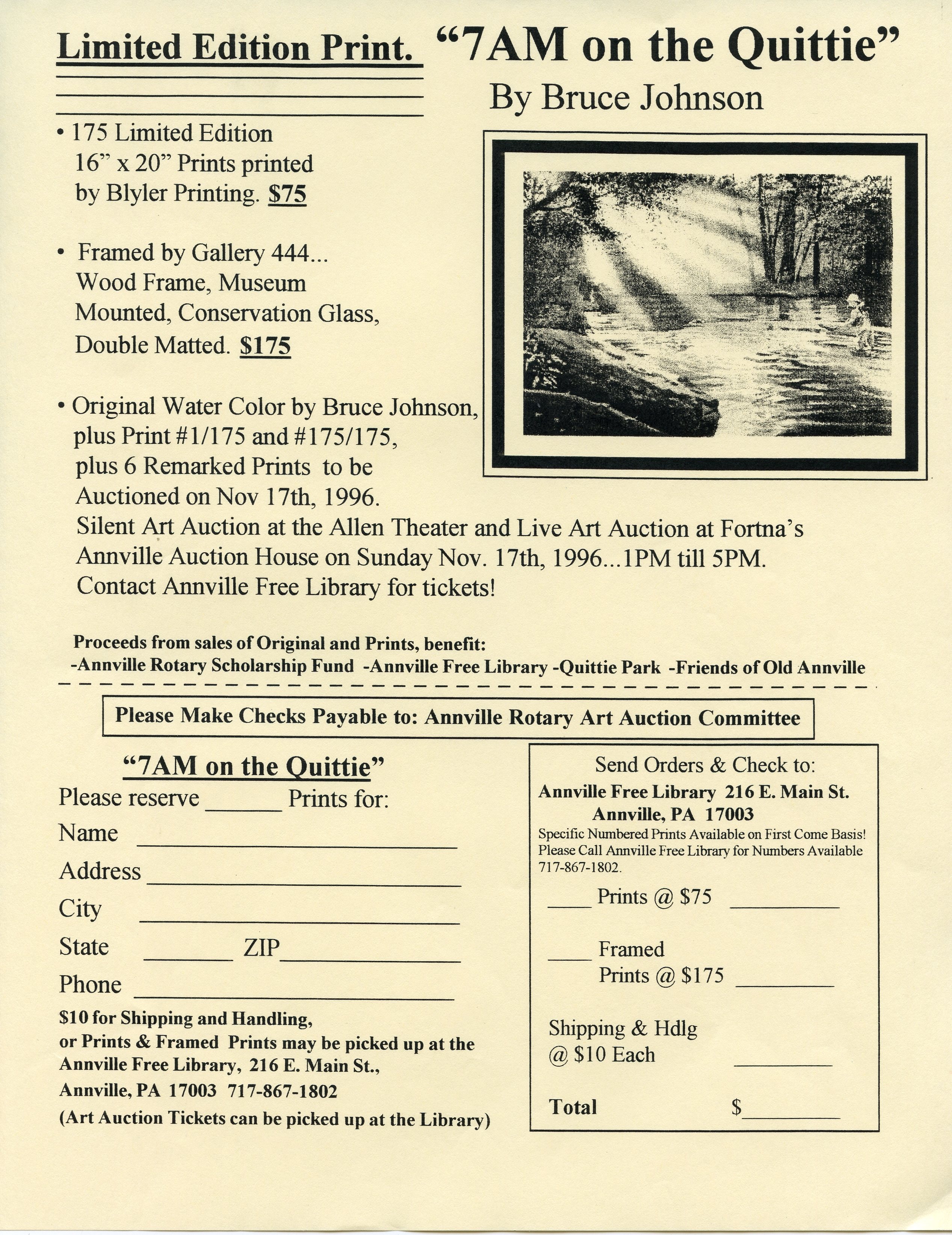
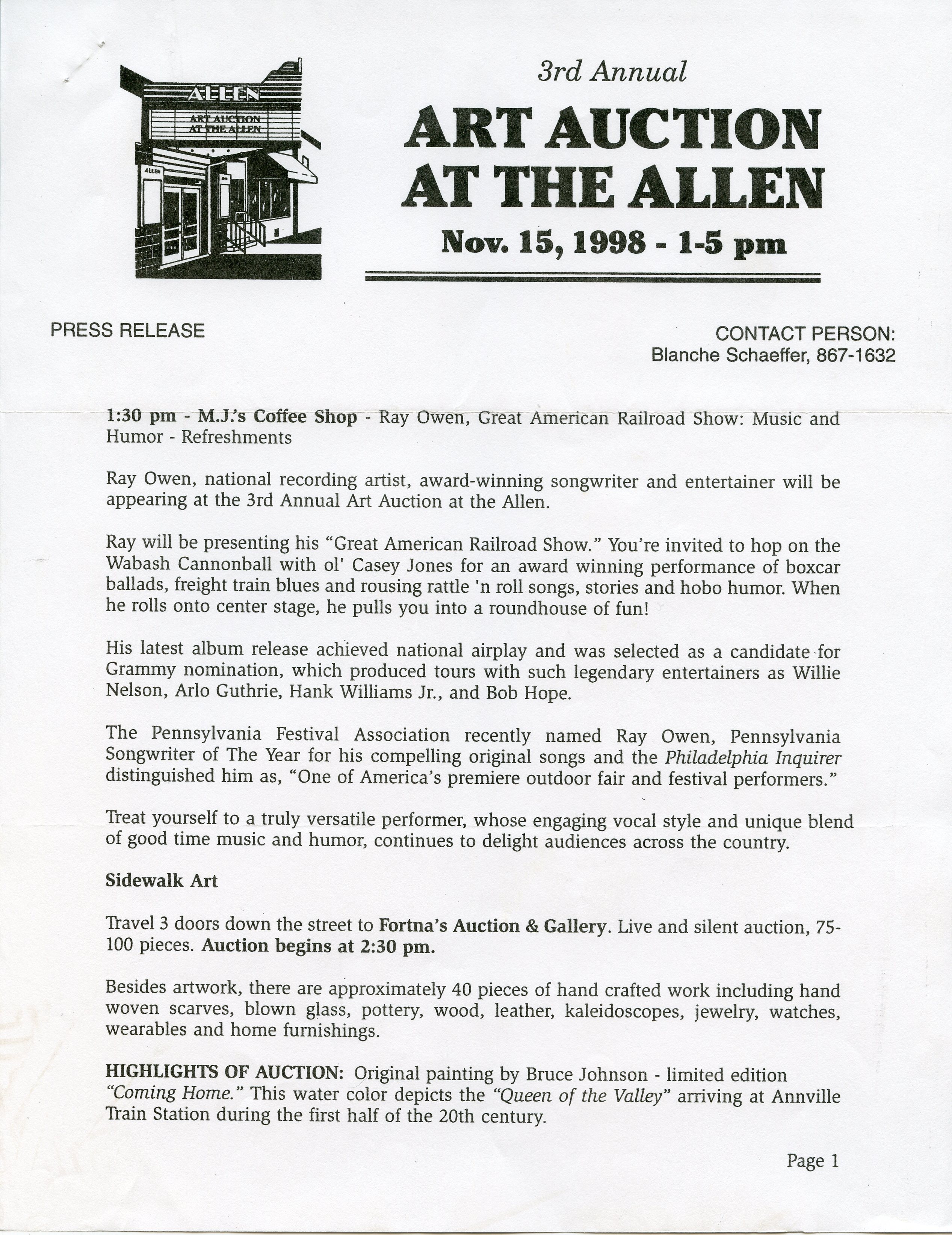
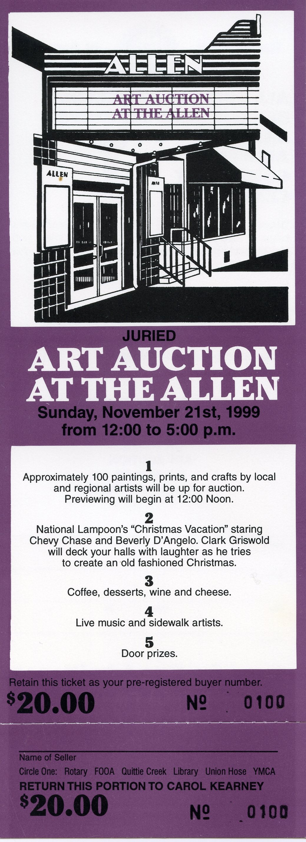
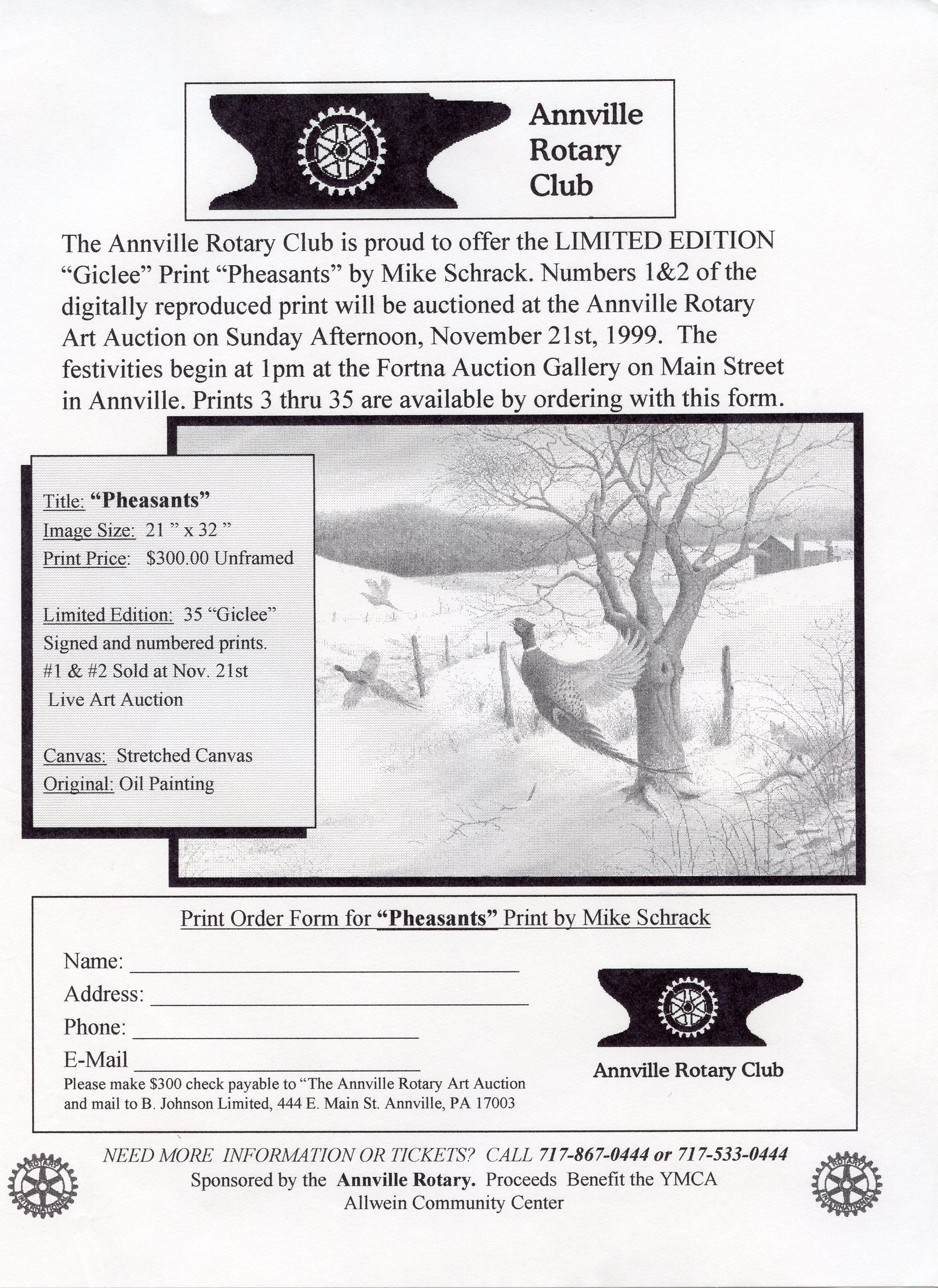
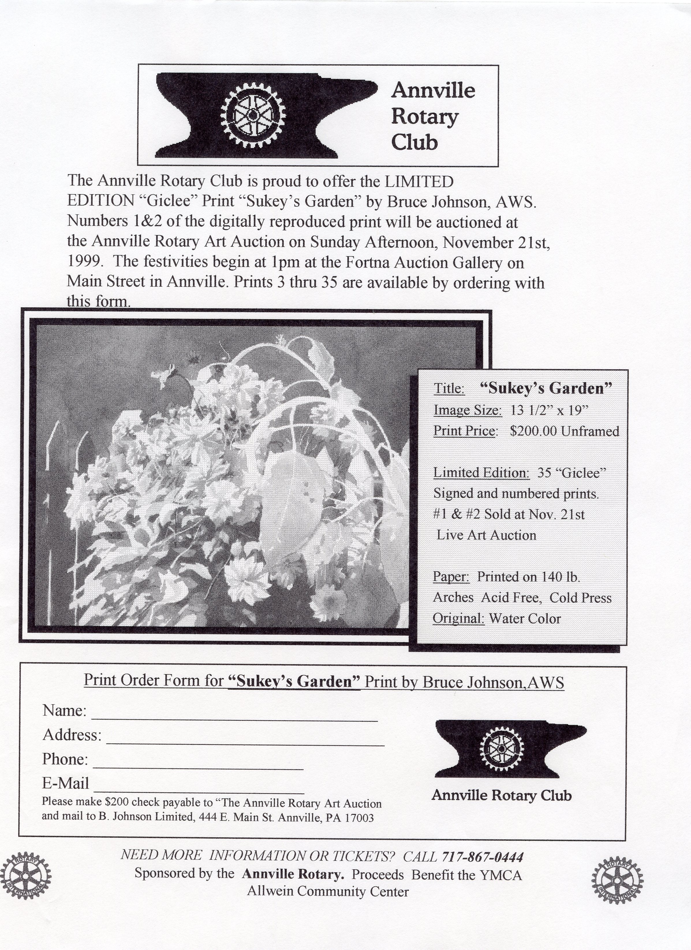
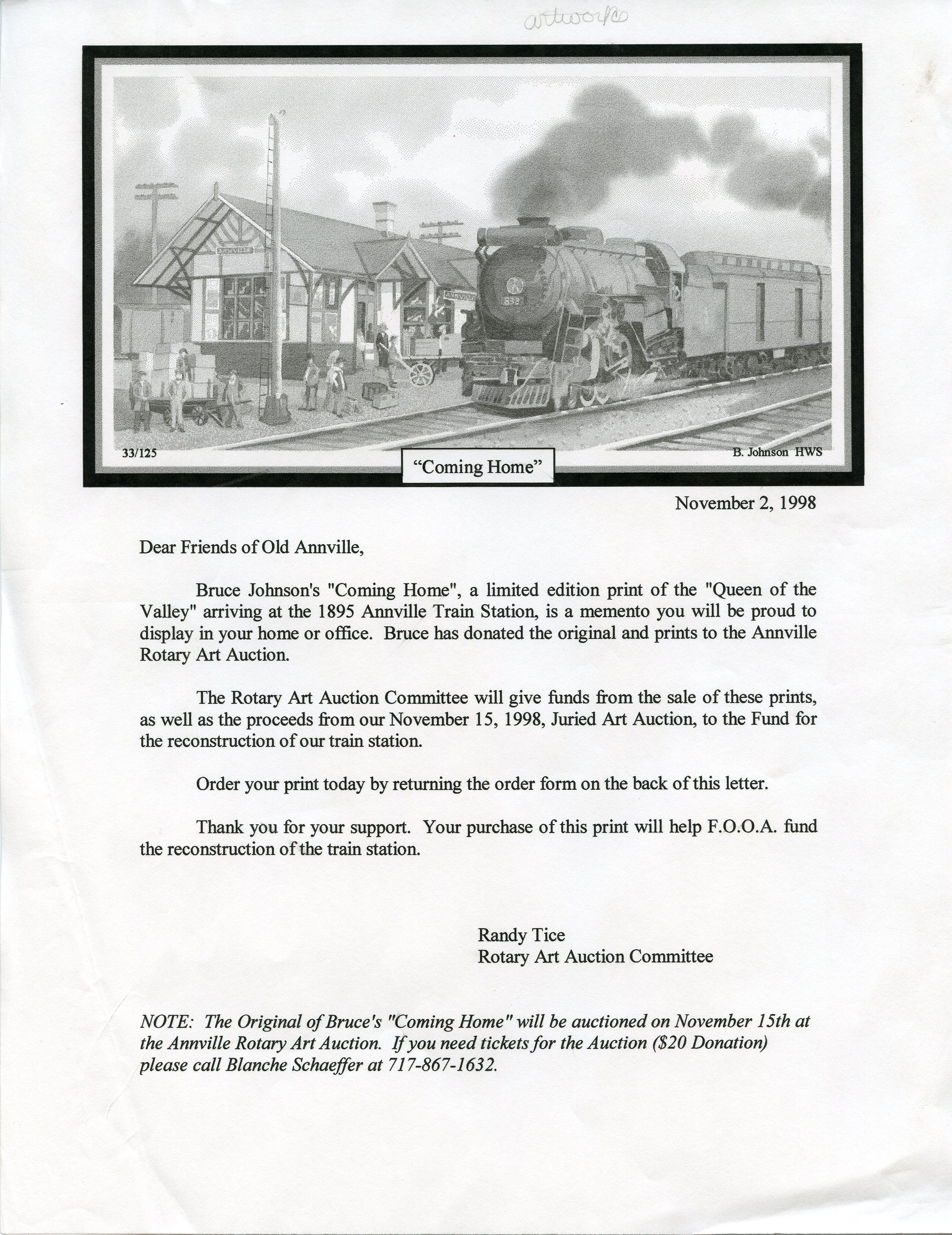
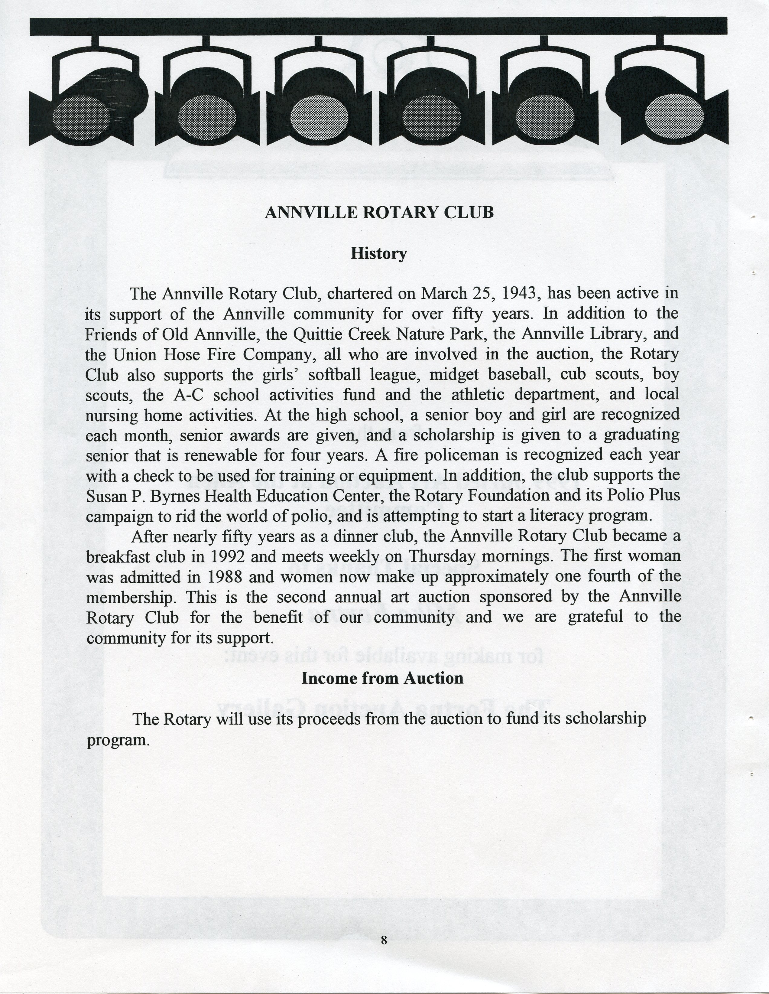
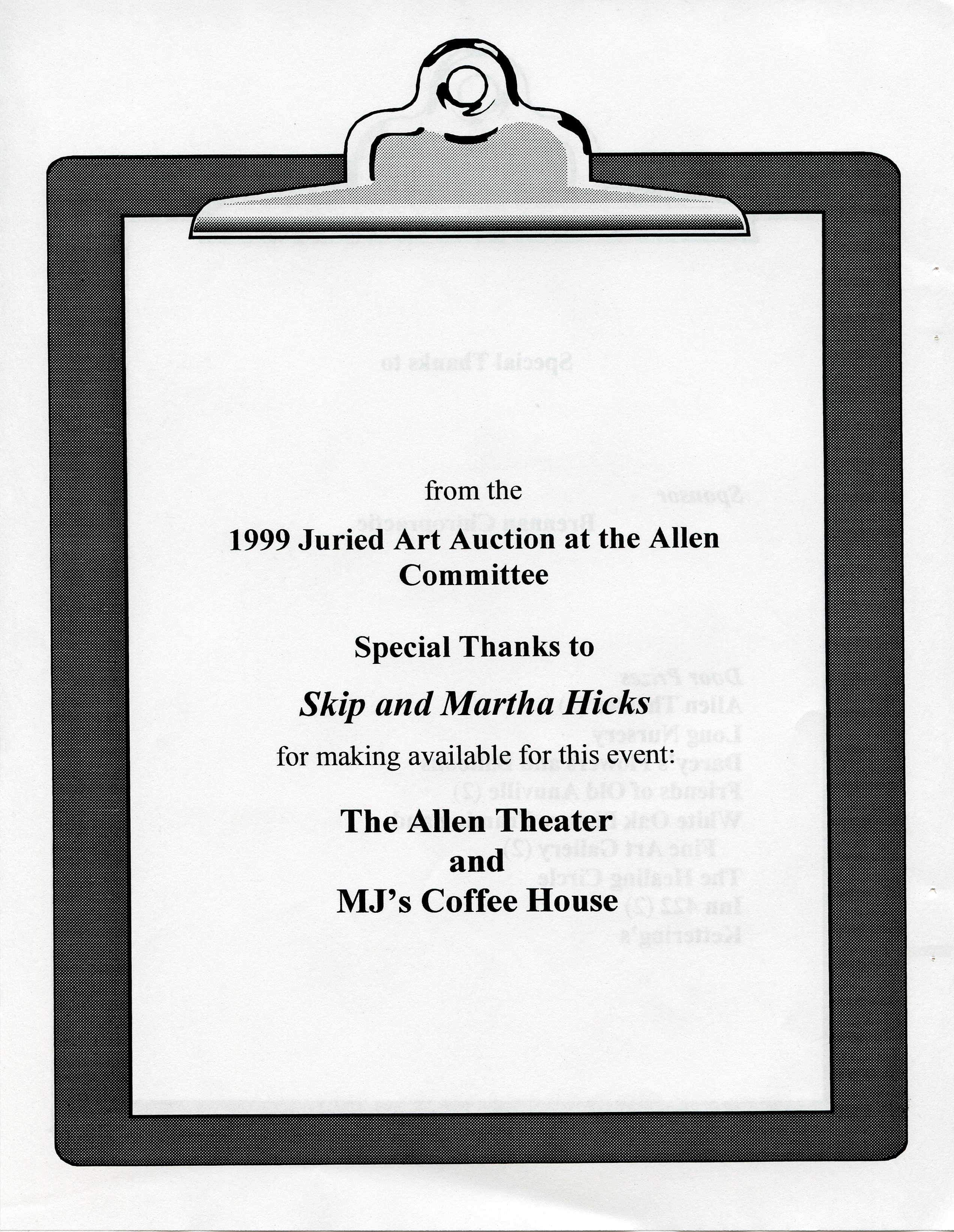
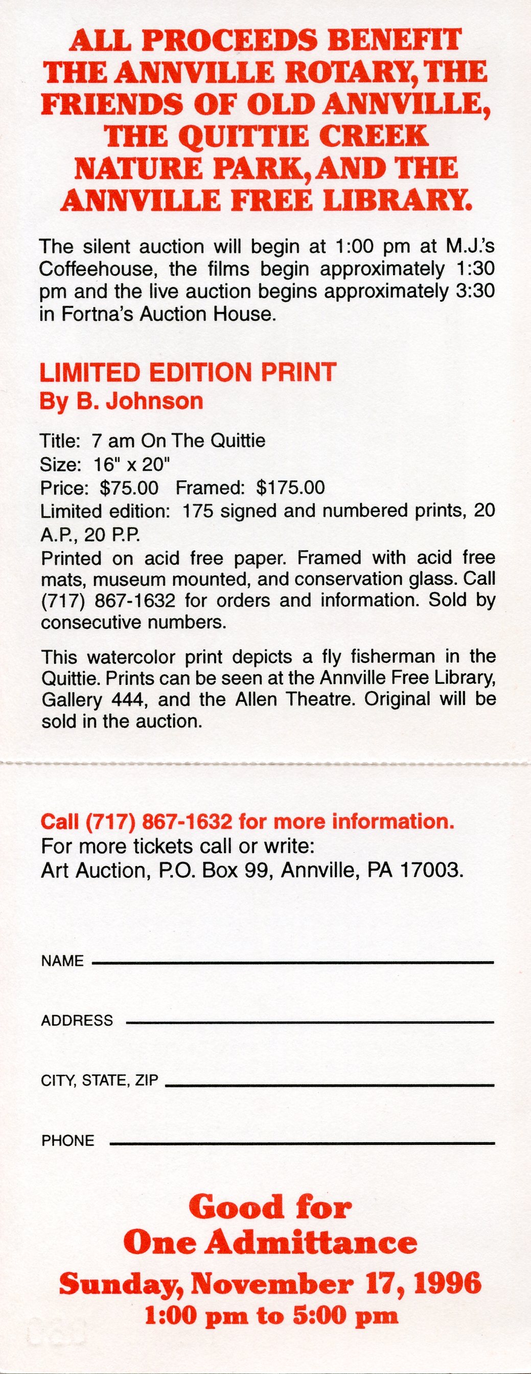
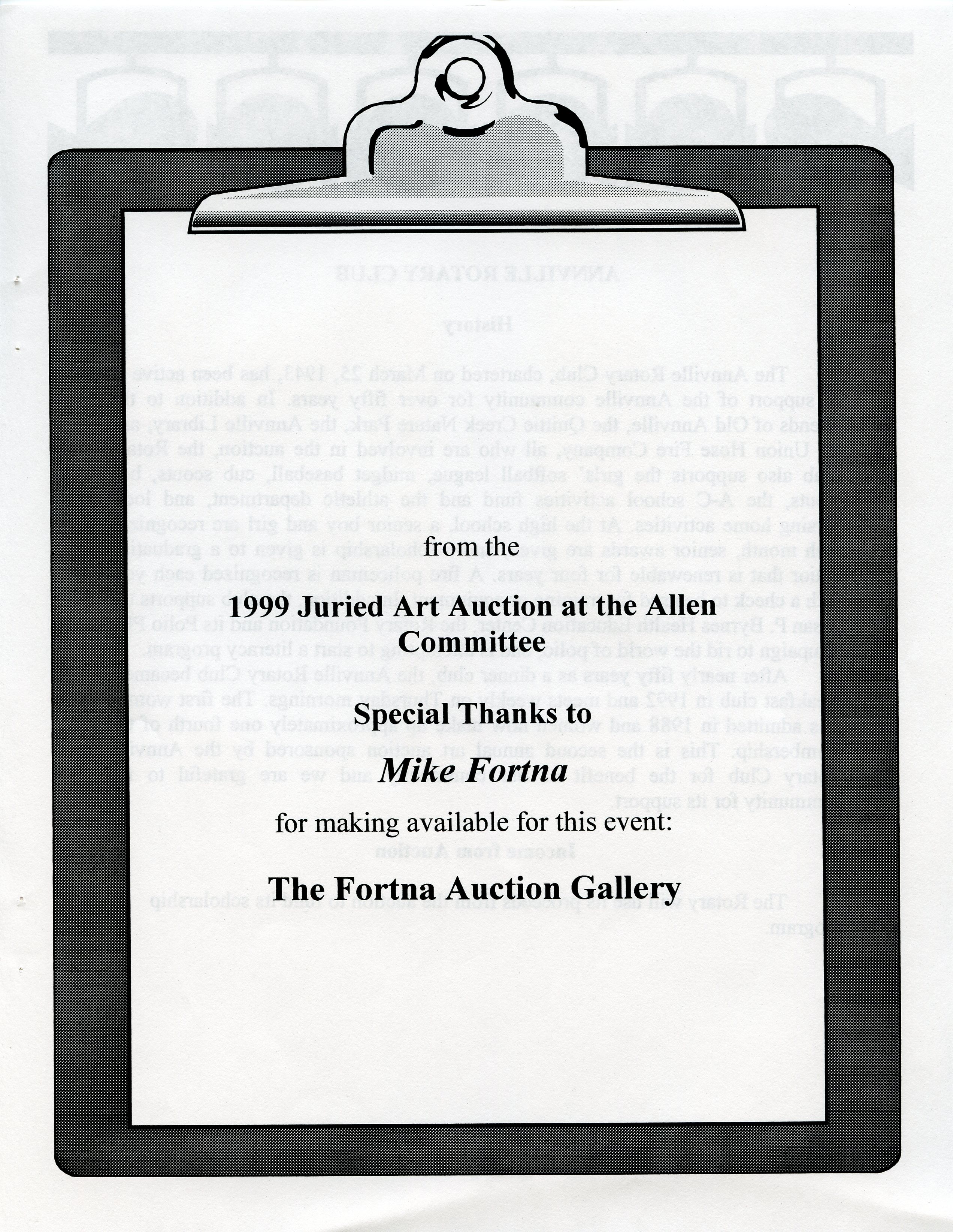
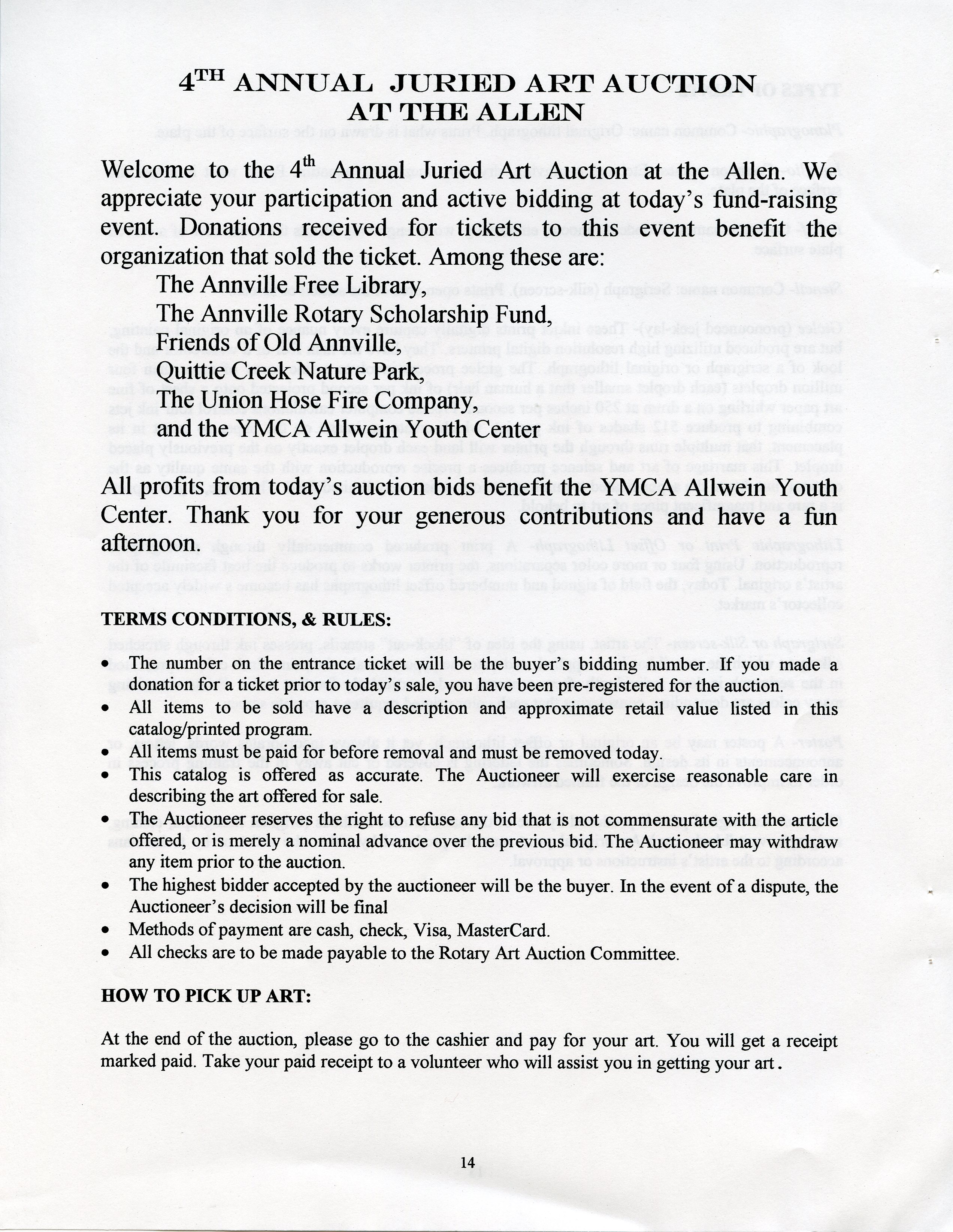
1996-1999 • Art & Fundraising: The Annville Rotary Club & the Seeds of the Watershed Association in Annville Civic Life
This select handful of documents shows the fundraising efforts spearheaded by the Annville Rotary Club from 1996 to 1999, in coalition with other active civic organizations in Annville: the Annville Free Library — Friends of Old Annville — Quittie Creek Nature Park — Union Hose Fire Company — Allen Theater — and the YMCA Allwein Youth Center. This was the civic soil out of which the Quittapahilla Watershed Association grew.
From the first document we learn that the first Juried Art Auction was November 1996, and in the last row we see that it continued strong through November 1999, with quite an extensive inventory of art to be auctioned in 1998! (the whole 1998 inventory is not included here ... nor are images of the artwork itself, which doesn't pertain to the watershed and is owned by its creators, not us). This is as far as the files take us. Click on thumbnails for full images.
 |
 |
 |
 |
 |
 |
 |
 |
 |
 |
 |
|
 |
 |
 |
 |
 |
 |
 |
 |
 |
 |
 |
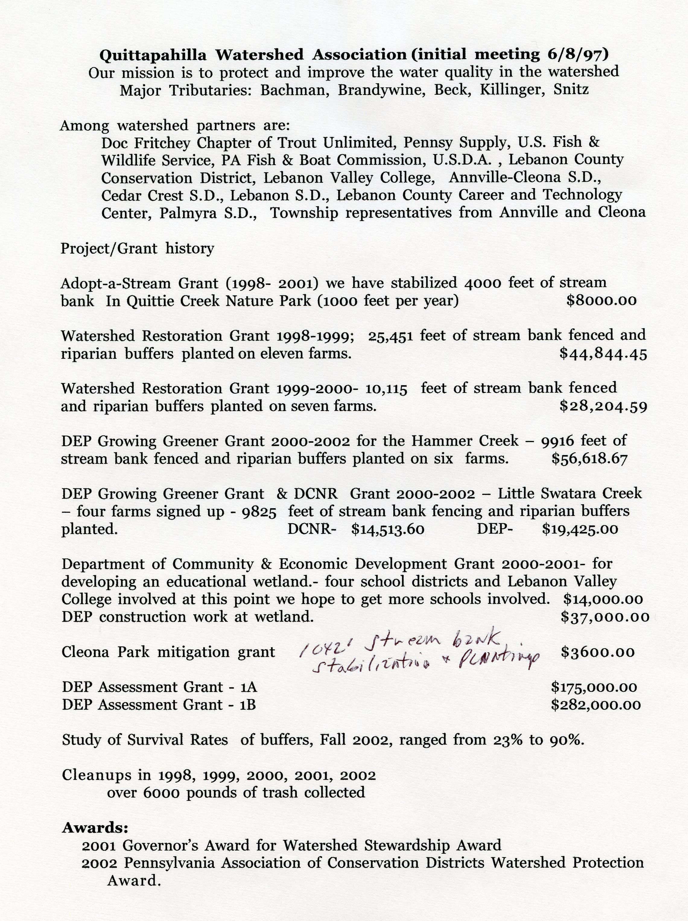
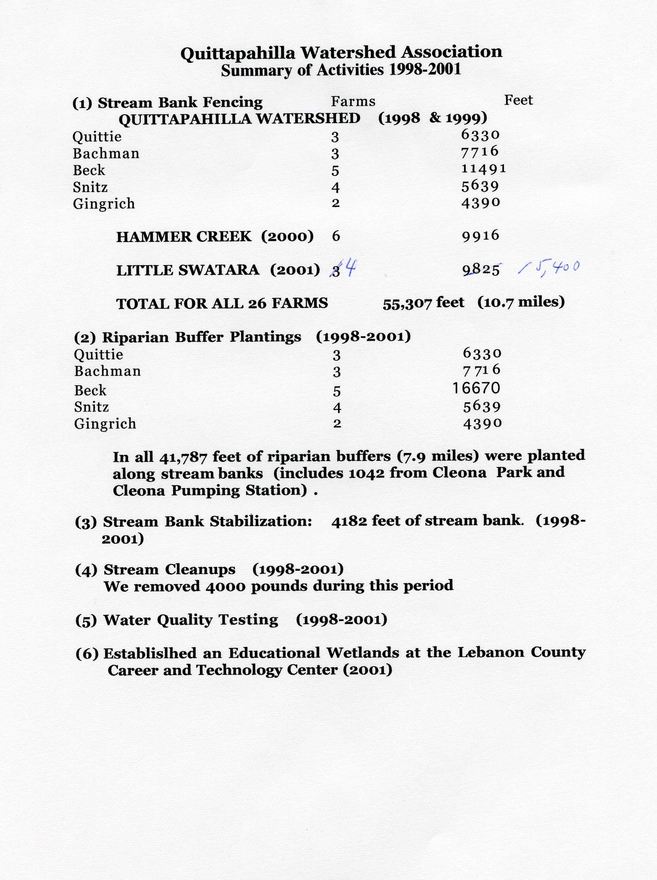
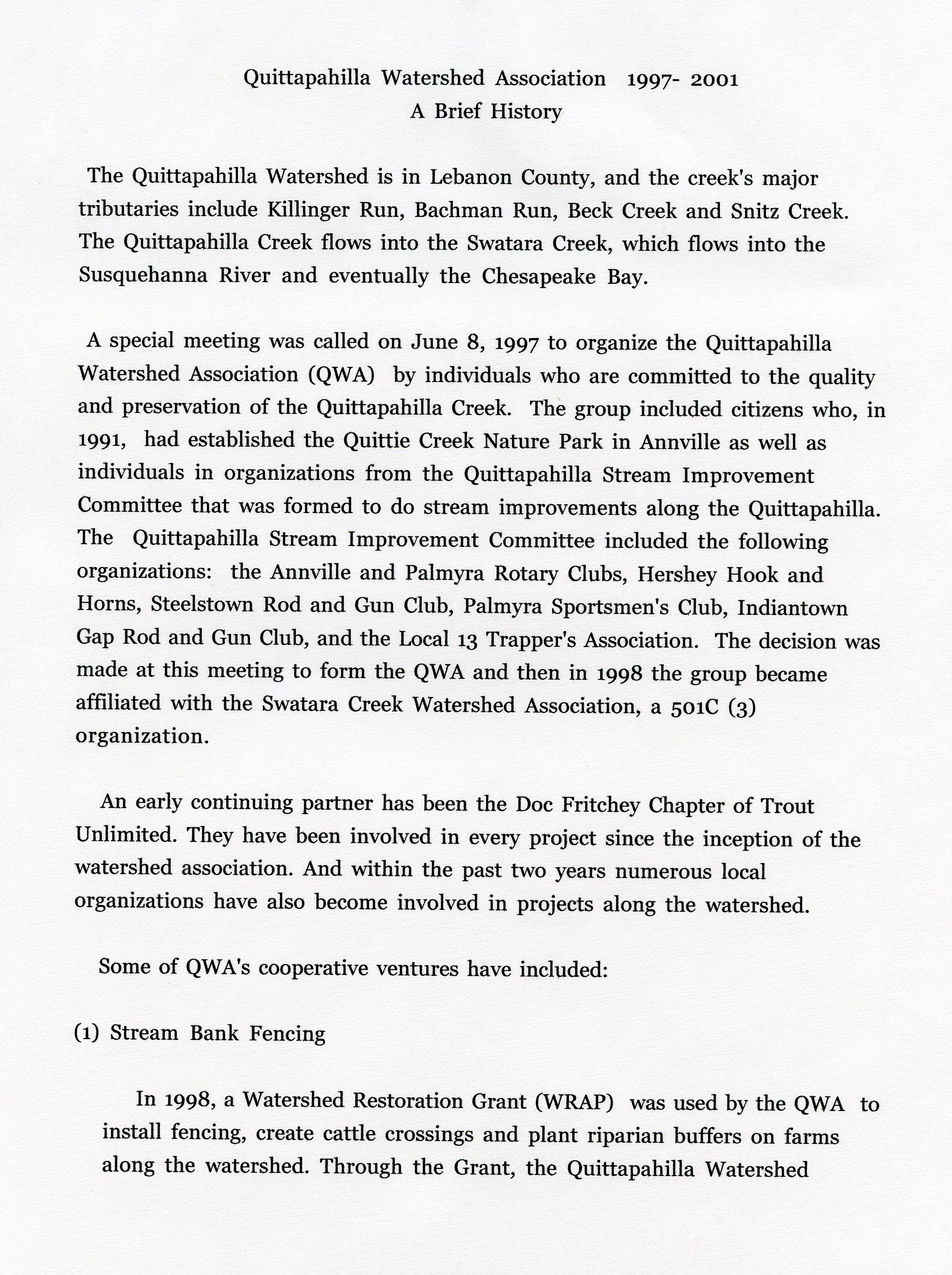
1997-2000 • Foundational Documents of the Quittapahilla Watershed Association
These six PDF files represent the foundational documents of the QWA — synopsizing not only the motivations behind the Watershed Association's formation, but the main projects & activities undertaken in its first four formative years. One cannot help but be impressed with the energy & dynamism of the QWA's efforts & leadership in these early years.
• Draft Initial Mission Statement, 8 June 1997 (1 p. PDF file)
• Quittie Watershed Association Committees (1 p. PDF file)
• Front page article, Lebanon Daily News, June 9, 1997, on the QWA's first meeting ( p. 1 | p. 5 )
• History of QWA 6/97-9/00 (3 pp. PDF file)
• 2nd Report: Quittapahilla Watershed Association, 1997-2001: A Brief History (3 pp. PDF file)
• Watershed Award (draft summary of accomplishments, 1997-1999) (5 pp. PDF file)
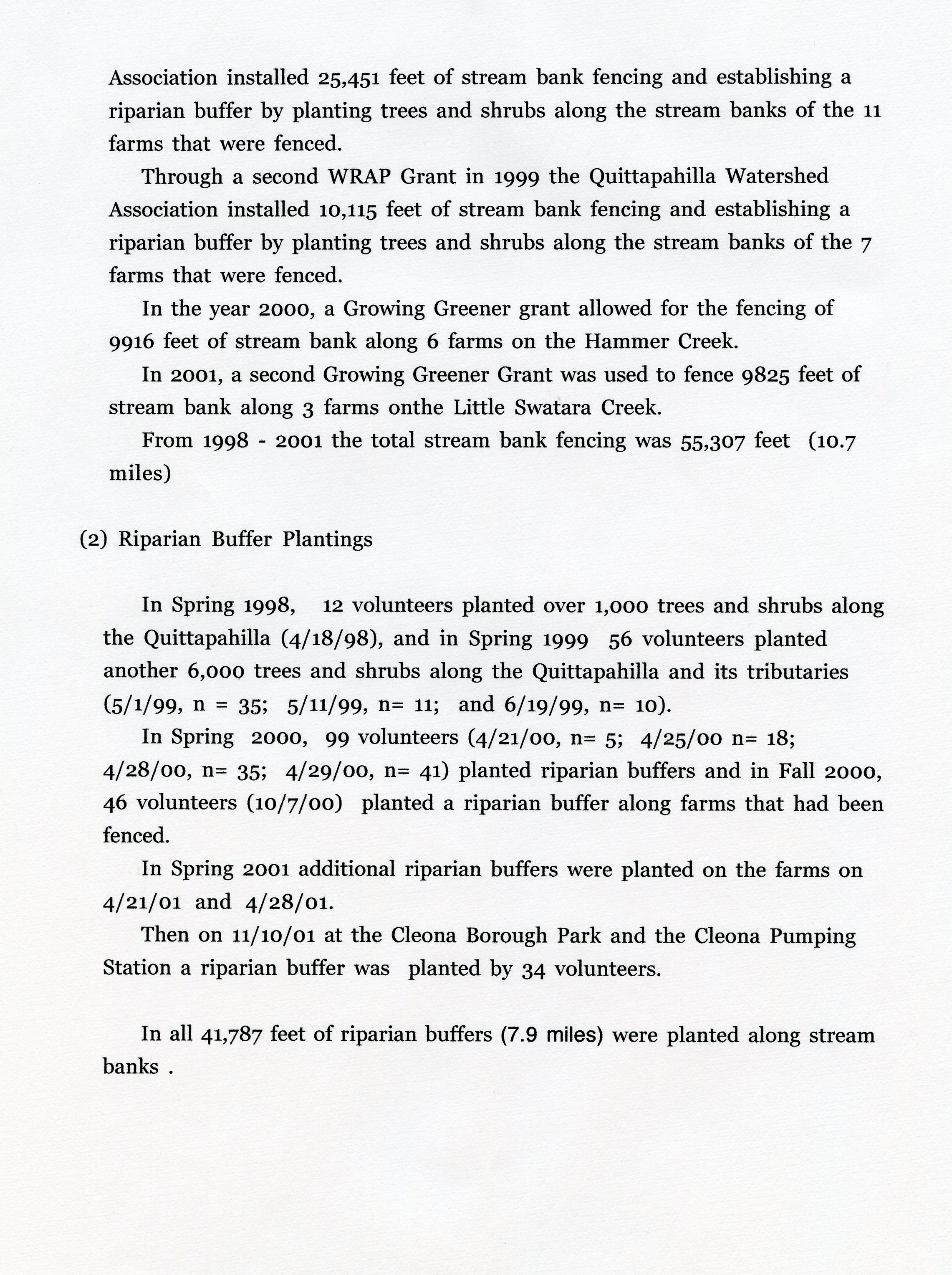
• Work Along the Watershed by the Quittapahilla Watershed Association (1998-2000, 3 pp. PDF file)
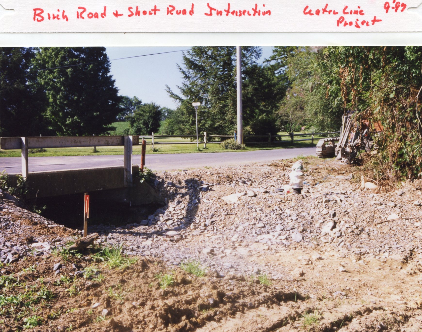
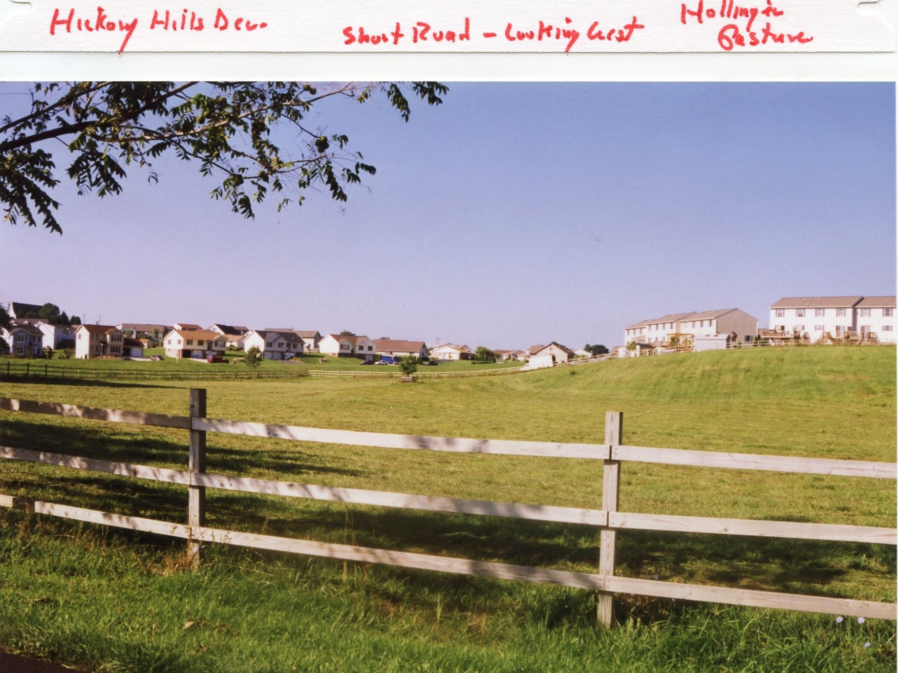
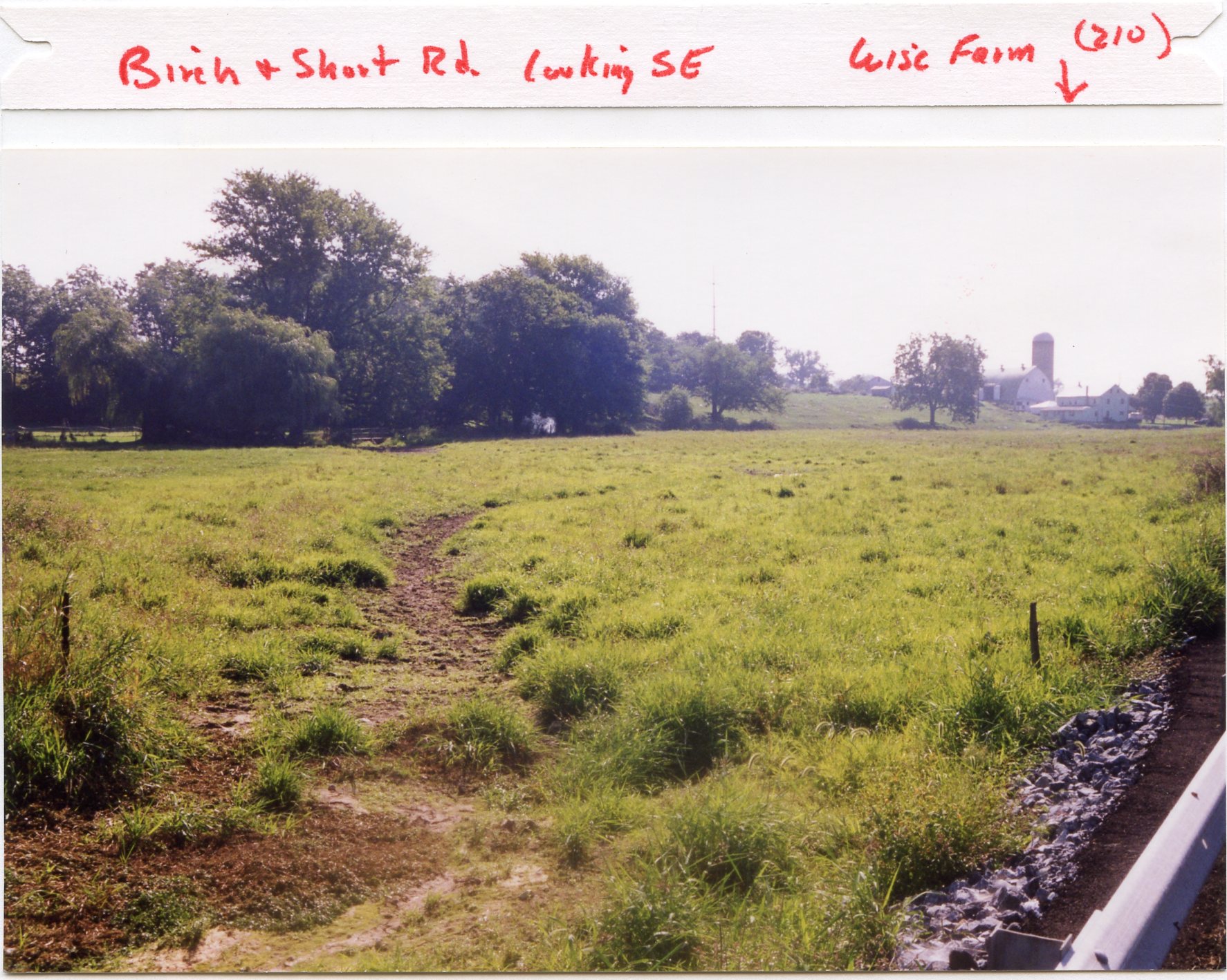
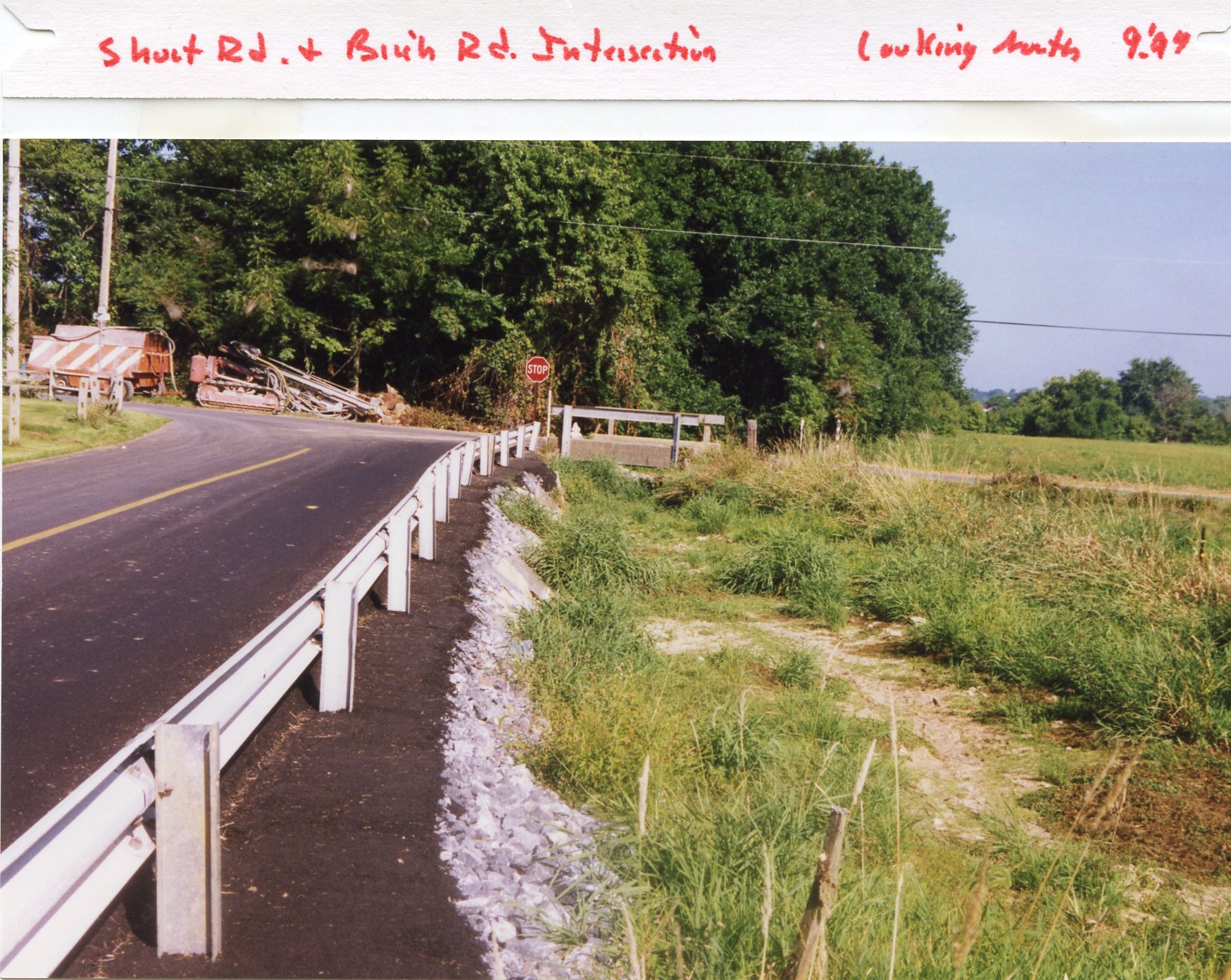
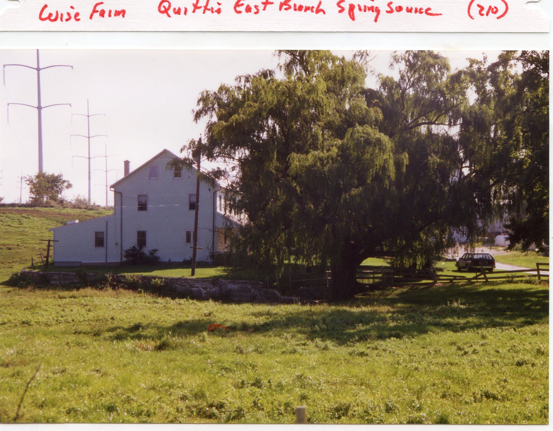
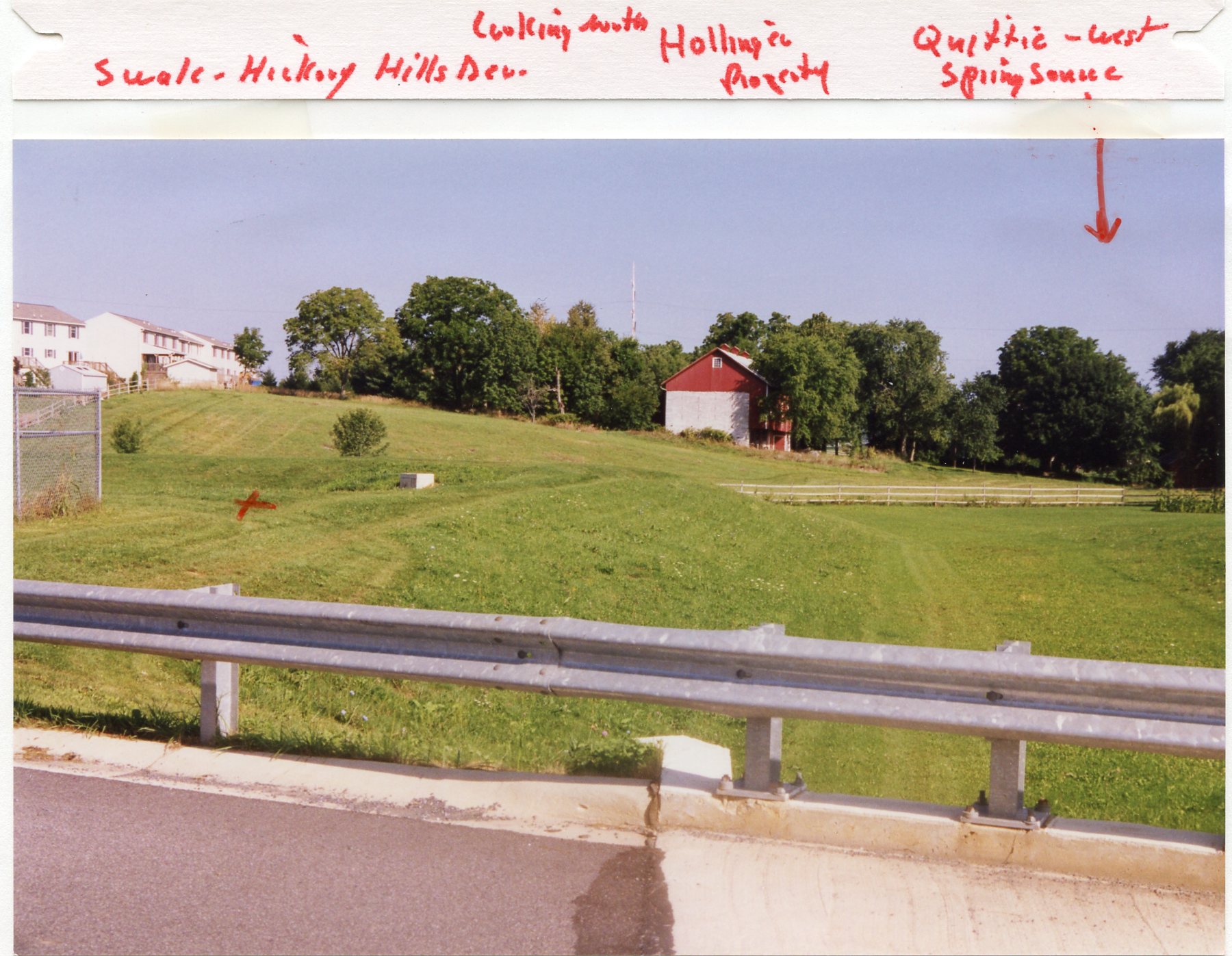
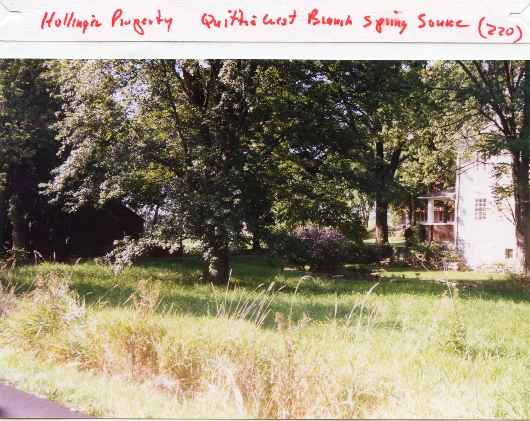
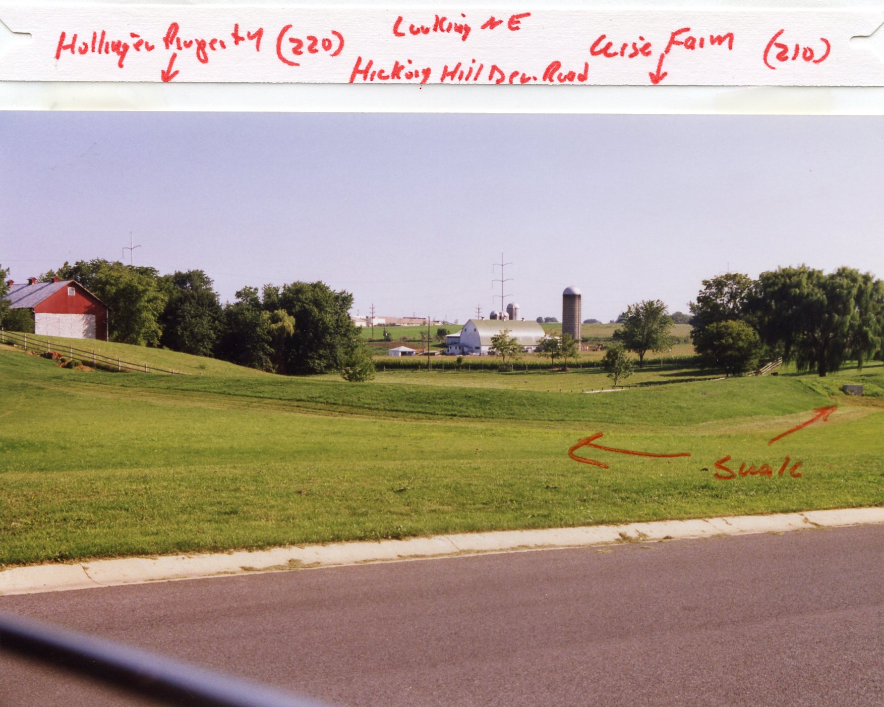
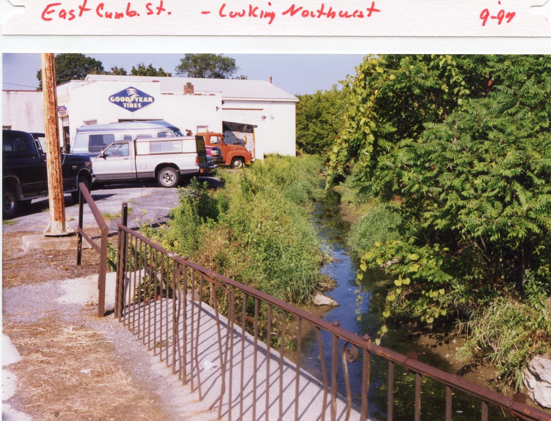
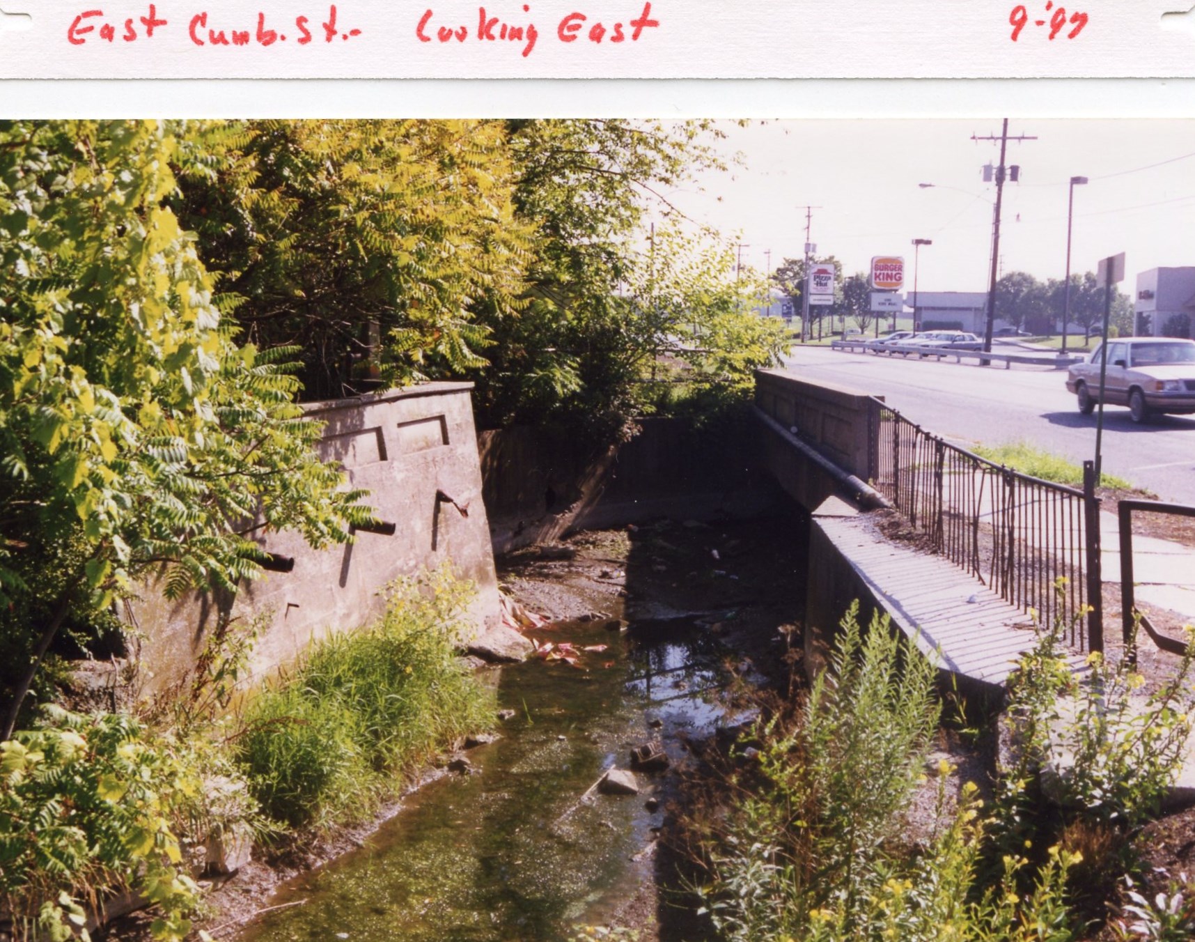
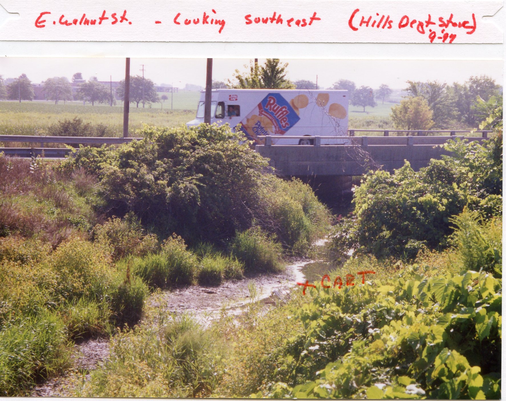
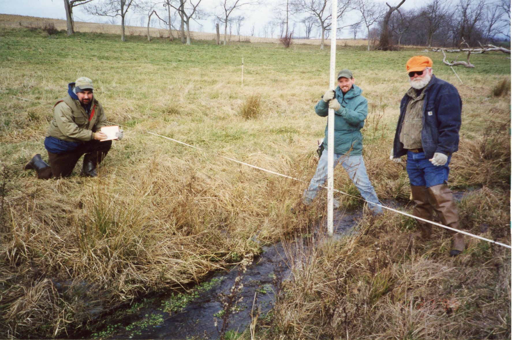
Sept 1997 • Photos of the Quittie's Headwaters
These 11 captioned photos of the Quittie's headwaters east & south of the City of Lebanon were taken in September 1997 as part of what looks like a survey mission and effort to document important recent changes in creek drainage patterns, and key locations in the watershed, like the "Quittie East Branch Stream Source". The first photo is labeled "Water Project" and shows recent construction under a road. Others show the "Hickory Hills Development" and were probably meant to highlight recent changes in flow & drainage patterns in those places. Dave, what do you remember about these photos?
 |
 |
 |
 |
|
Birch Rd & Short Rd intersection, water line project, Sept 1997 |
Hickory Hills Development, Short Rd - looking west - Hollinger Pasture |
Birch & Short Rd, looking SE - Wise Farm (210) |
Short Rd & Birch Rd intersection, looking north - Sept. 1997 |
 |
 |
 |
 |
|
Wise Farm, Quittie east branch spring source (210) |
Swale - Hickory Hills Development, looking north - Hollinger property - Quittie west spring source |
Hollinger property, Quittie west branch spring source (220) |
Hollinger property (220) Looking NE, Hickory Hills Dev Rd, Wise Farm (210) - "Swale" marked |
 |
 |
 |
|
|
E Cumberland St looking NW, Sept 1997 |
E Cumberland St looking east, Sept 1997 | E Walnut St looking SE (Hills Dept Store), Sept 1997 - "cart" in creek |
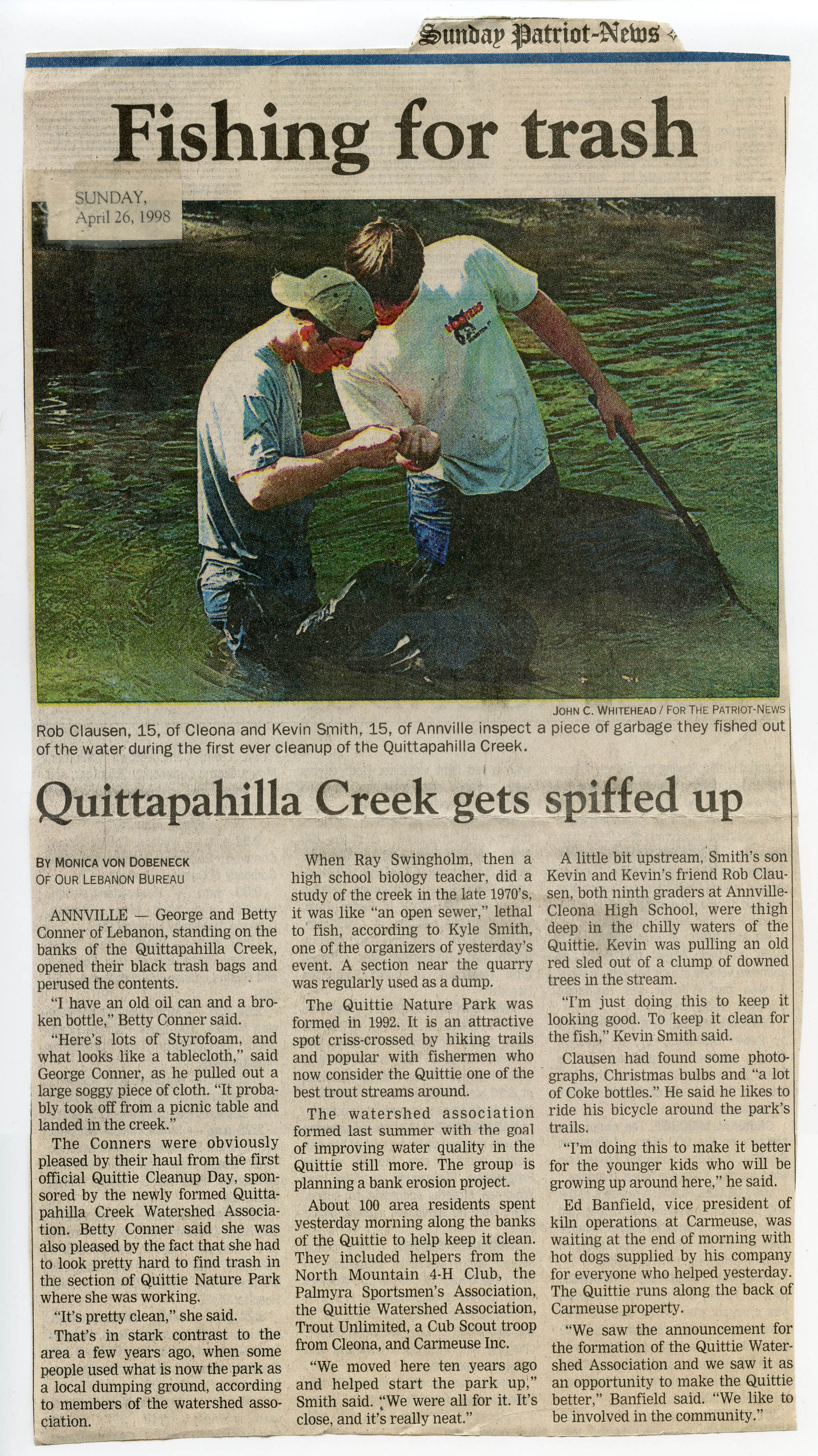
1998 • "Fishing for Trash - Quittapahilla Creek Gets Spiffed Up," by Monica von Dobeneck in the Harrisburg Sunday Patriot-News, April 26, 1998
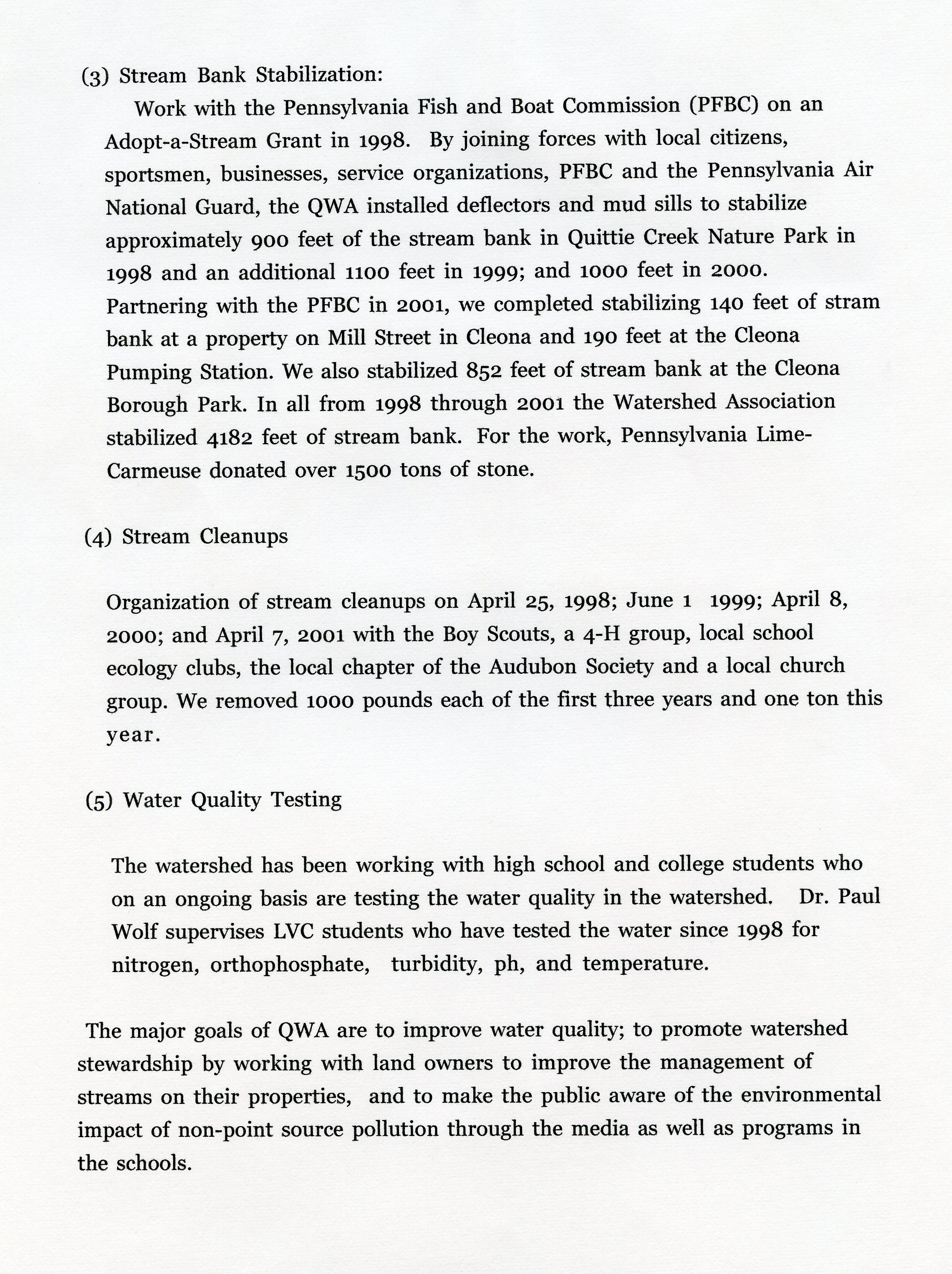
Today's Quittie cleanups are part of a long & distinguished tradition. Click on the image below for a 1.7 MB, 300 dpi JPEG file of this newspaper article of 26 April 1998 from the Harrisburg Patriot-News about local boys Kevin Smith & Rob Clausen, and QWA founding members Kyle Smith (Kevin's dad), and Betty & George Conner of Lebanon, and Ray Swingholm, former high school biology teacher who recalls how in the 1970s the creek was an open sewer . . . a very well-told story.
1998 • Water Sampling Results from Quittapahilla Creek, by TRC, Inc.
Robert J. Golden, Jr., Manager, Environmental Permitting, TRC Environmental Corp., to David Lasky, with "copies of field screening and water sampling results from Quittapahilla Creek," May 6, 1998 (9 pp., PDF file). Offers a sound scientific appraisal of the Quittie's water quality at various points on December 17, 1997, the date of TRC's sampling. "The sample was analyzed for anions, cations, heavy metals, and wet chemistry parameters." Results included high nitrate & phosphorous concentrations and excessively high temperatures at the Lebanon Sewage Treatment Plant, but overall the numbers painted a pretty decent picture. "Field measurement results were consistent with previously reported data suggesting that water quality in Quittapahilla Creek is generally good." The Quittie is shown to be holding its own. This report also appears on the Studies & Documents page.
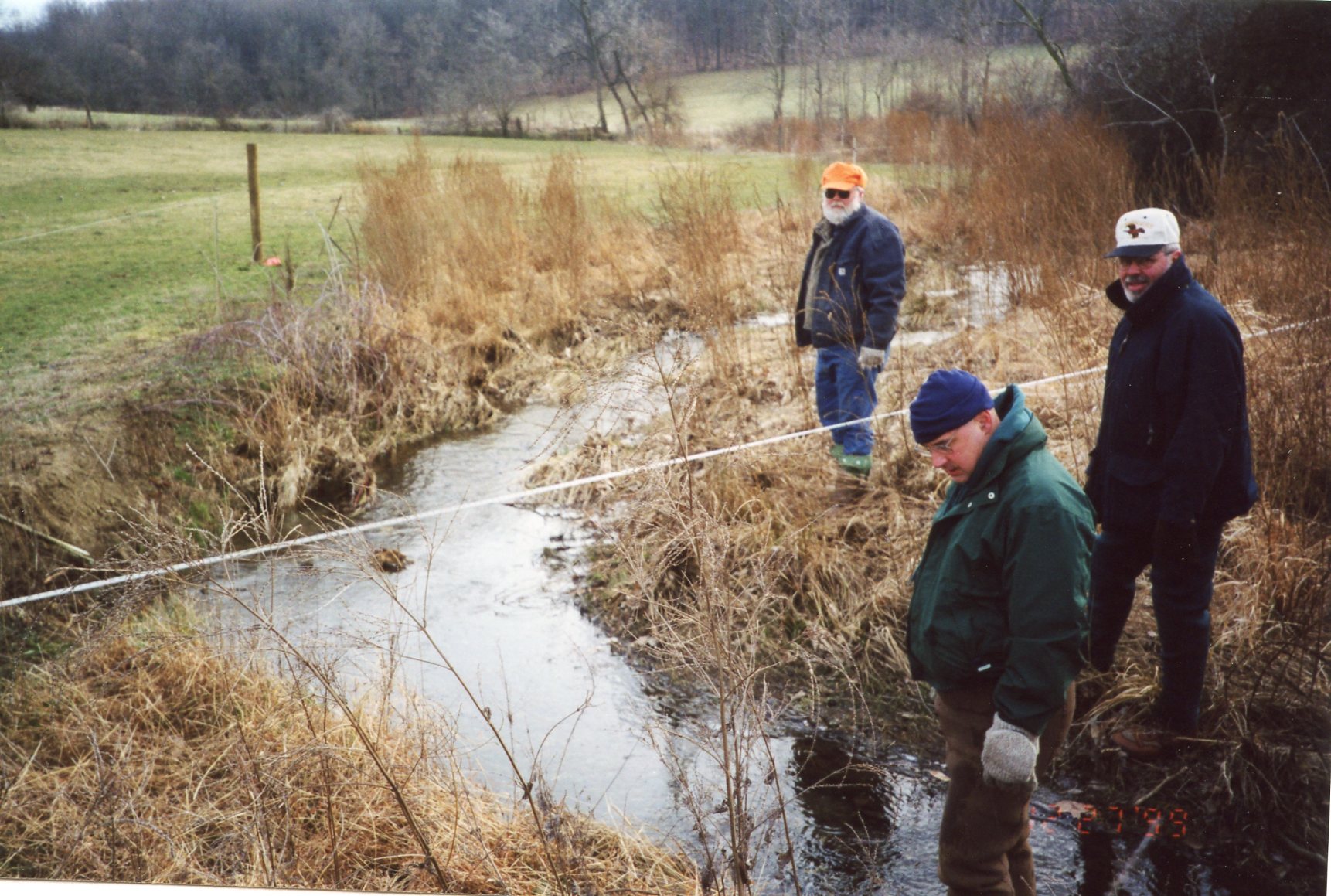
May 10, 1999 • "Fence 'em In" — Building a Livestock Fence on Snitz Creek
A heartening image, and the kind of work that ought to be done more often & systematically across the watershed today: Mike Fern & Craig Skeath of the Lebanon County Bassmasters building a simple and inexpensive wire fence to keep cattle out of Snitz Creek on the farm of Melvin Hershey, thanks in part to a grant from the Chesapeake Bay Foundation. Lebanon Daily News, May 10, 1999. Click on image for higher-resolution scan.
.jpg)
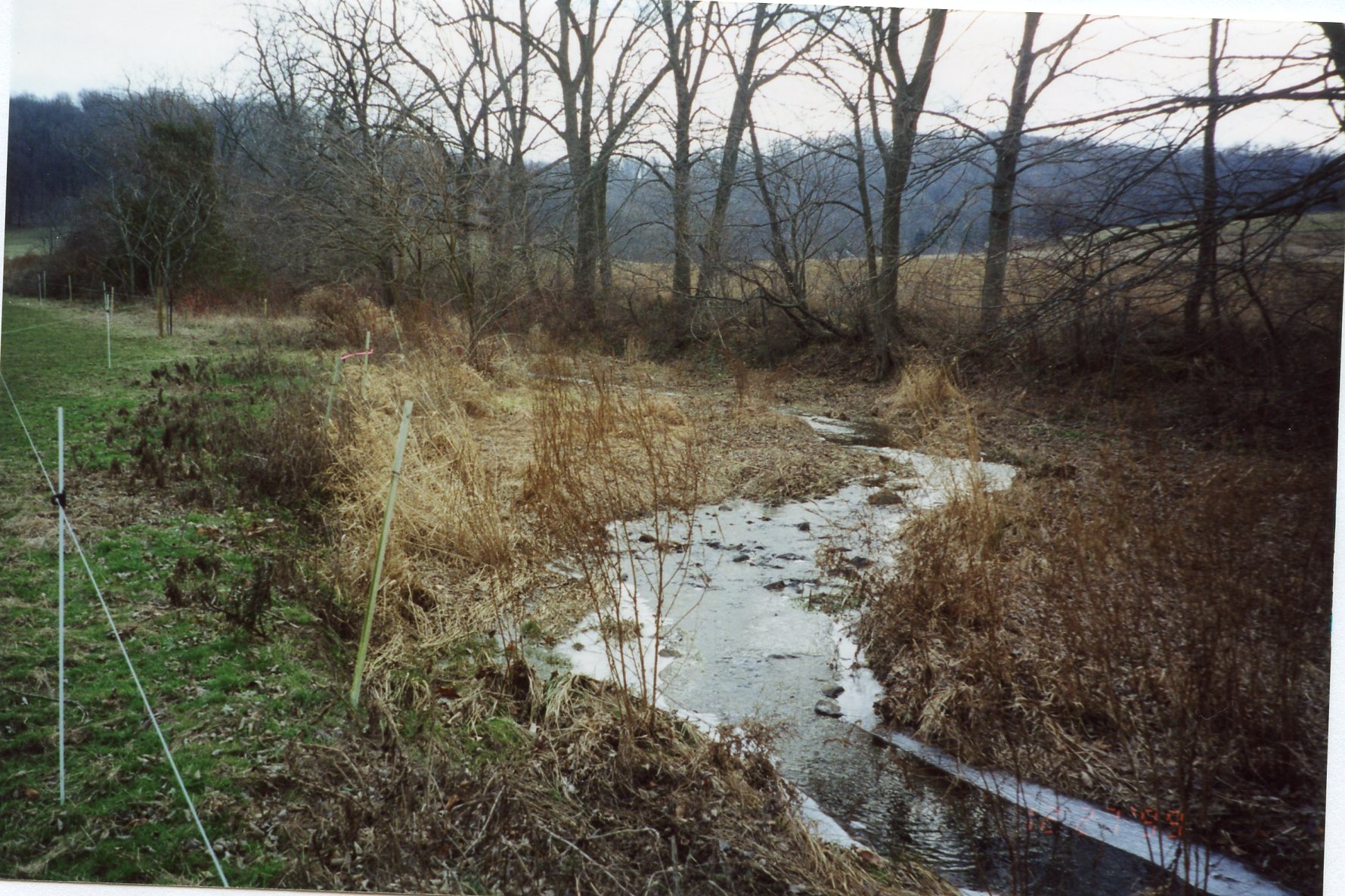
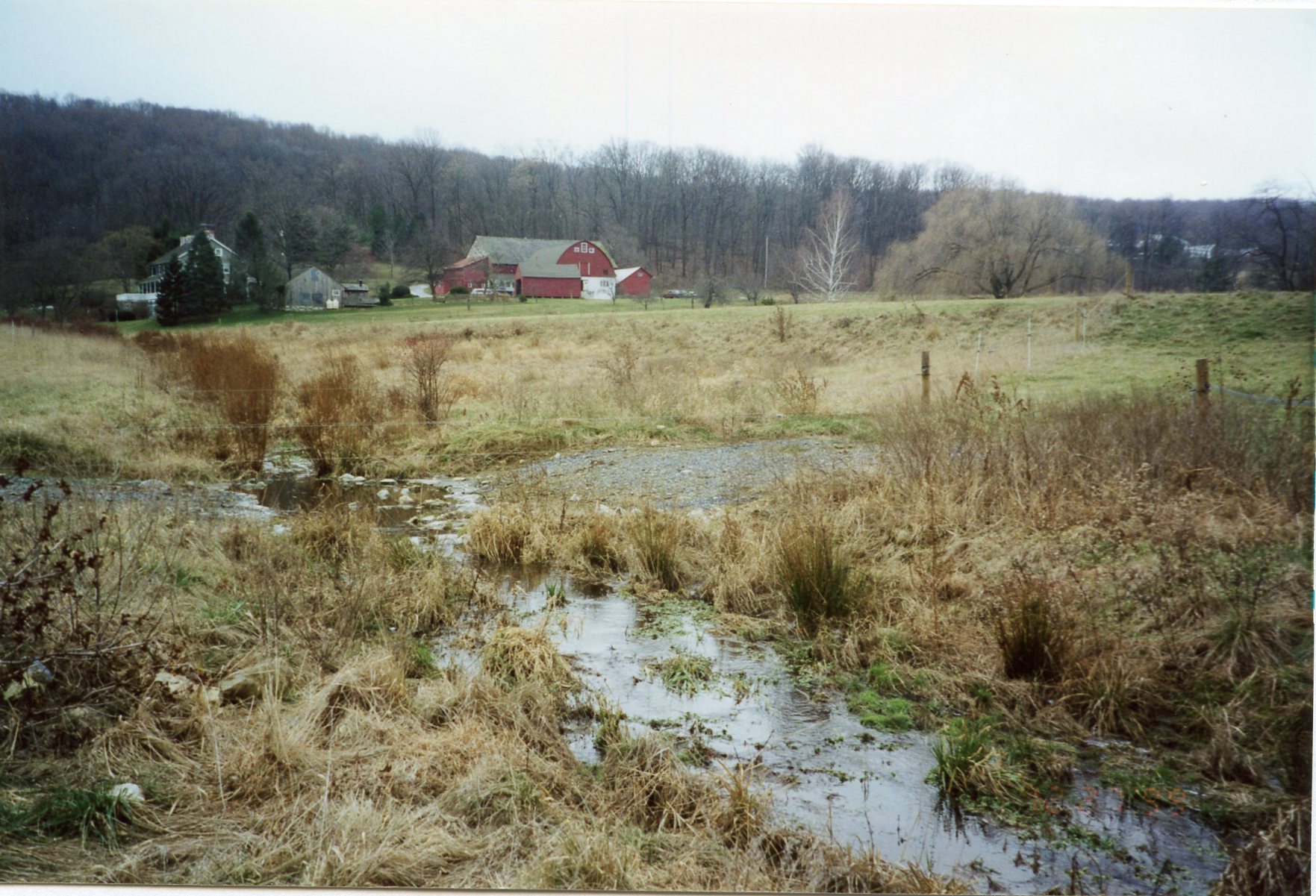
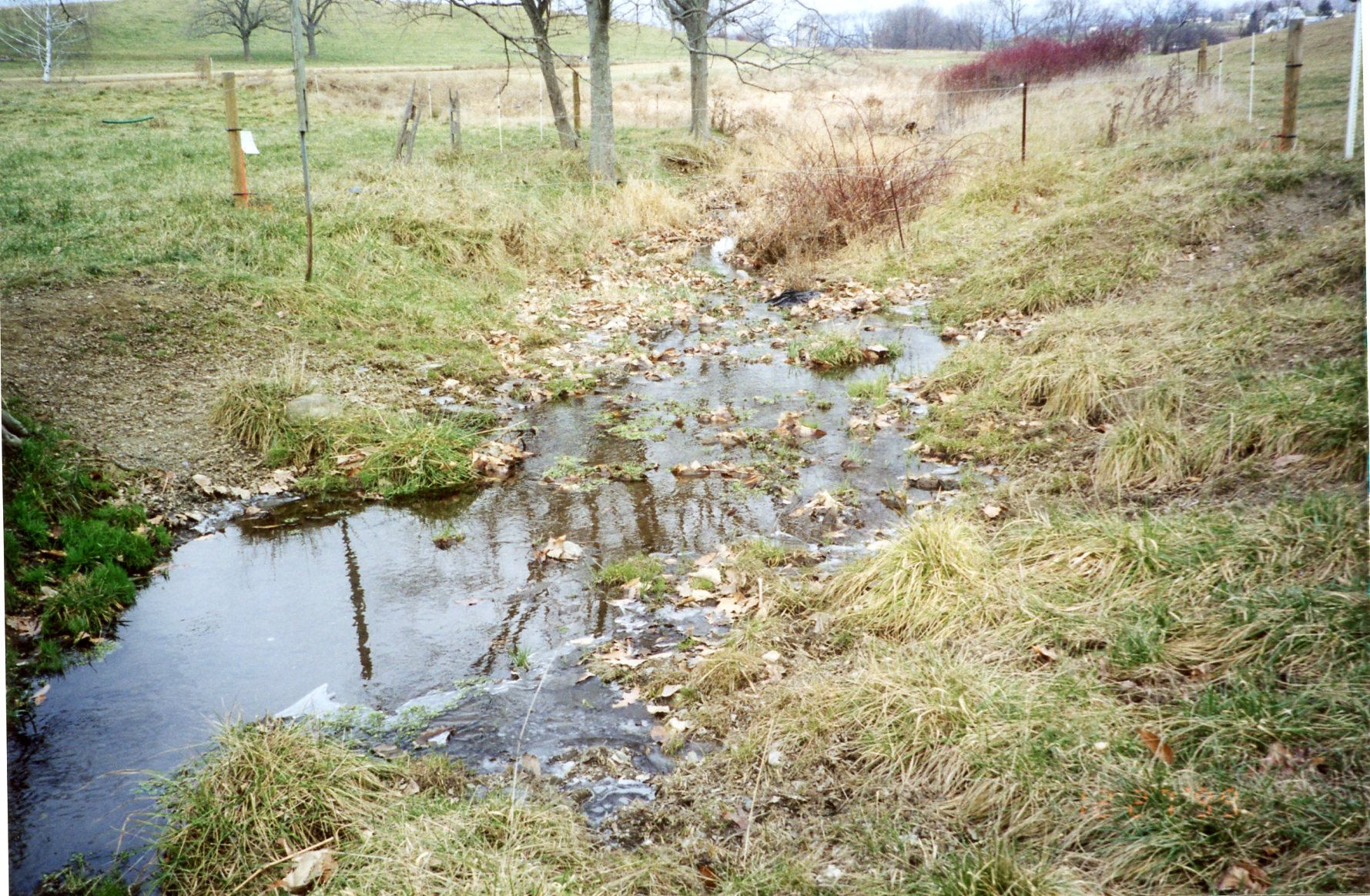
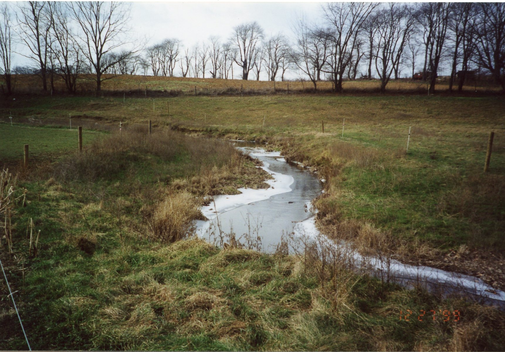
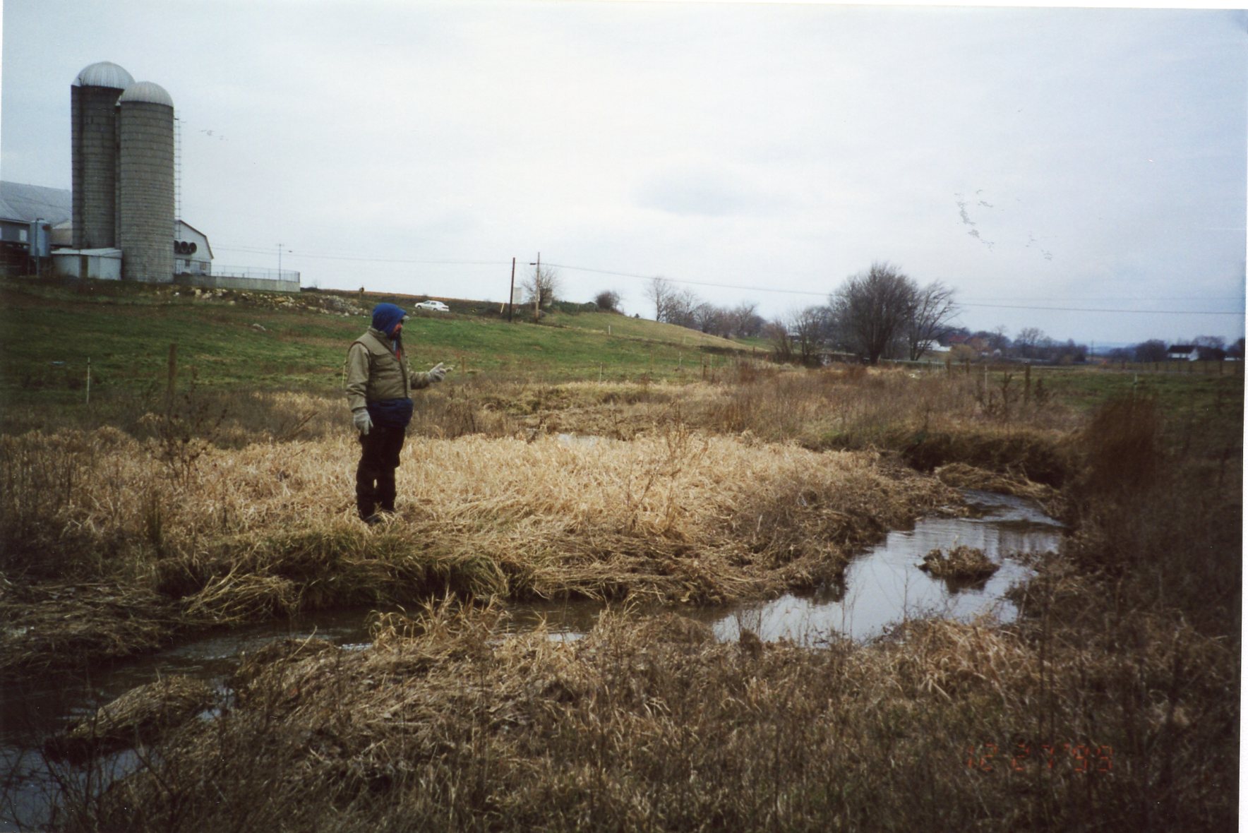
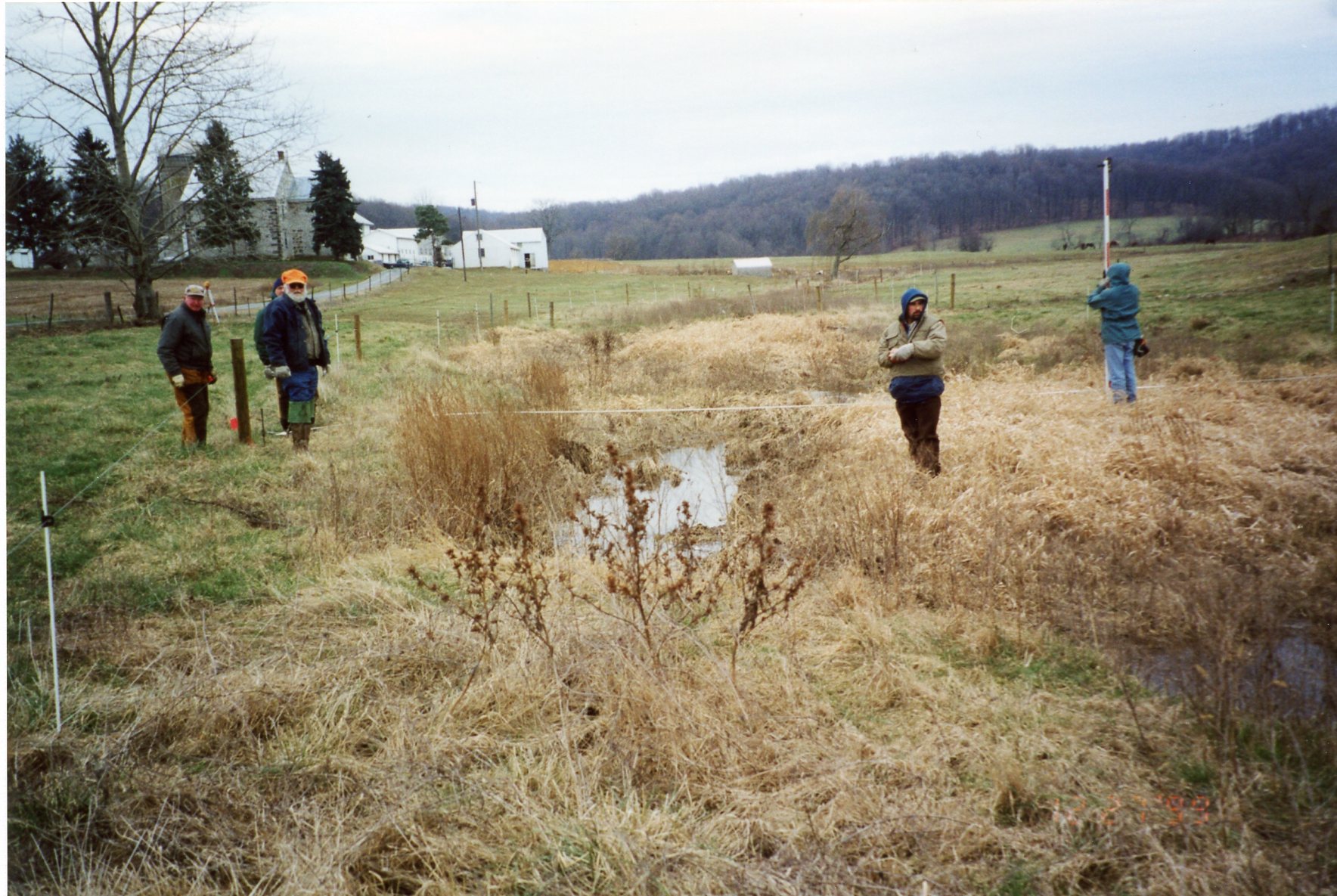
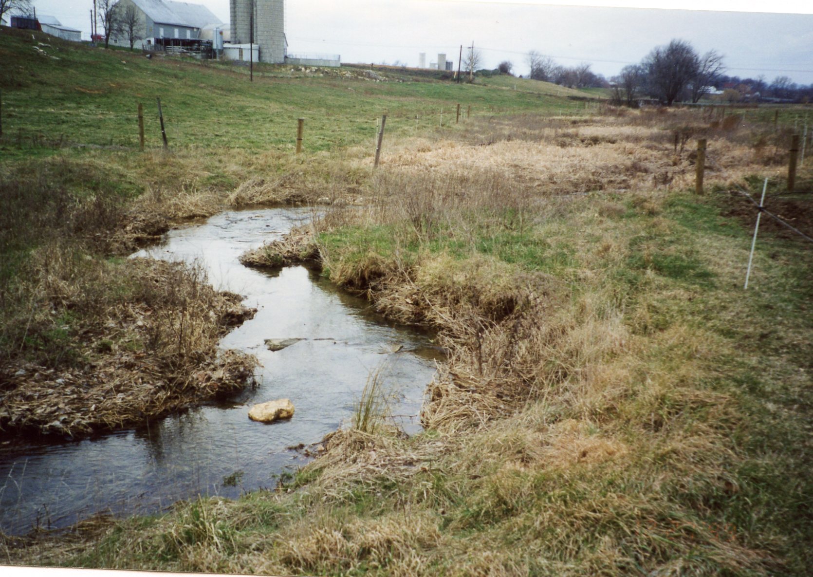
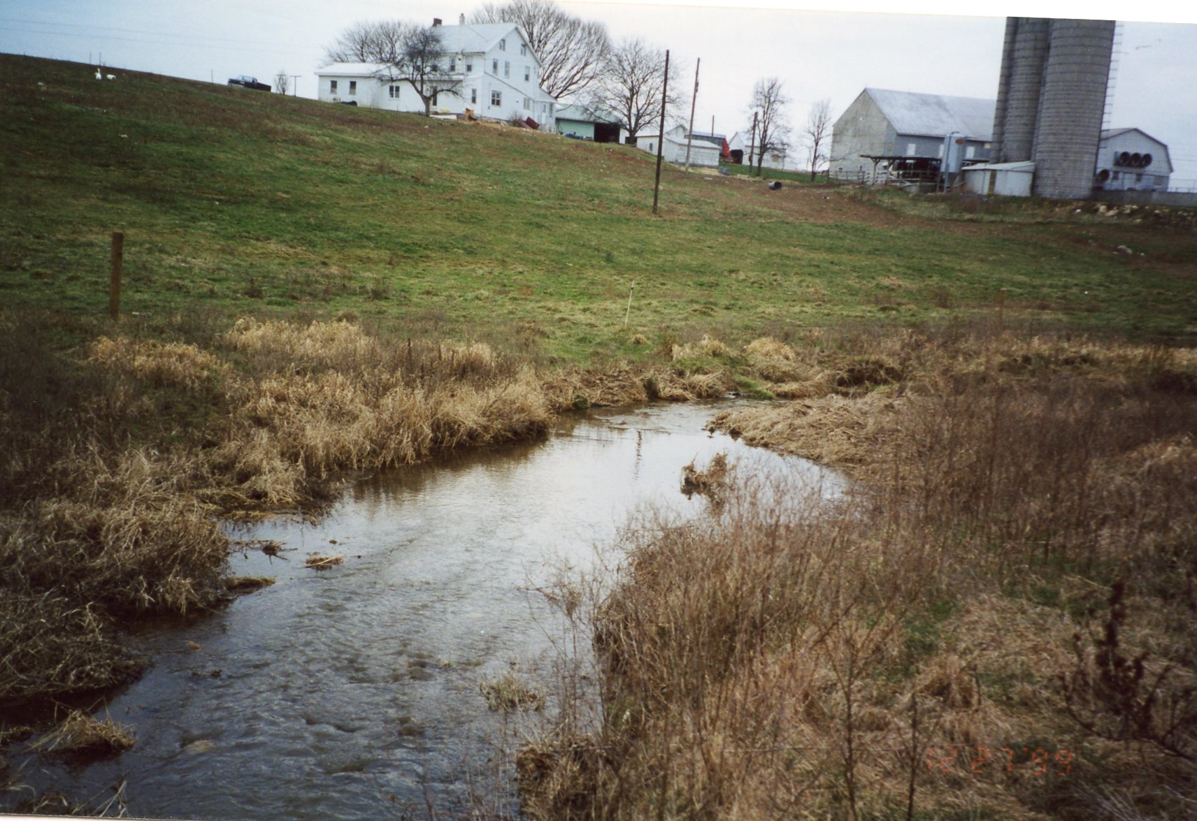
December 1999 • Projects on Henry, Mumma & Wise Farms on Beck Creek under WRAP-2
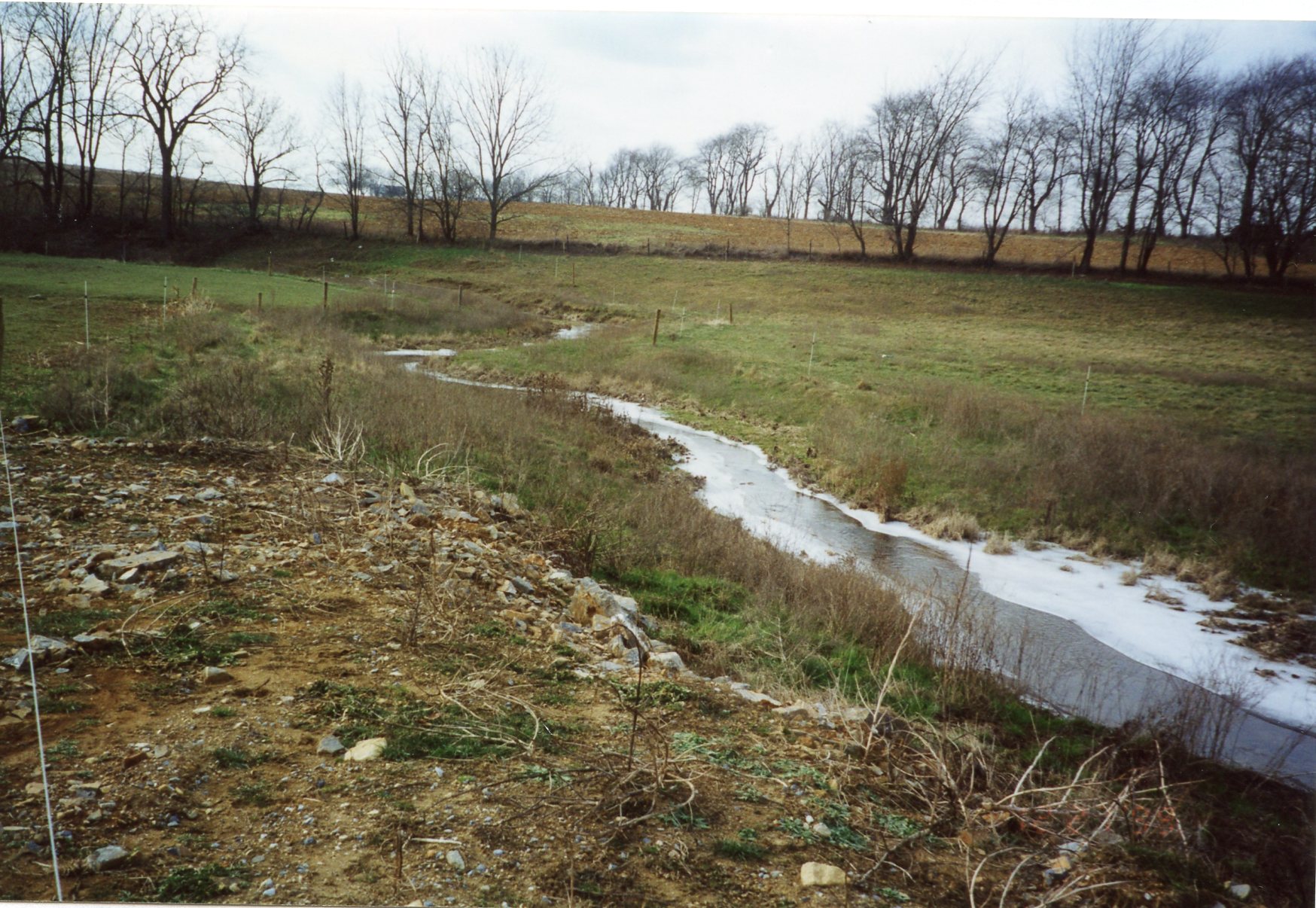
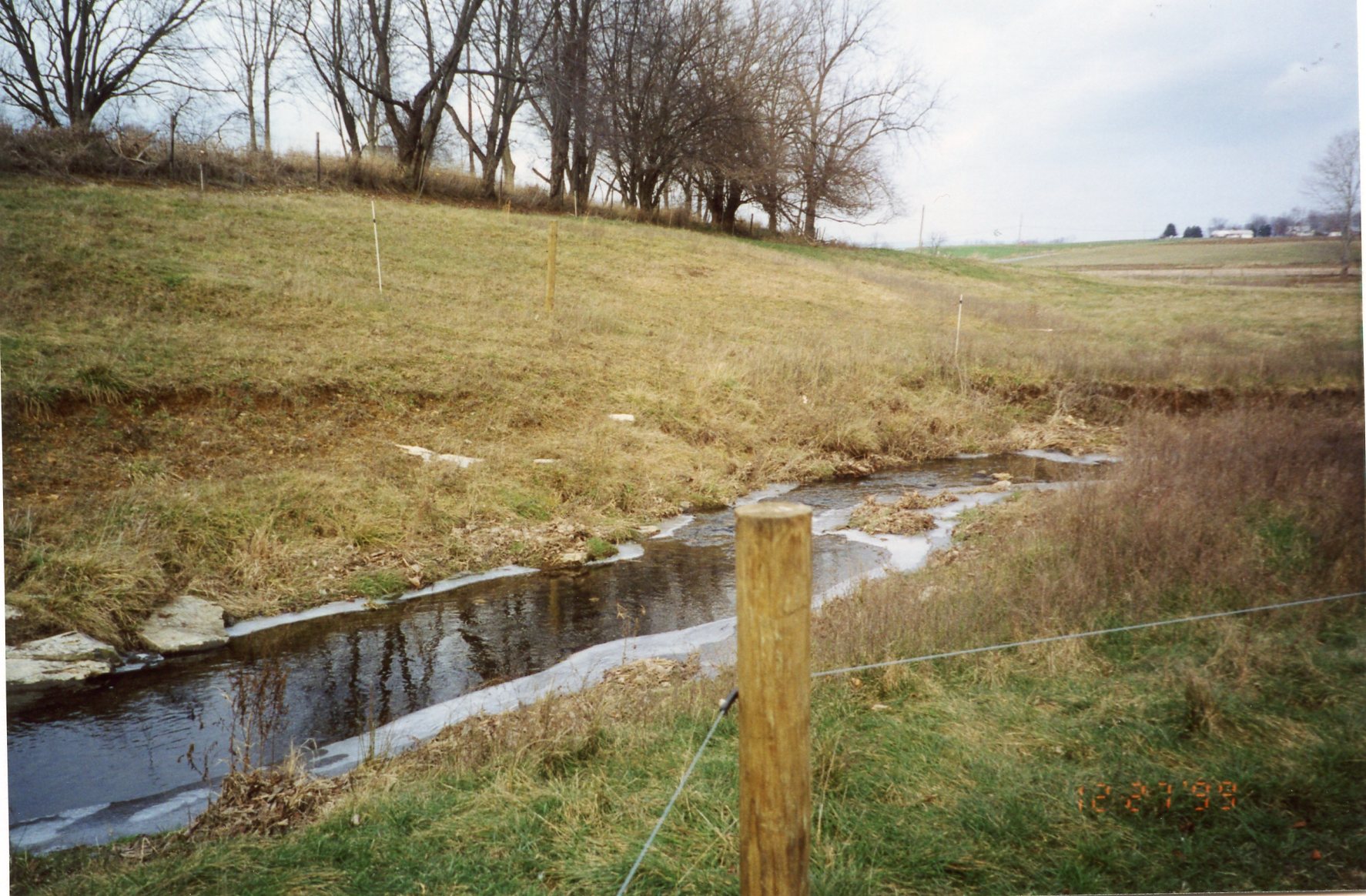
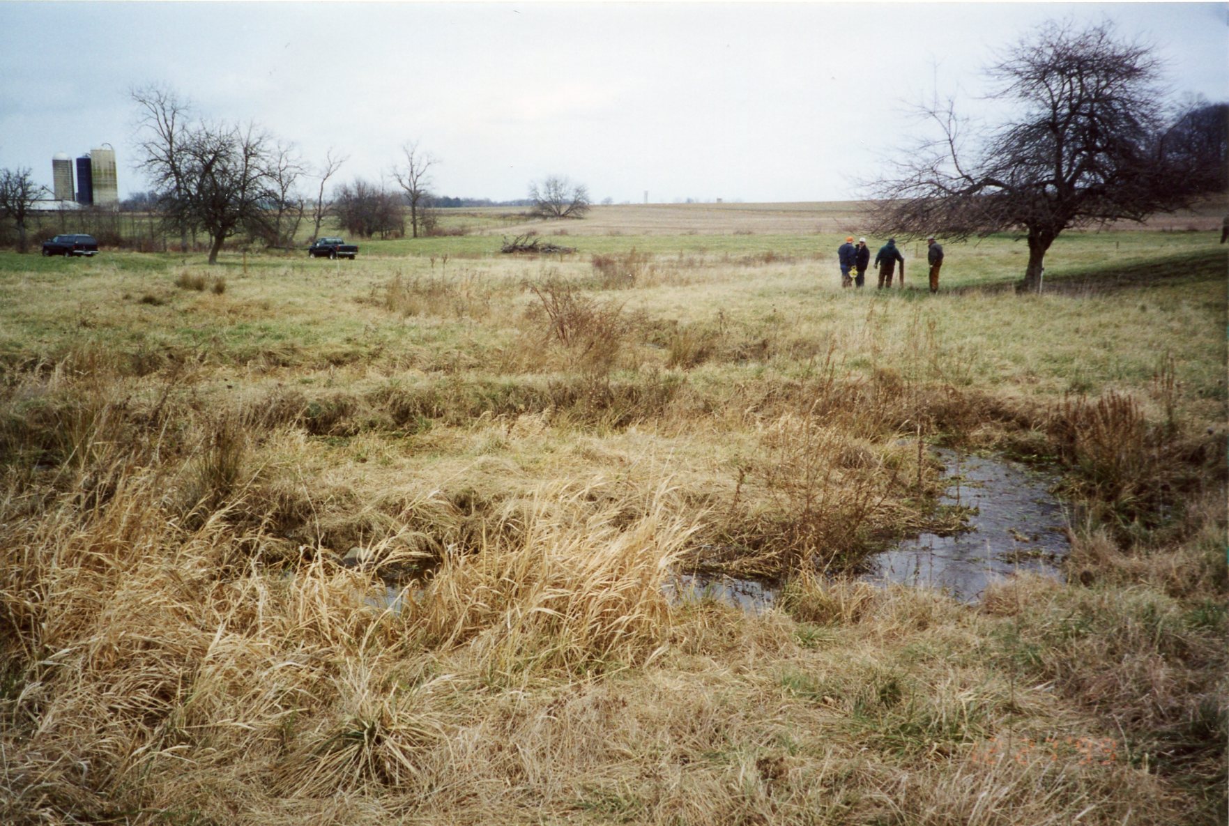
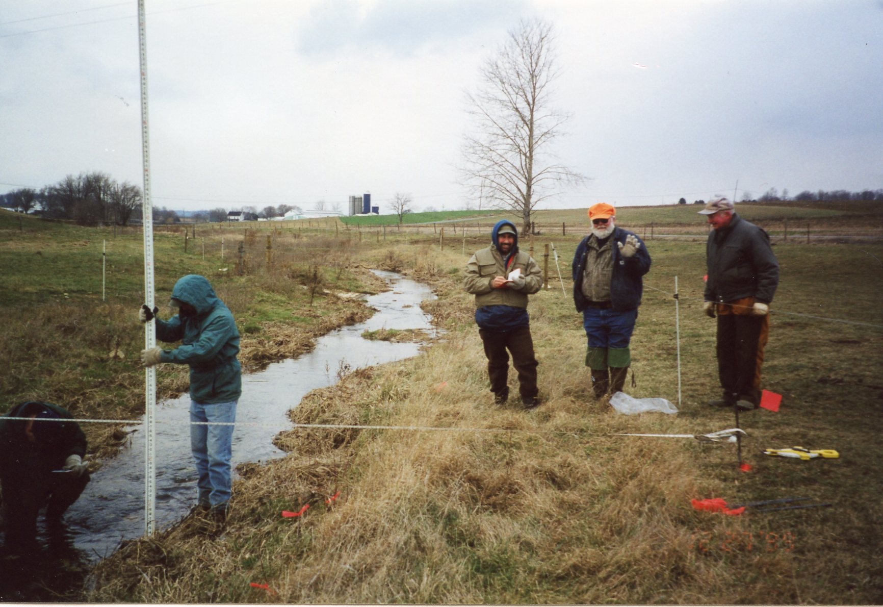
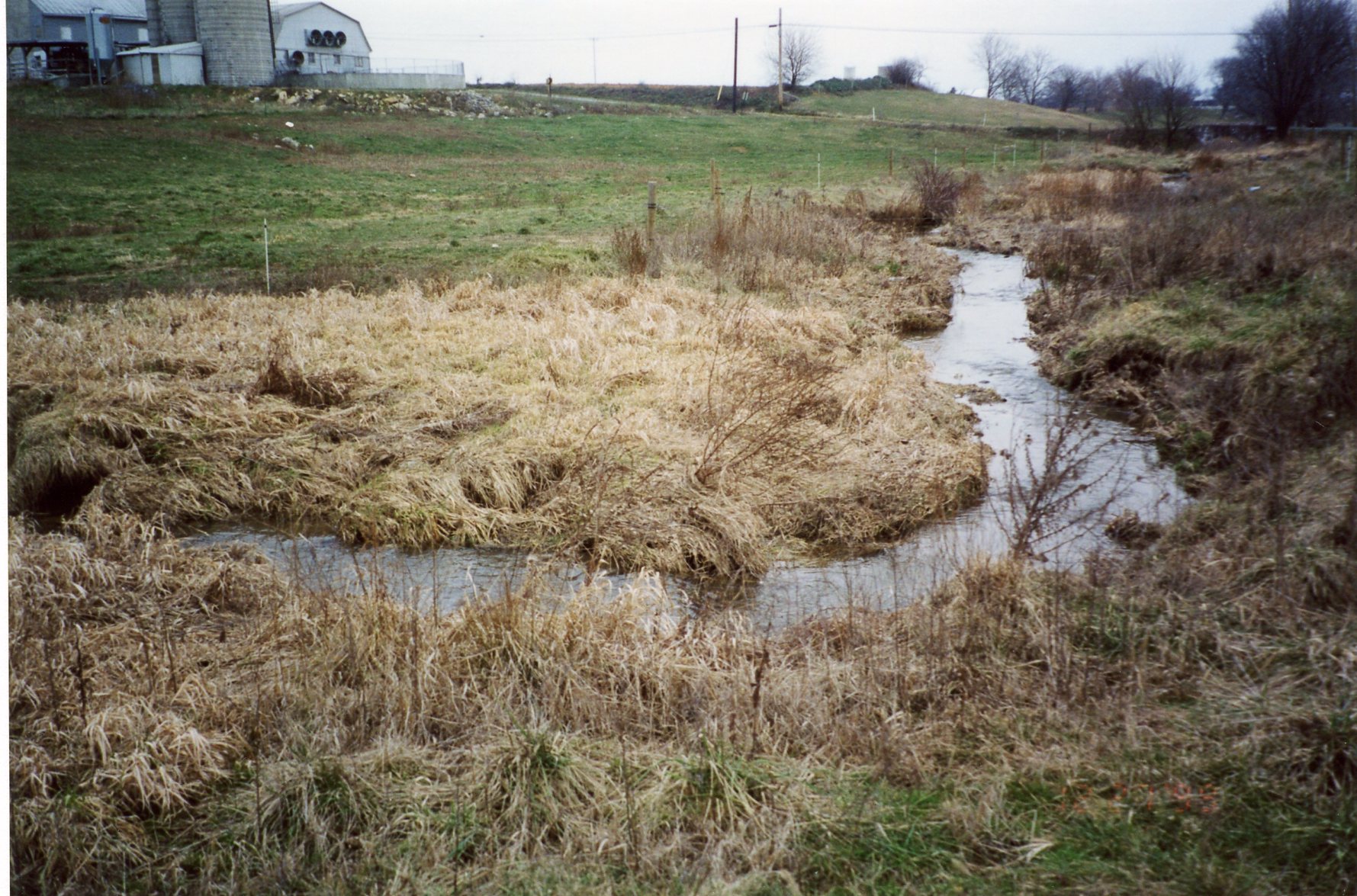
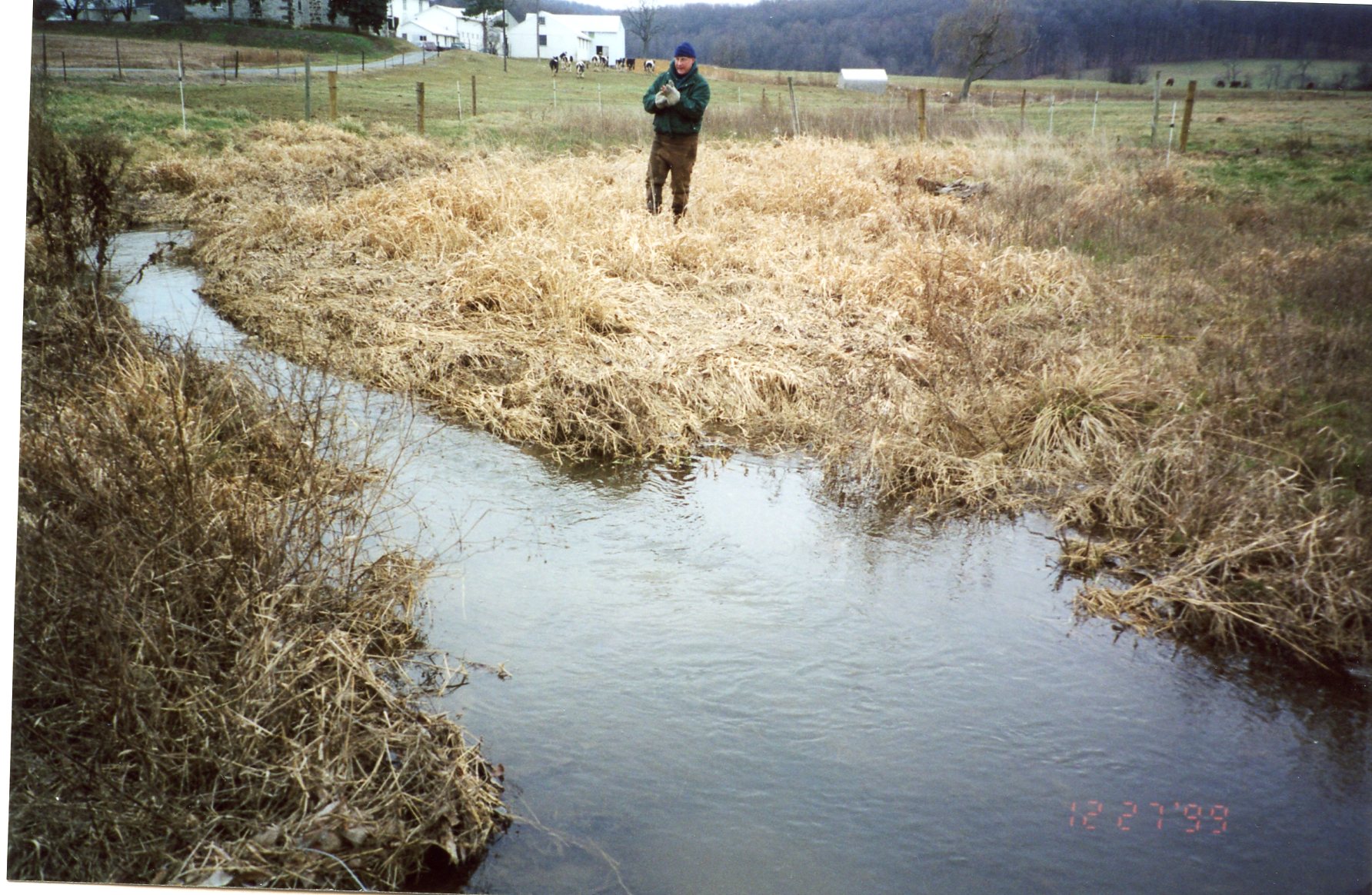
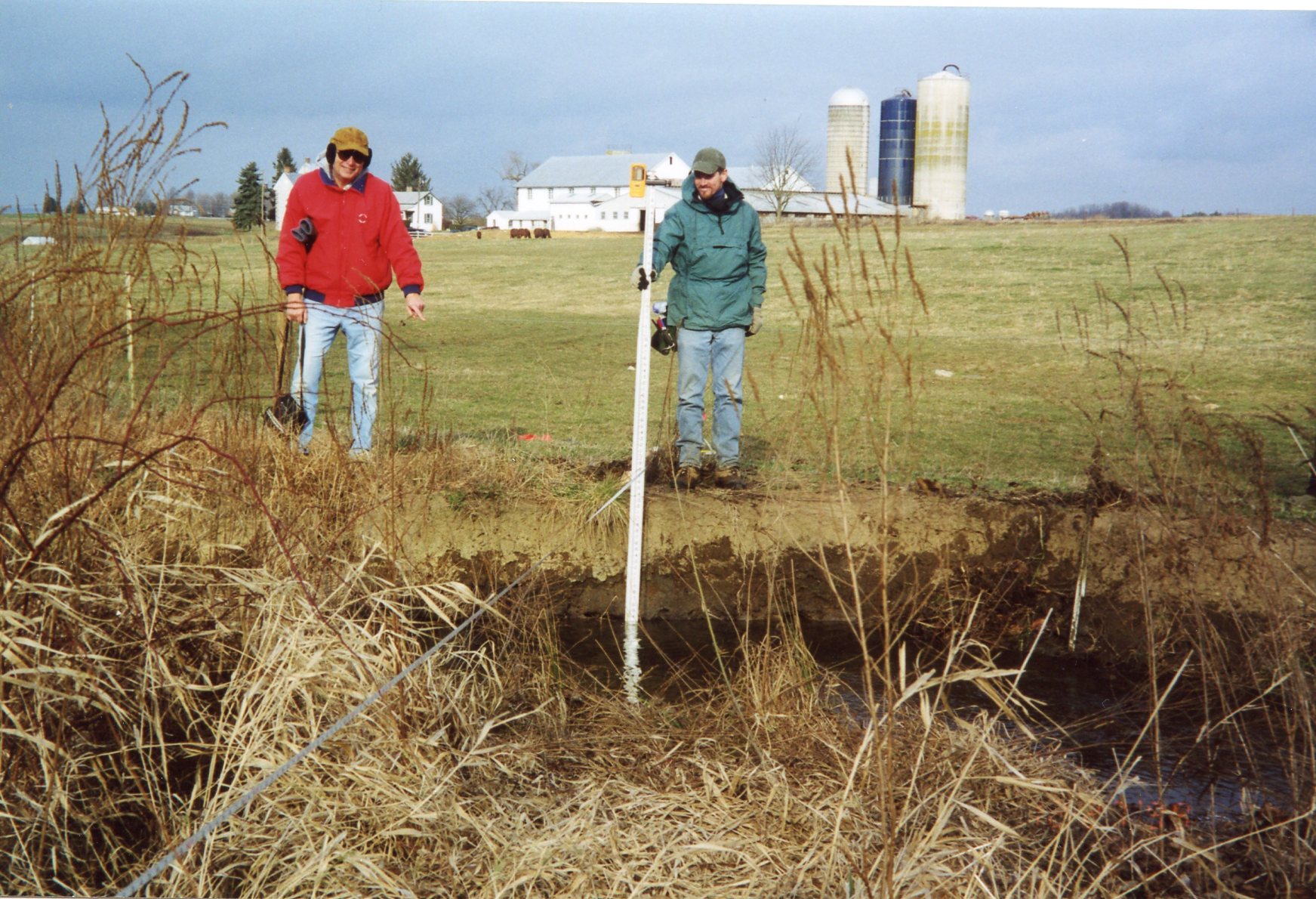
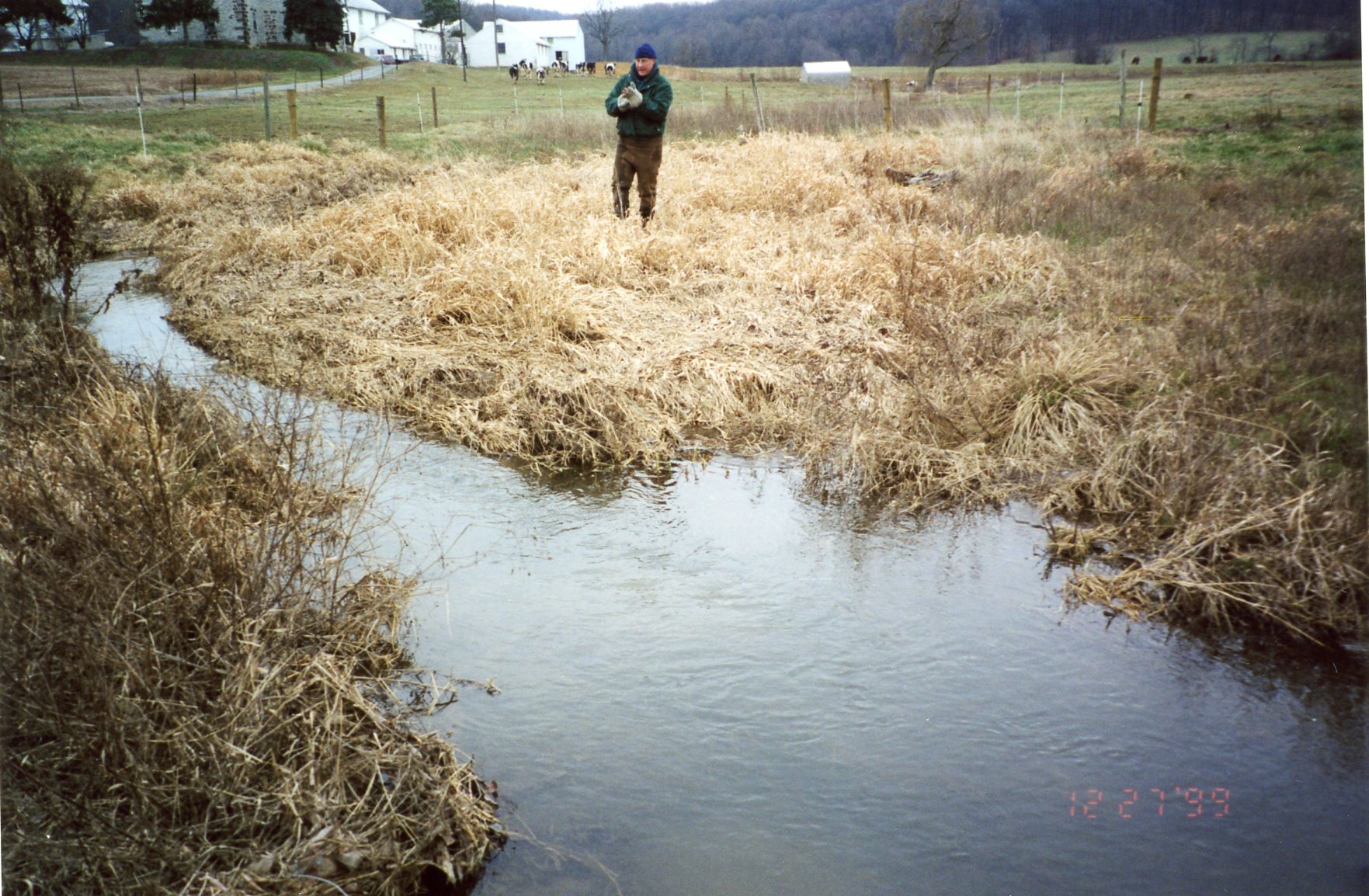
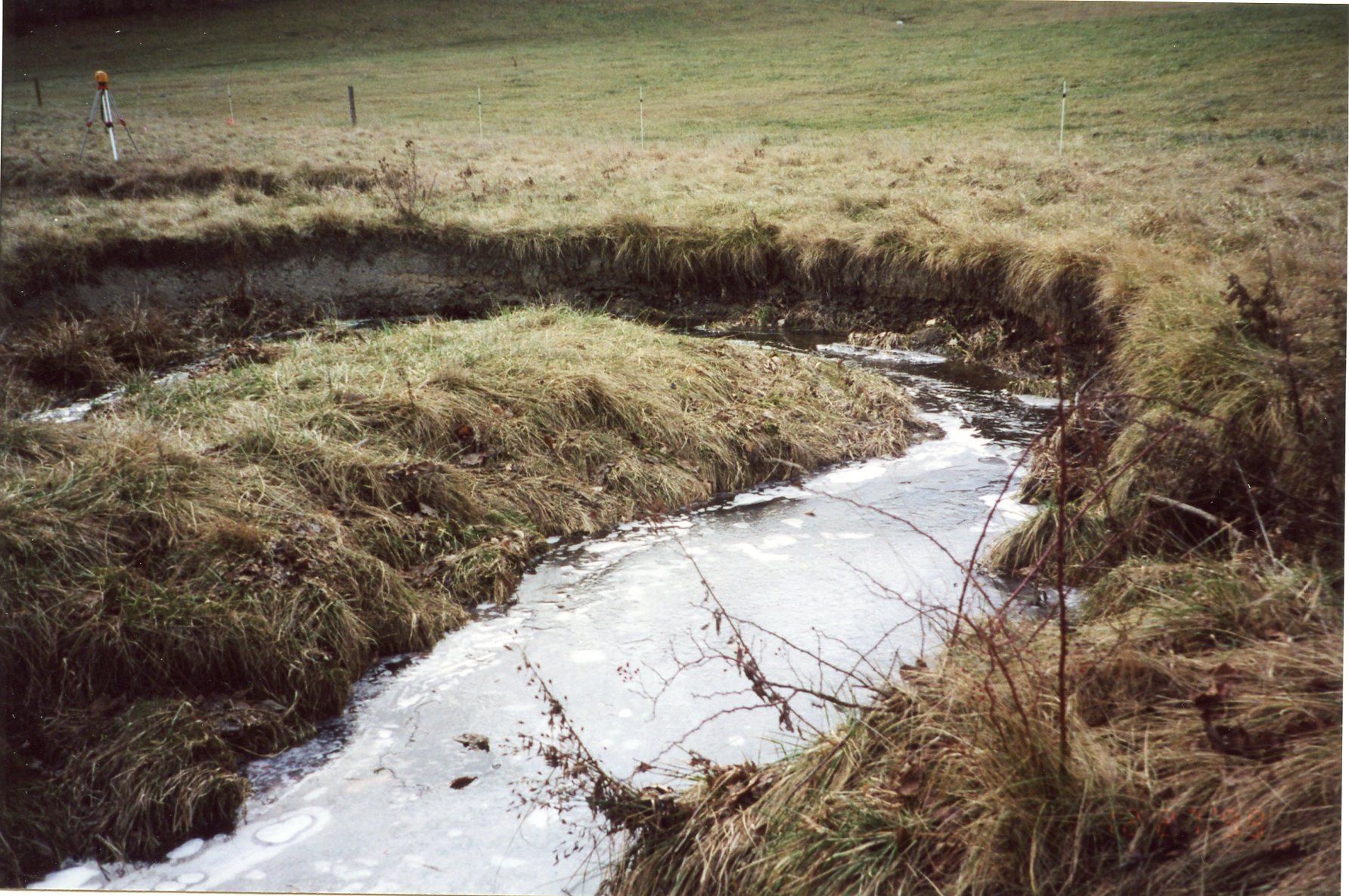
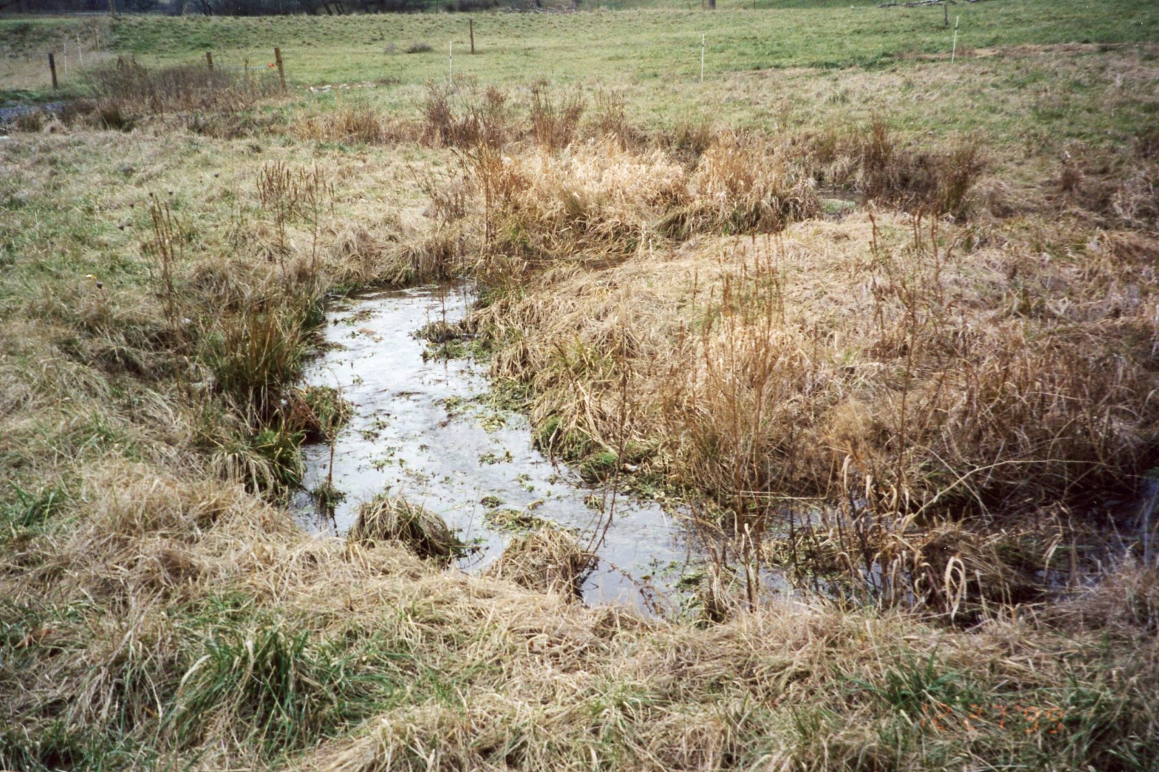
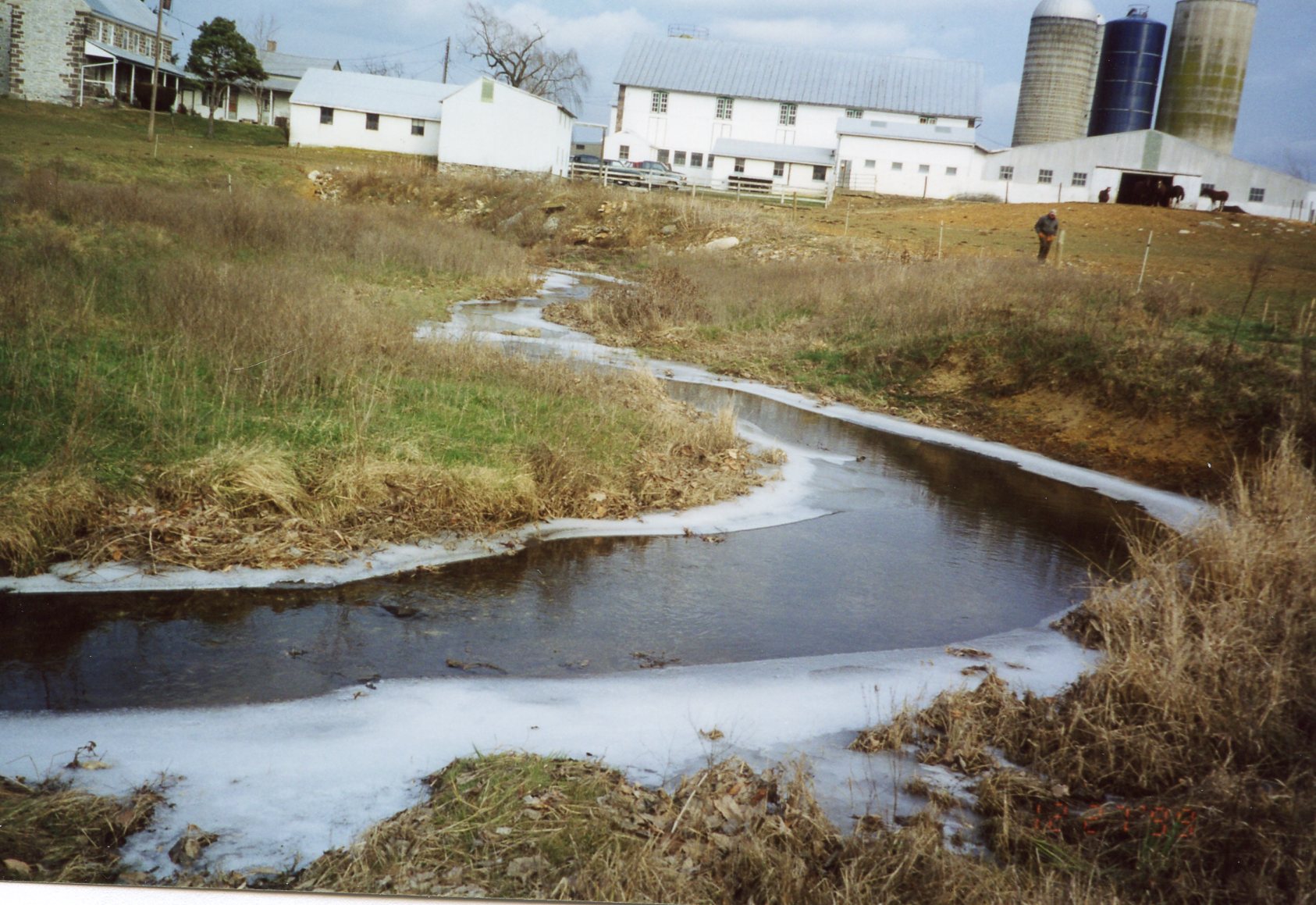
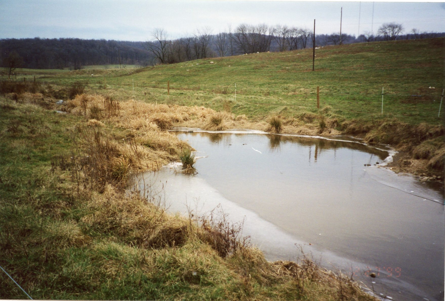
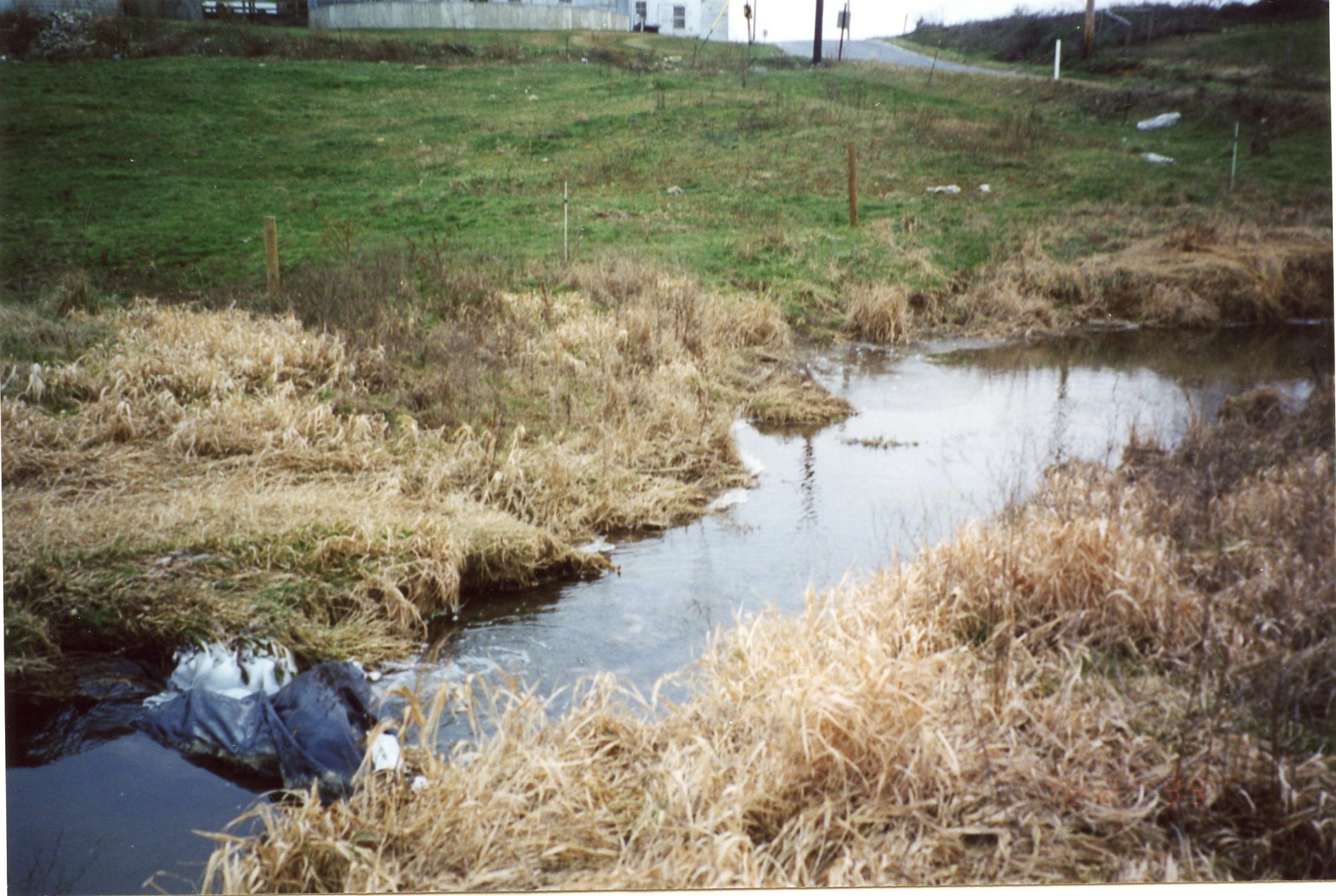
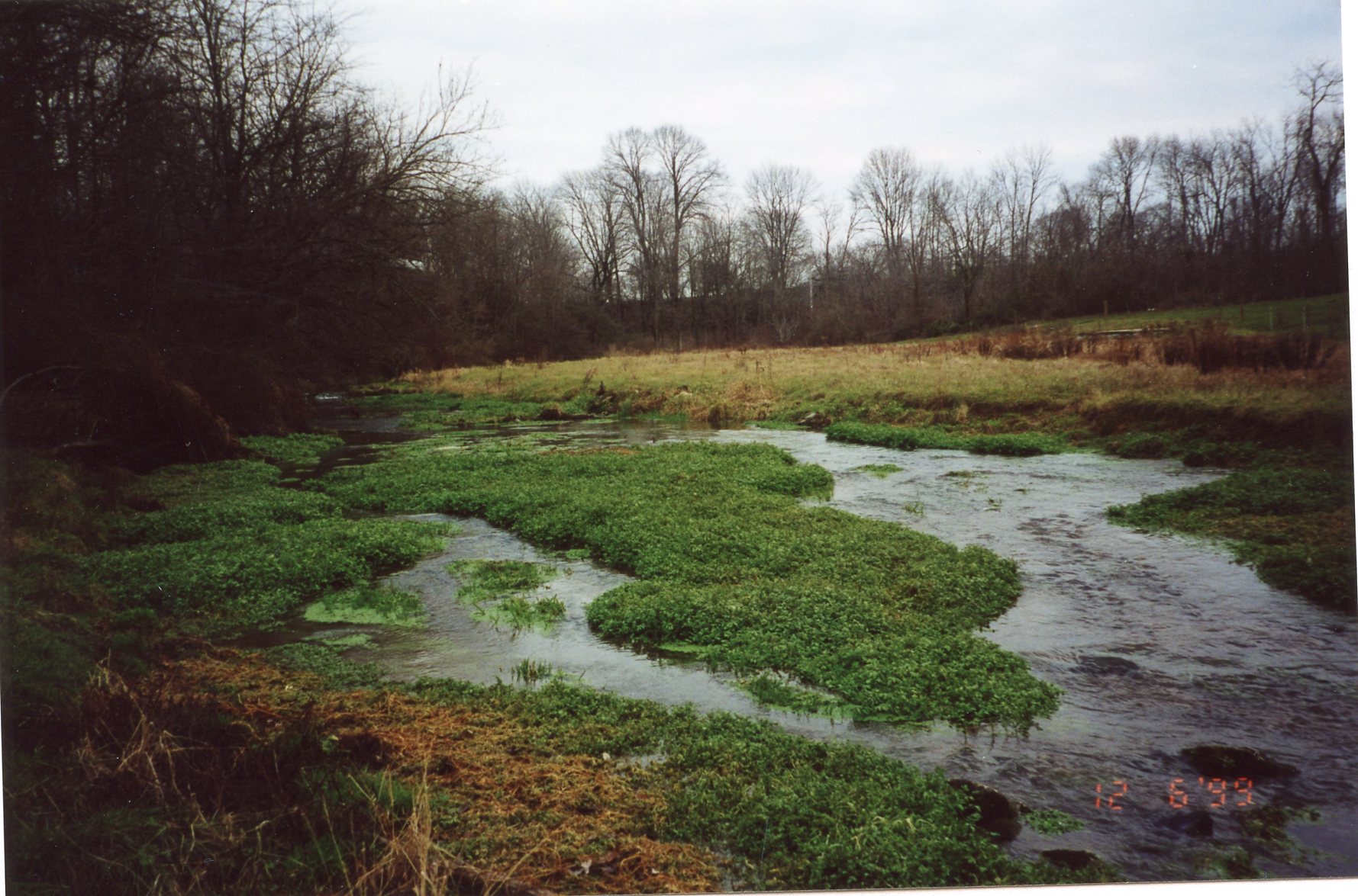
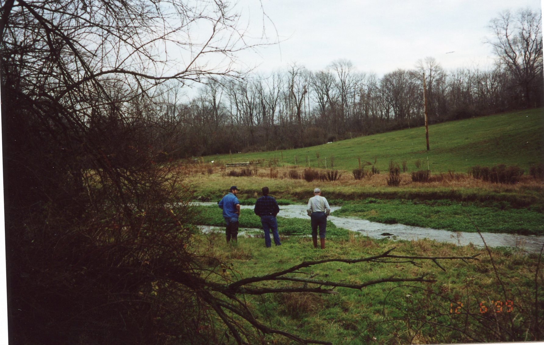
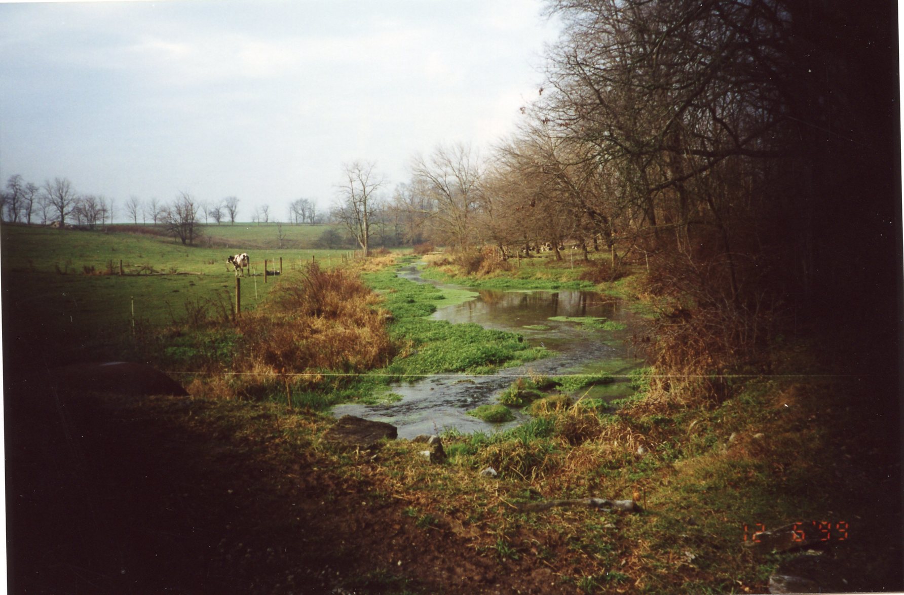
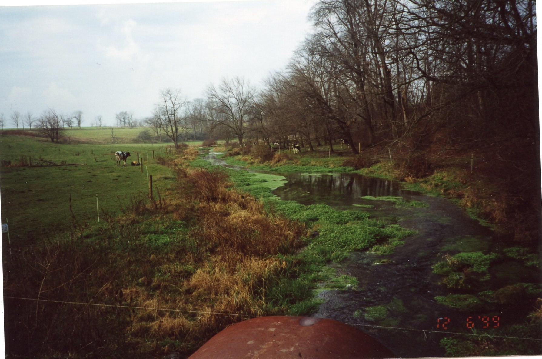
Fruits of the 1999 Watershed Restoration Grant (WRAP-2) to install fencing and plant riparian buffers along the stream banks of seven farms in the watershed. Here we see work on three of these farms: the Henry, Mumma, and Wise farms, all on Beck Creek. Thanks to the grant and the hard work of volunteers, in 1999 under WRAP-2 the Watershed Association installed 10,115 feet of stream bank fencing, and established a riparian buffer by planting trees & shrubs along the stream banks of the seven farms that were fenced. This was atop the cattle crossings, riparian buffers, and 25,451 feet of stream bank fencing installed the previous year, in 1998, under WRAP-1.
All photos are dated 27 December 1999. The first nine are captioned "Henry Farm," the next eight "Mumma Farm," and the last eight, "Wise Farm".
 |
 |
 |
 |
 |
 |
 |
 |
 |
 |
 |
 |
 |
 |
 |
 |
 |
 |
 |
 |
 |
 |
 |
 |
 |
December 1999 • Building Stream Bank Fencing on a Farm on Bachman Run in South Annville Township
Four photos dated 6 December 1999 of stream bank fencing being built on a farm on Bachman Run in South Annville Township. Also part of the WRAP-2 Grant? Further narrative forthcoming.
 |
 |
 |
 |
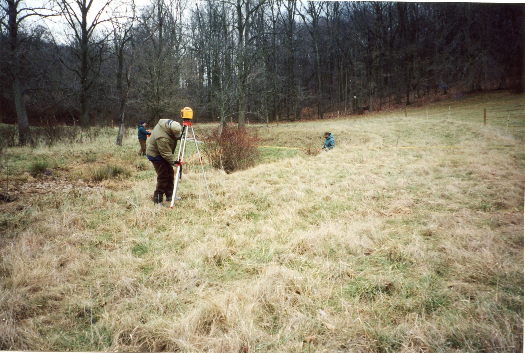
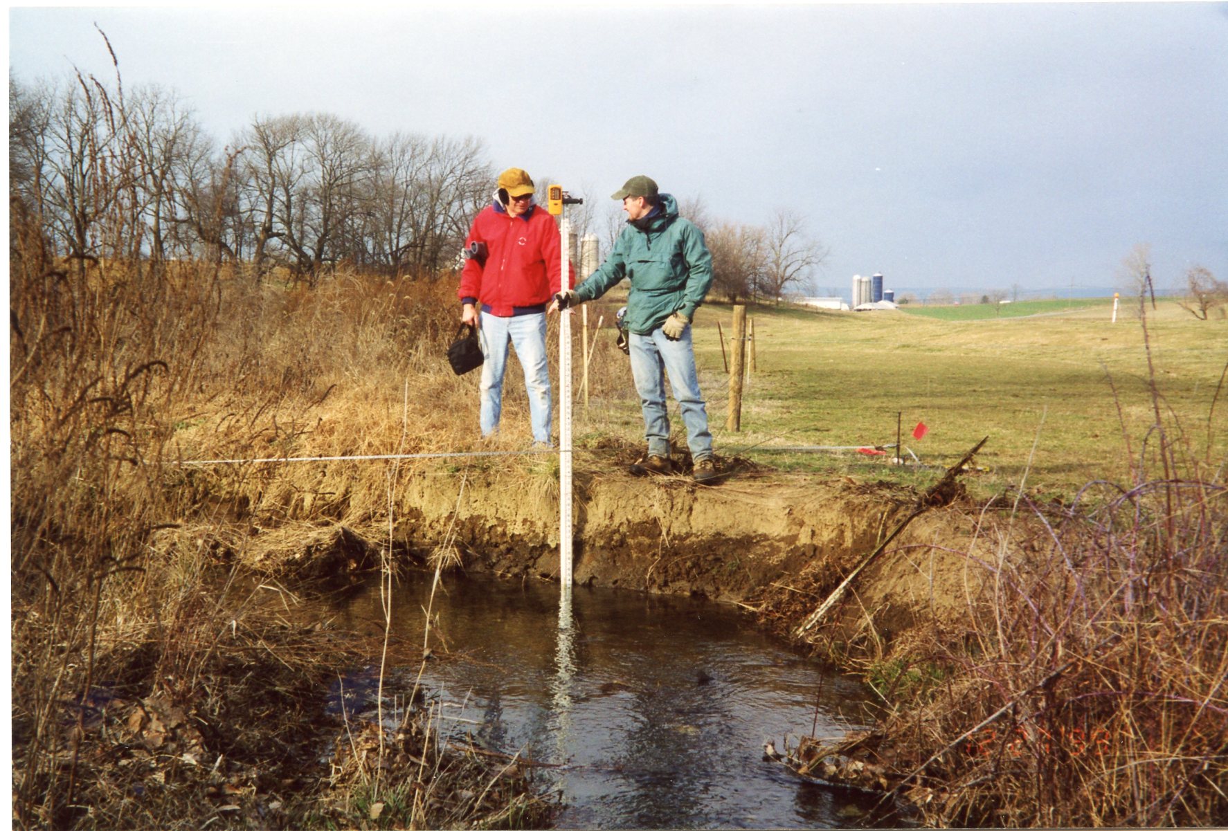
December 1999 • Prospective Pedestrian Bridge Location & Stream Bank Erosion at Old Mill Site in Annville
Six captioned & sequenced photos dated 29 December 1999 of the "Quittapahilla Creek Project Site" and "potential footbridge location" at the Old Mill Dam, and the "Mill Street Project Site". Some in the sequence are missing; looks to be part of a prospectus for the project.
.jpg) |
.jpg) |
.jpg) |
.jpg) |
.jpg) |
.jpg) |
1998-2000 • Misc newspaper clippings & photos
Quittie Creek Nature Park -- envisioning the pedestrian bridge in 1999 -- streambank stabilization -- Cleanups -- lots of stuff forthcoming.
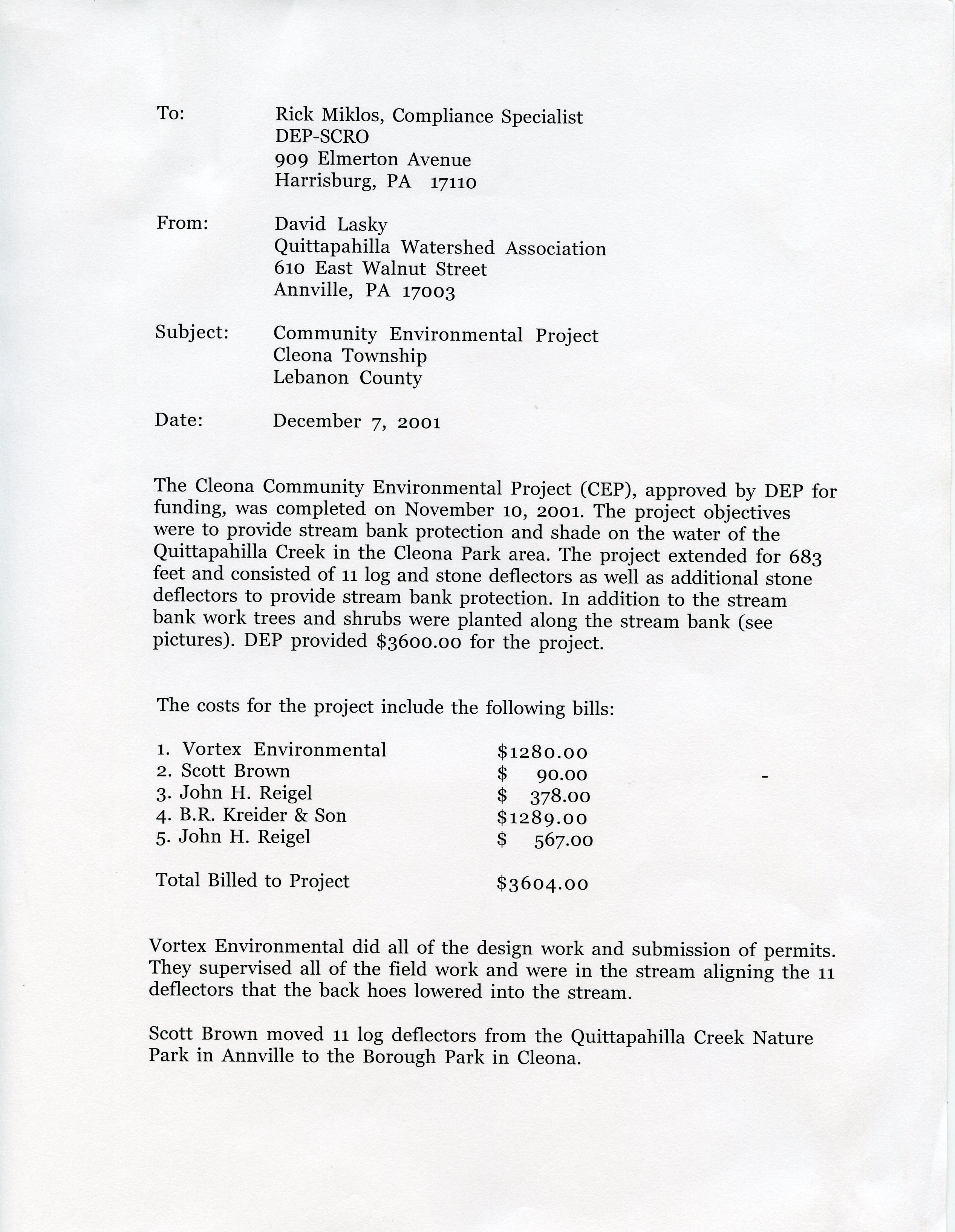
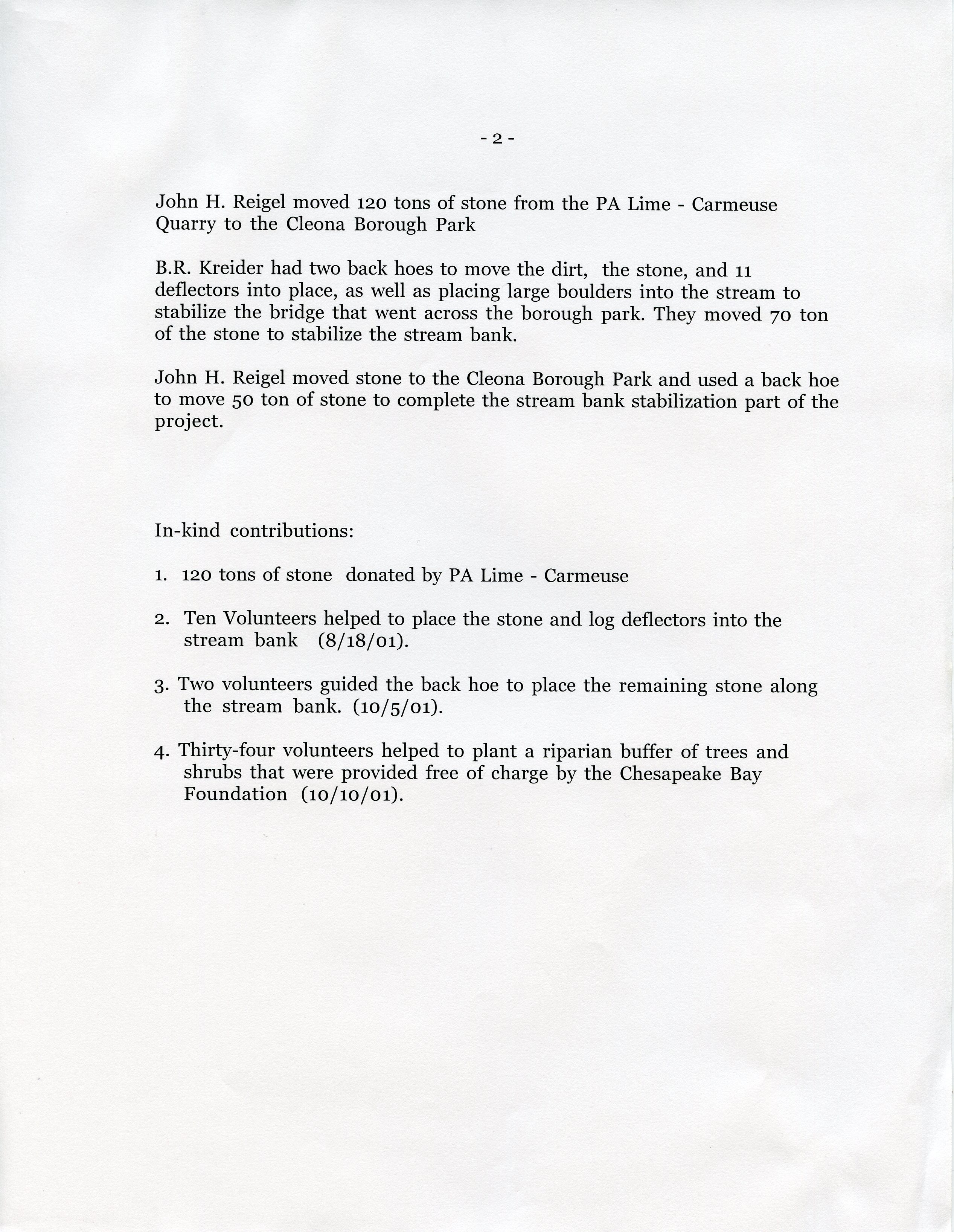
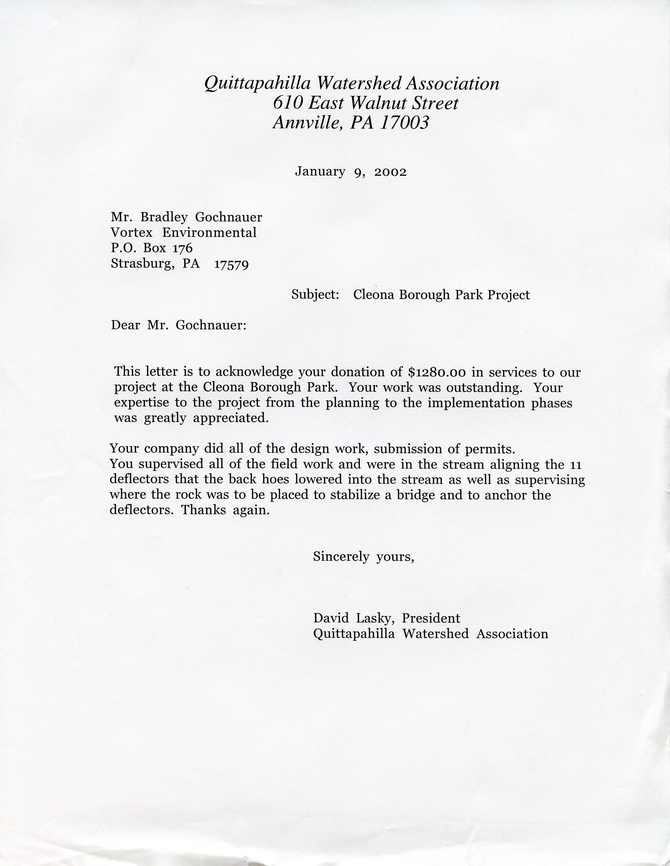
1999-2001 • Cleona Community Environmental Project (CEP) Material
The Cleona Community Environmental Project (CEP) consisted of a range of grant-funded stream restoration measures in Cleona Borough, the groundwork laid in early 1999 and the work completed in November 2001. The material is still being compiled here.
 |
 |
 |
|
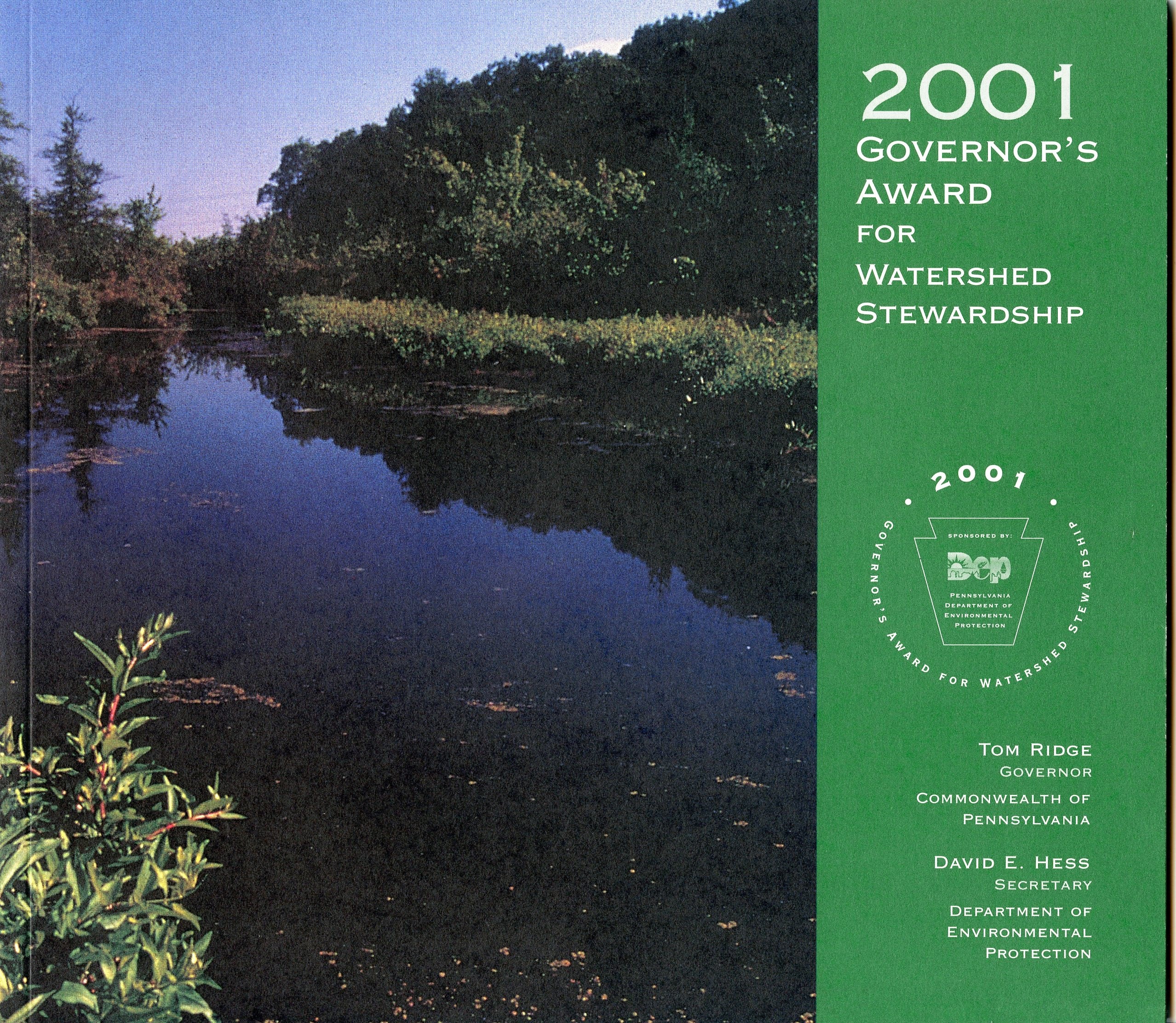
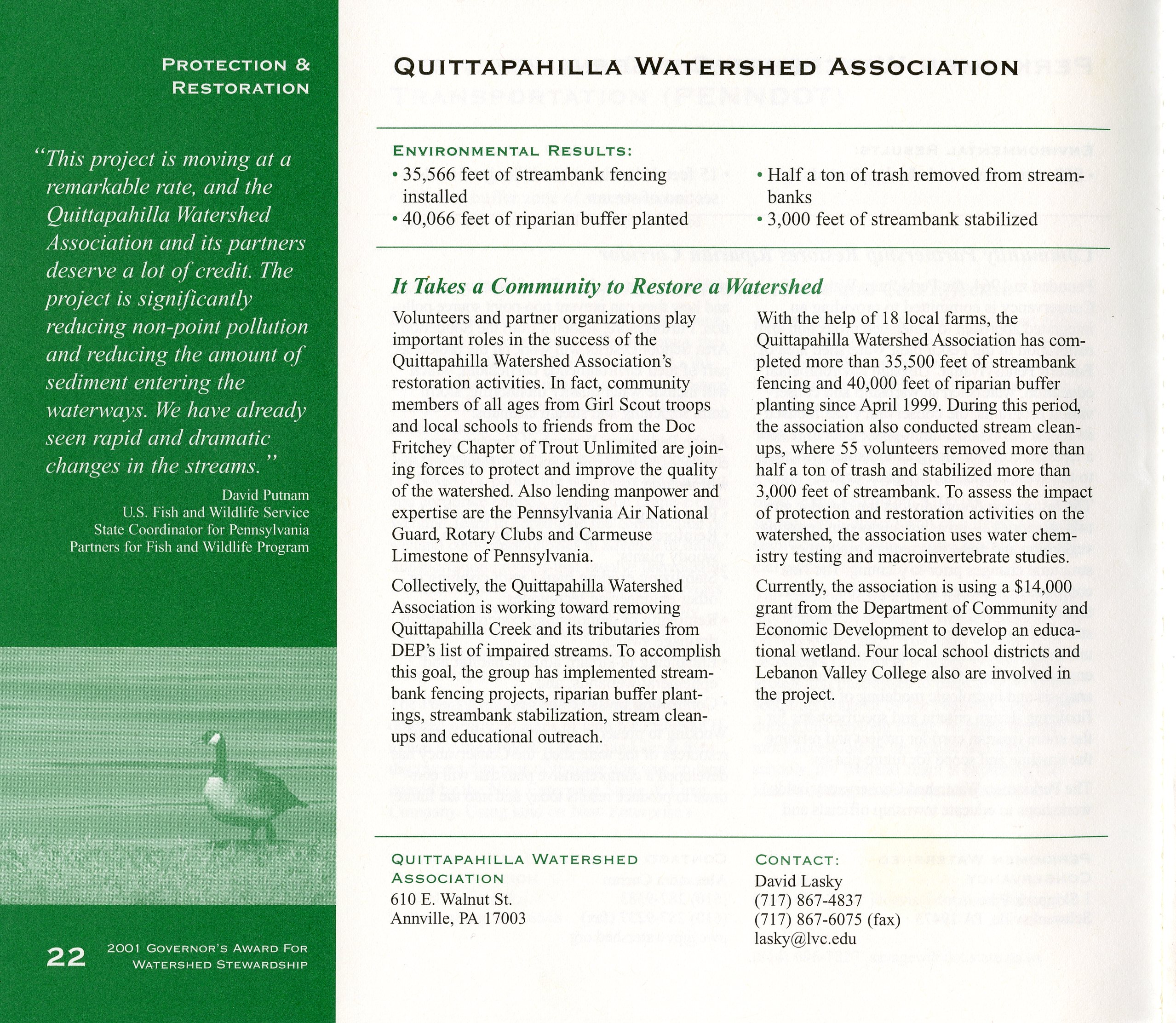
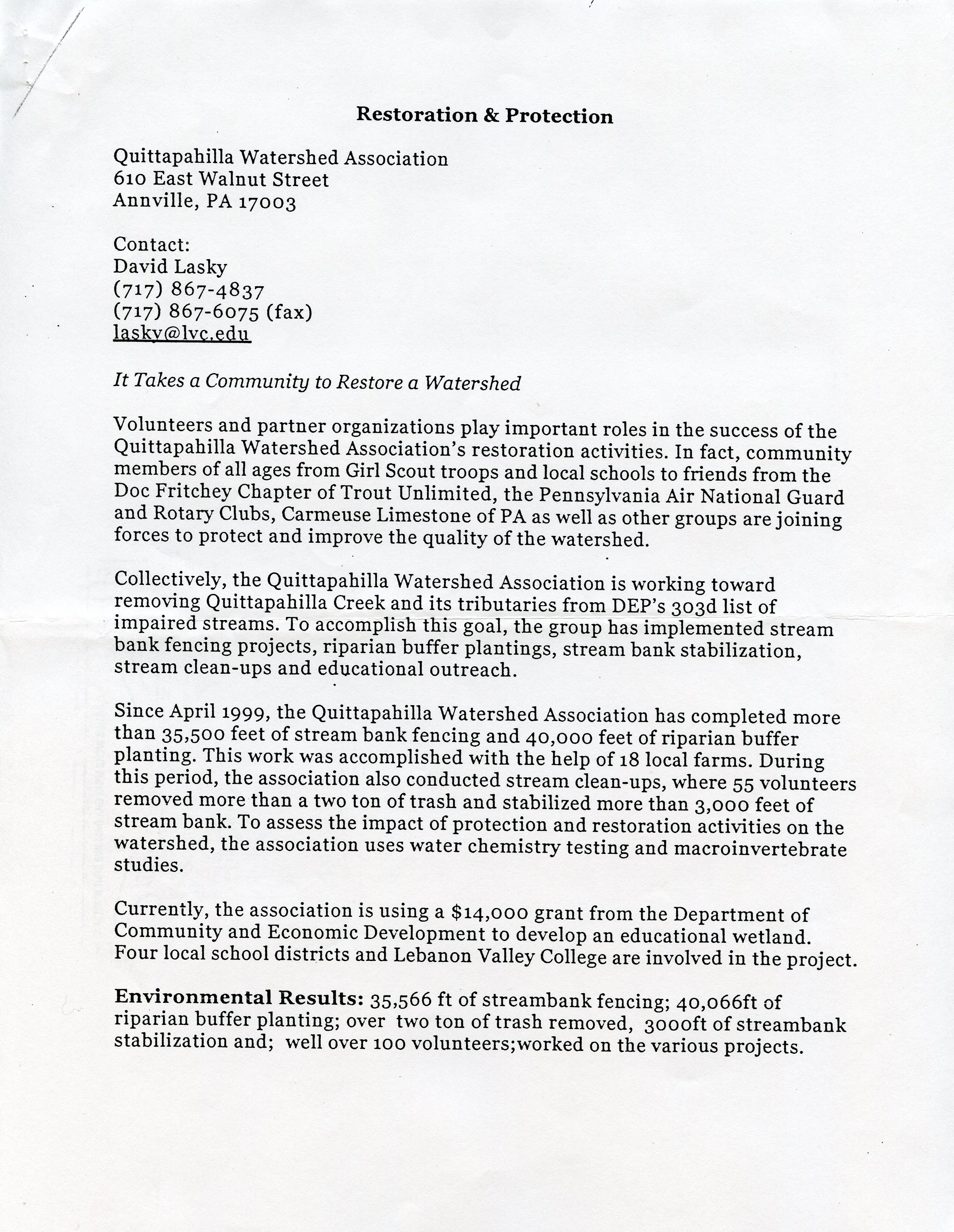
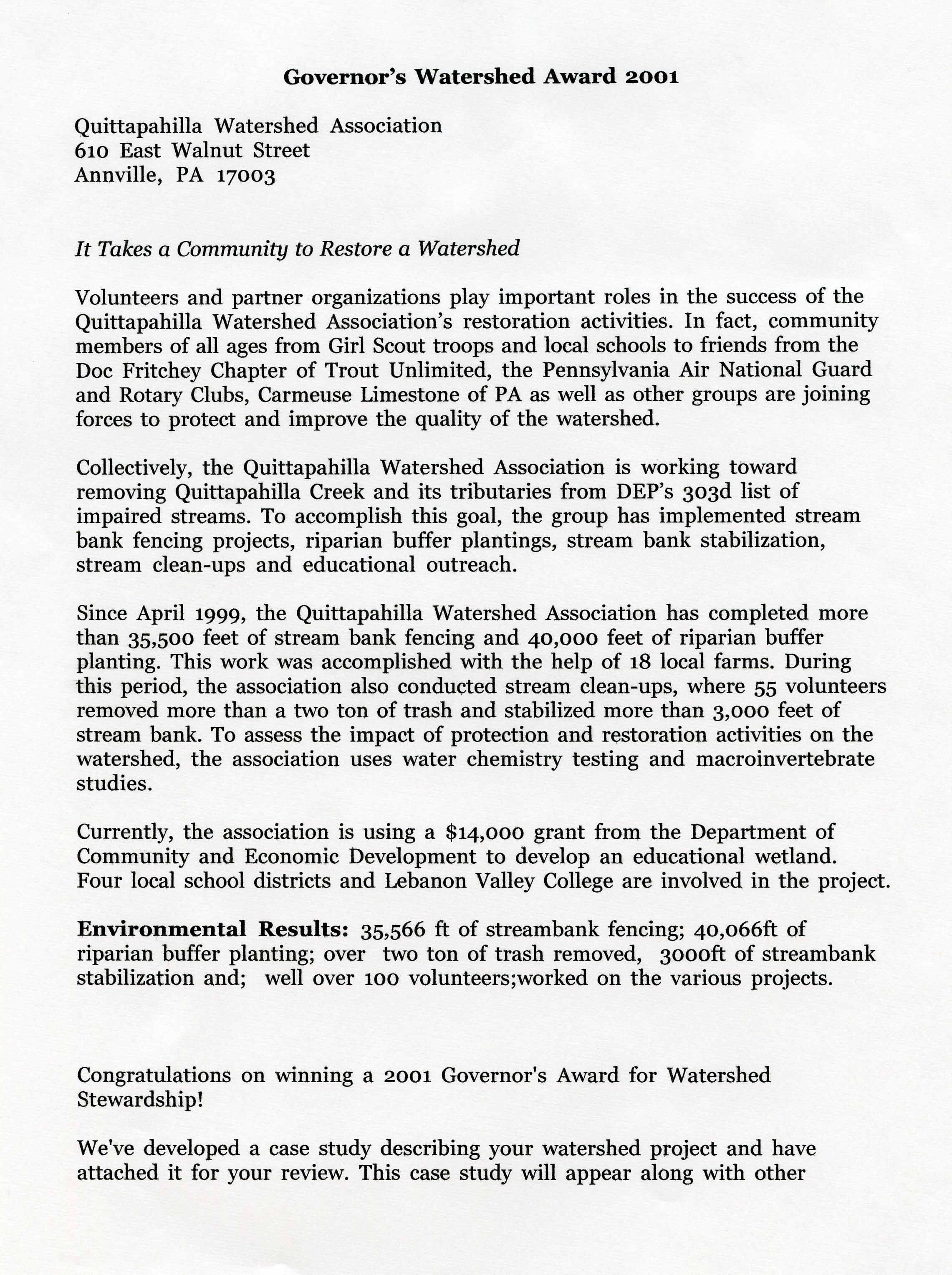
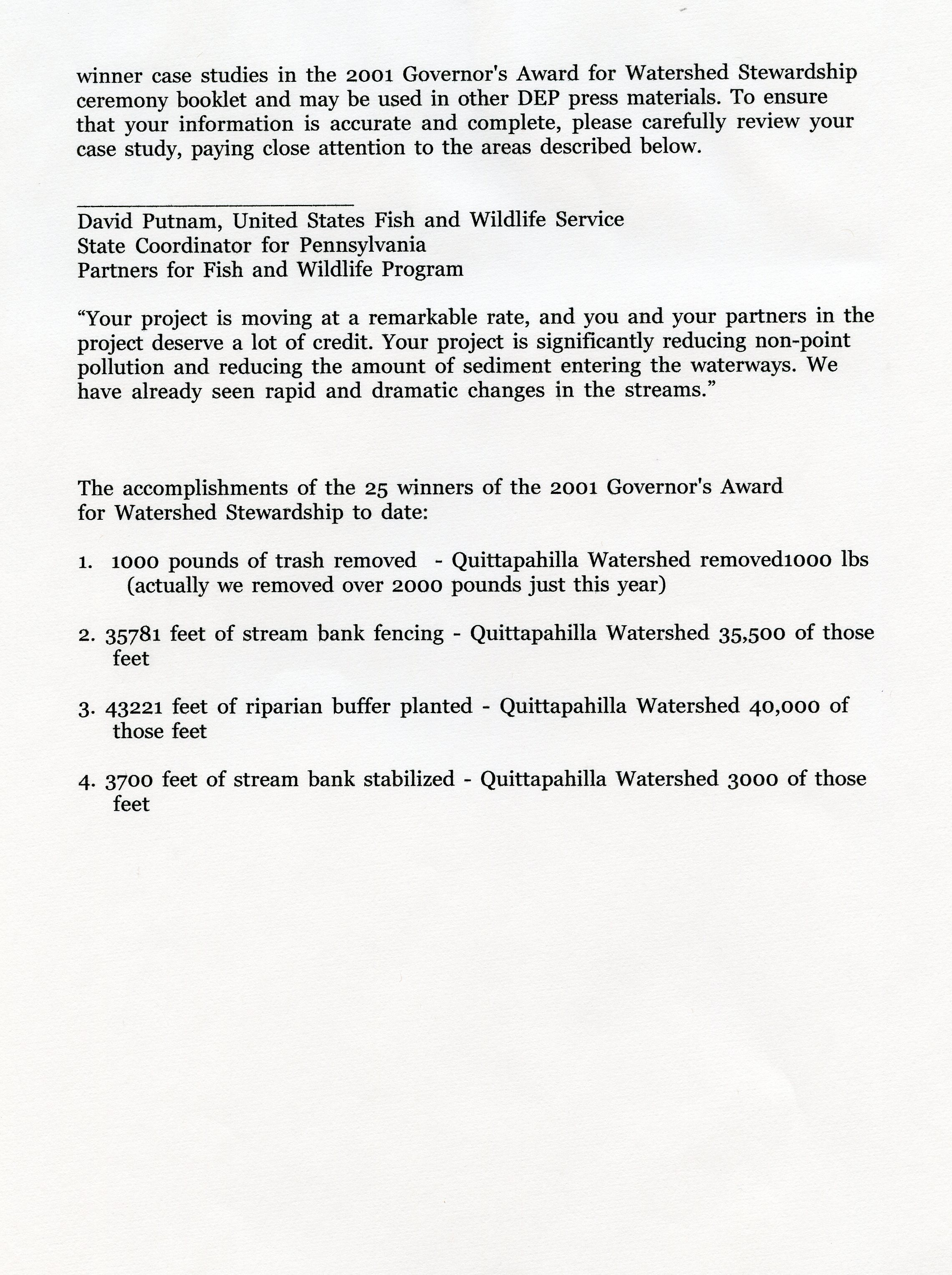
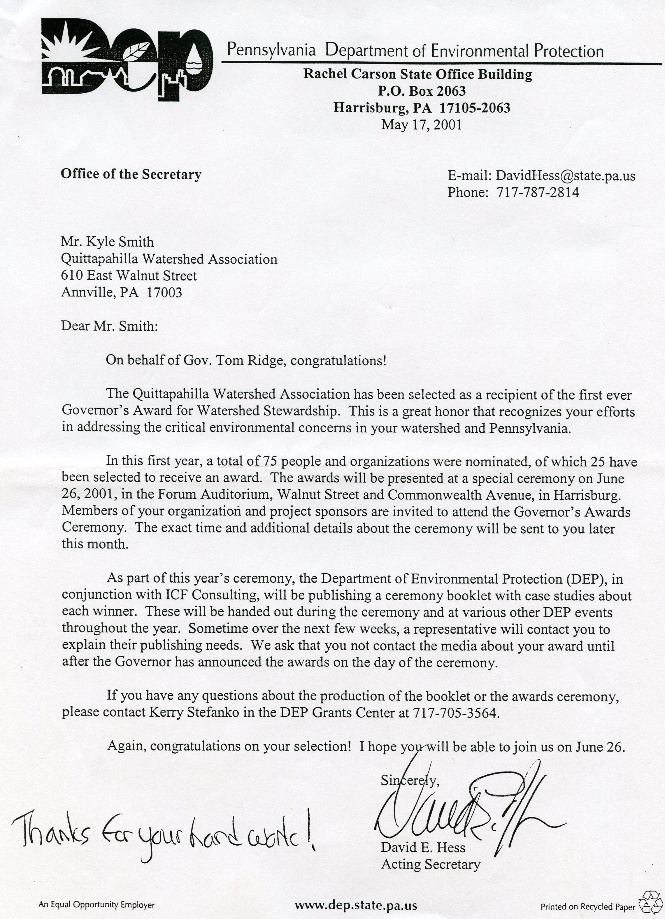
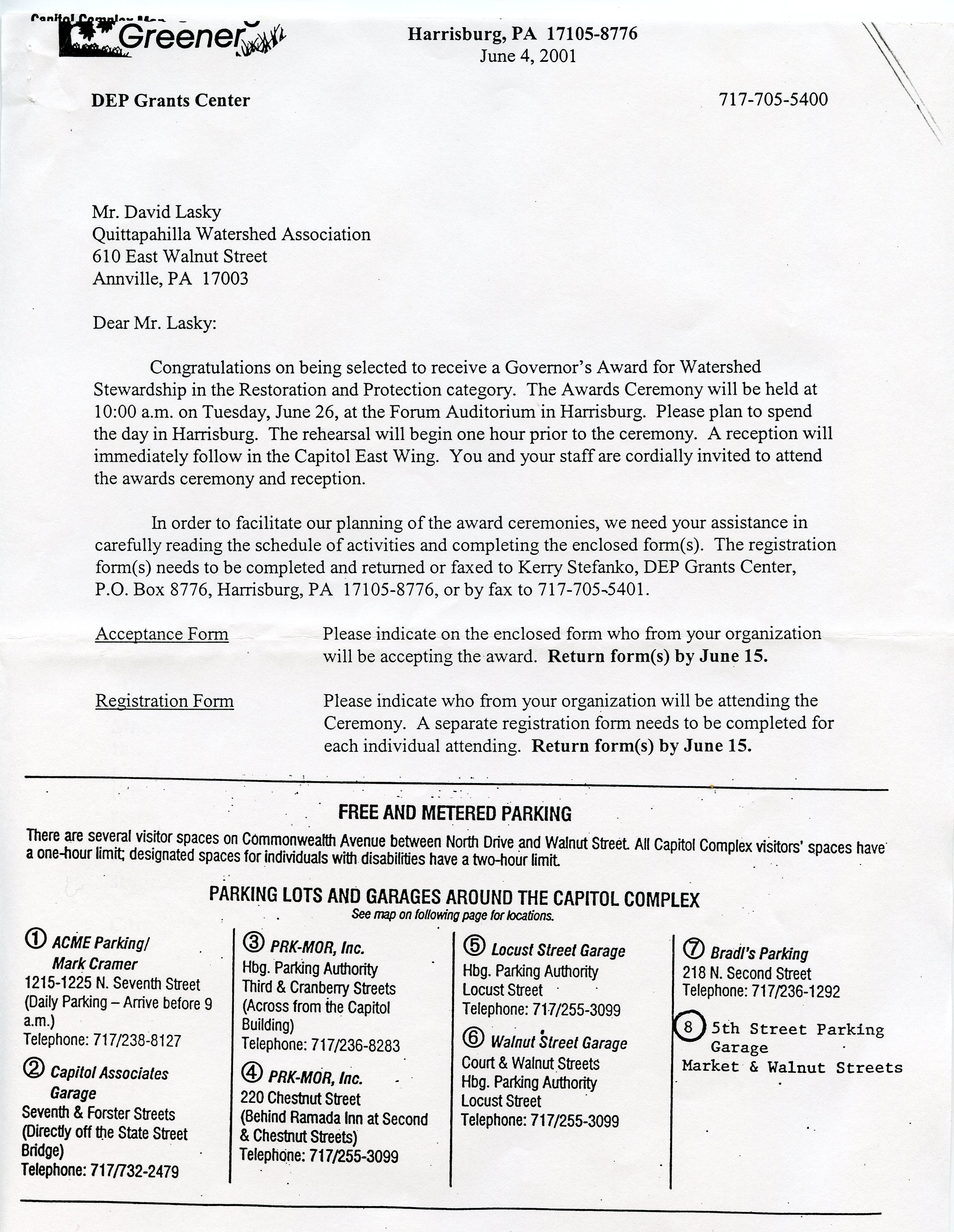
June 2001 • Governor's Award for Watershed Stewardship
The following 12 JPEG files document the Watershed Association's receipt of the 2001 Governor's Award for Watershed Stewardship, and include the cover & relevant page of the published booklet, official press releases, the QWA's submitted materials, and letters from the PA-DEP to QWA Presidents Kyle Smith and David Lasky.
.jpg)
 |
 |
 |
 |
 |
 |
 |
 |
 |
 |
 |
 |
April-June 2002 • Creation of a Wetlands Educational Preserve at the Lebanon County Career & Technical Center (LCCTC) in East Lebanon
Narrative & documentation forthcoming. Dave, could you provide captions for these?
.jpg) |
.jpg) |
.jpg) |
.jpg) |
.jpg) |
.jpg) |
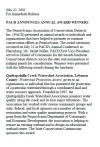
July 2002 • Watershed Protection Award from the Pennsylvania Association of Conservation Districts
These two documents record the QWA's July 2002 receipt of the Watershed Protection Award from the Pennsylvania Association of Conservation Districts; click on images for PDF files.
 |
 |
2006 • Rocky Powell's Public Presentation of Findings
Forthcoming.
2008 • Water discharge by Annville-Cleona H.S. into Quittie
Forthcoming.
200x • xxx
Forthcoming.